WEATHER TO WATCH: Cold temps linger; tracking mid-week thunderstorms
It may be nearly April, but winter-like temperatures are sticking around New Jersey for the next few days.
News 12 Staff
•
Mar 28, 2022, 9:39 AM
•
Updated 782 days ago
Share:
More Stories
1:01

LIVE BLOG: News 12 weather updates
2ds ago1:14

Rainy weekend streak to grow across tri-state
3ds ago1:30
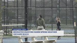
Bronx residents enjoy spring weather at Orchard Beach
20ds ago
Ready to explore the great outdoors? These 14 tips can help you stay safe while hiking
24ds ago
Guide: Tips to prevent fires during red flag warning
40ds ago1:20

Checking in on city conditions following damaging storm in Brooklyn
44ds ago1:01
LIVE BLOG: News 12 weather updates
2ds ago1:14
Rainy weekend streak to grow across tri-state
3ds ago1:30
Bronx residents enjoy spring weather at Orchard Beach
20ds agoReady to explore the great outdoors? These 14 tips can help you stay safe while hiking
24ds agoGuide: Tips to prevent fires during red flag warning
40ds ago1:20
Checking in on city conditions following damaging storm in Brooklyn
44ds agoIt may be nearly April, but winter-like temperatures are sticking around New Jersey for the next few days.
Storm Watch Team Meteorologist Justin Godynick says he is also tracking the potential for severe thunderstorms by Thursday.
Monday night will see mostly clear skies with overnight lows in the low-20s. Wind chills may make temperatures feel as if they are in the single digits.
LIVE BLOG: News 12 weather updates
Tuesday will see mostly clear skies, but daytime highs will be in the low-40s. Tuesday night will also see mostly clear skies, with overnight lows cooling into the upper-20s.
Wednesday will start off with sunshine, but clouds are expected to develop by the afternoon. Daytime highs will be in the mid-40s. Rain is expected to develop by Wednesday evening, with overnight lows around 40 degrees.
Temperatures are expected to warm up for Thursday, with daytime highs in the low-70s. The day is expected to start off sunny, but clouds and rain will develop by the afternoon. There is the potential for severe thunderstorms.
Friday should see clouds in the morning, followed by sunshine by the afternoon. Daytime highs are expected to be mild in the upper-50s and low-60s.


