Mild but windy Thursday in Connecticut, cold and dreary weekend
It's dry and pleasant for the rest of the work week, but we're tracking a storm that could washout some weekend plans.
Top Stories


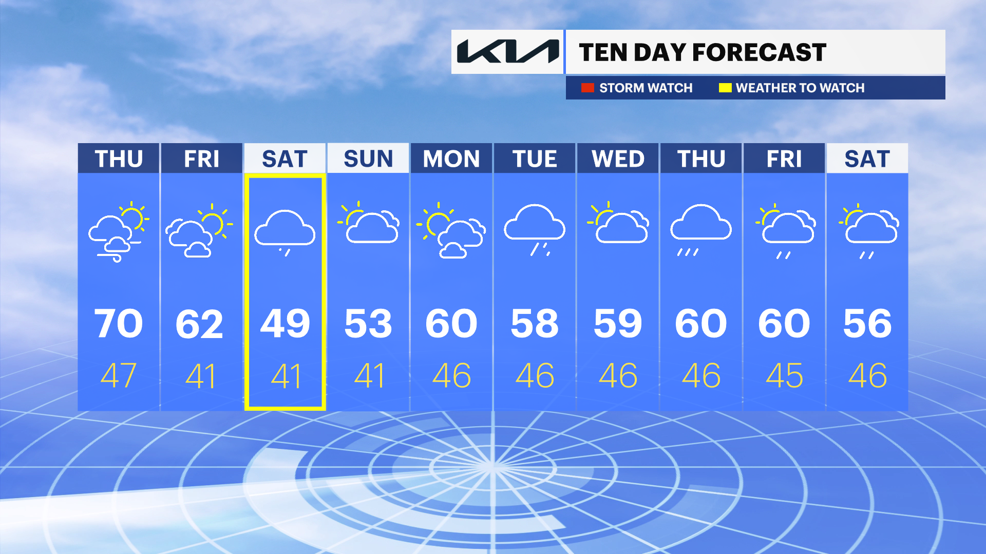
It's a chilly and mainly cloudy morning, but improvements are on the way later today and this is definitely the pick out of the week! If you have weekend plans, keep a close eye on the forecast because there will be rain and very chilly weather. Colder than average temperatures are expected for the next two weeks.
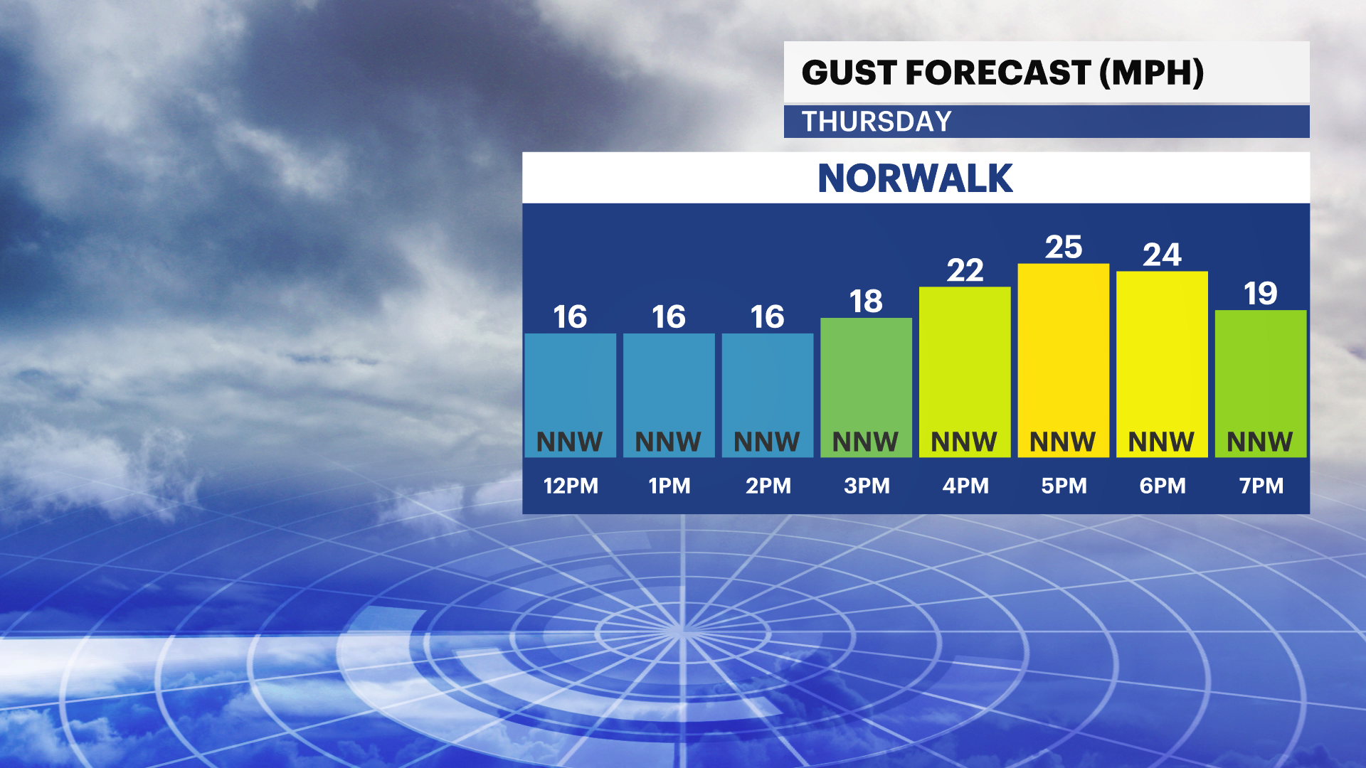
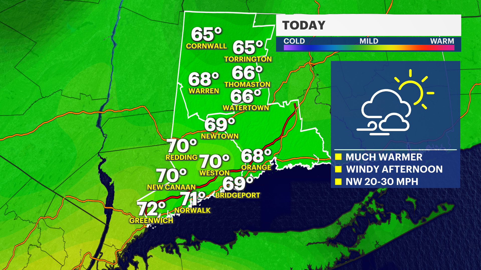
Today - Mild & Breezy
Afternoon highs are near 70-degrees with mostly sunny skies early and a few clouds in the afternoon. Winds will increase to 20 mph with gusts over 30 mph after 2 p.m. There's an elevated risk for fire spread today because of the dry wind.
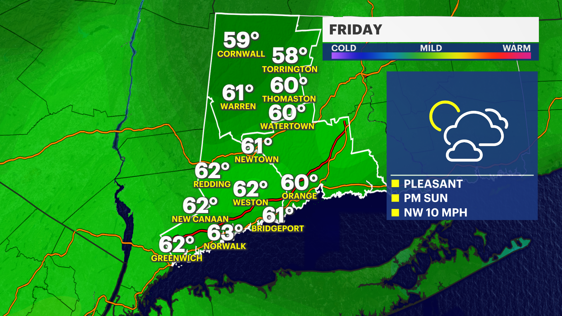
Friday - Clouds then Sun
Temperatures are near average with morning lows in the upper 40s and afternoon highs in the low 60s. It's cloudy early with some sunshine later in the day.
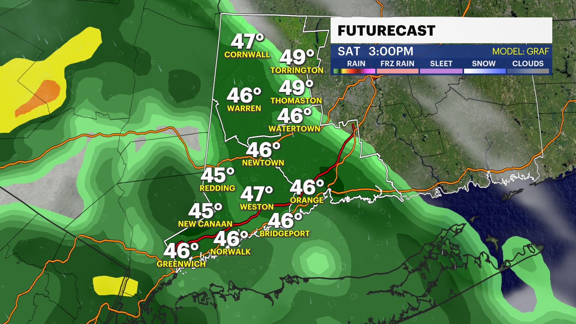
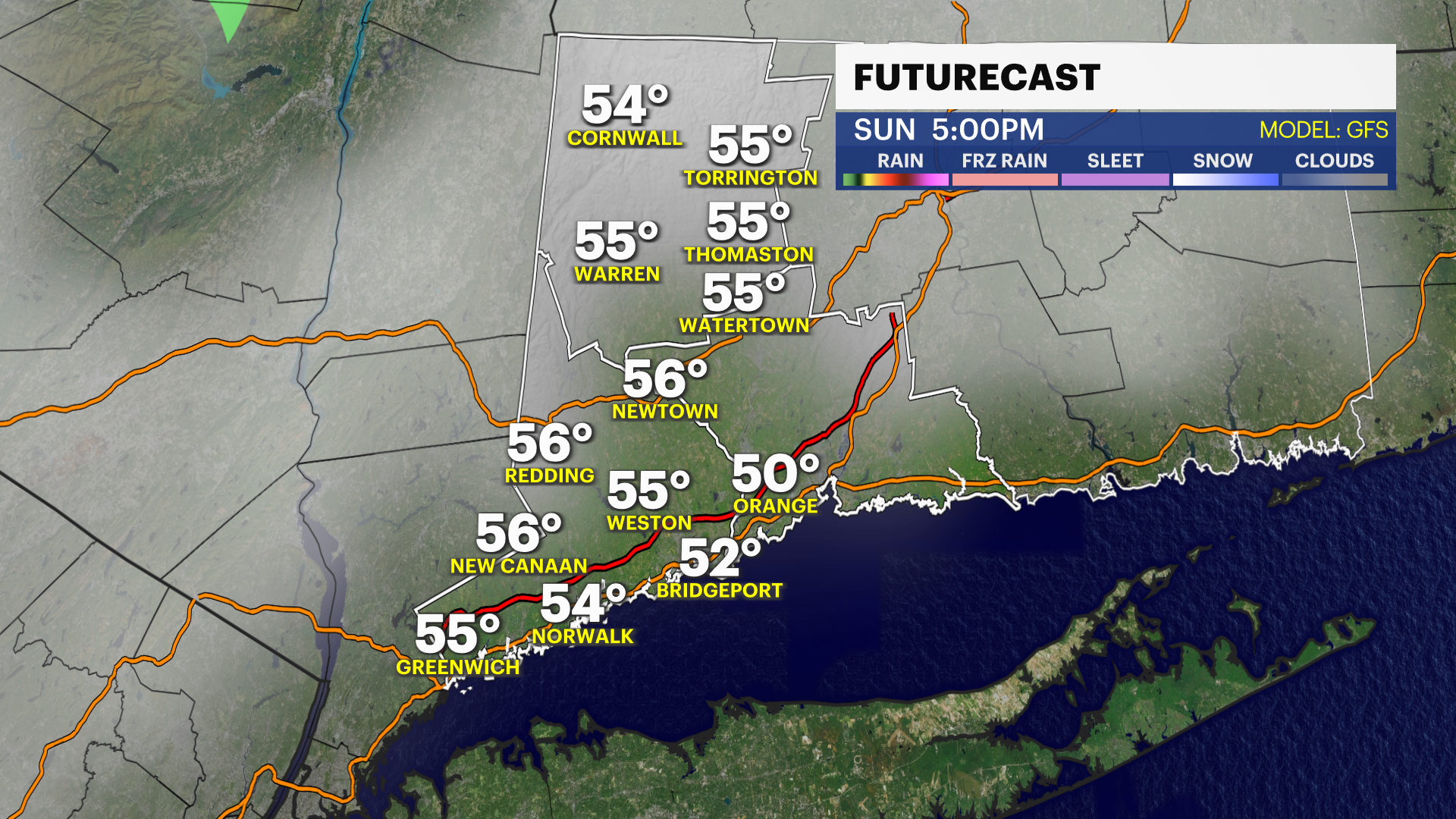
The weekend - Wet and gloomy.
Saturday is the wettest and coldest day out of the weekend. High temperatures are only in the 40s. Sunday is mainly overcast also, but the risk for rain will decrease throughout the day.
Next week - Seasonable start, then cold & wet
Temperatures are near 60-degrees for most of the upcoming work week. It's likely dry Monday and Tuesday but the risk for rain increases later in the week.
Stay tuned to News 12 Connecticut for forecast updates throughout the week regarding the timing of the weekend rain.