Spring sings once again tomorrow as temperatures warm up
Sunny skies and a favorable wind warm us back above average for the rest of the week. On and off showers put a damper on Saturday plans. Will the rain linger into Sunday is the question?
Top Stories


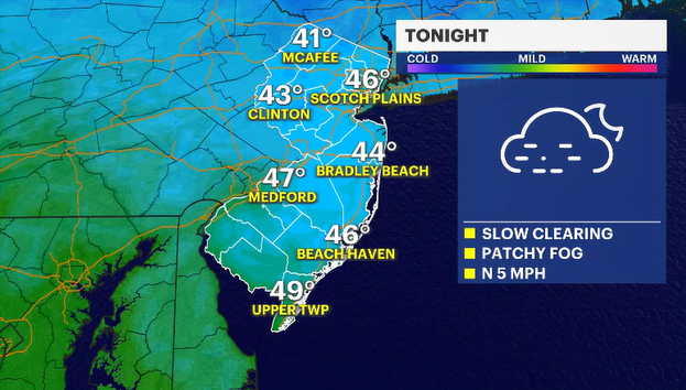
Temperatures remained below average this afternoon. A weather feature remained to our south, which did not allow seasonable to warmer-than-average air to migrate northward. Clouds and the morning rains also contributed to the raw feel.
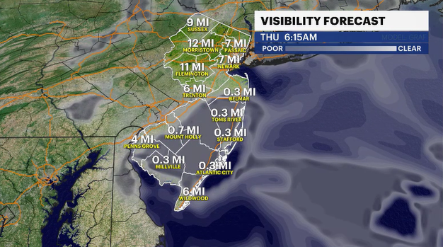
The moist air at the surface and a slowly warming airmass will contribute to patchy dense fog developing in some areas tonight. Please be a little more cautious during tomorrow morning's drive to work and school.
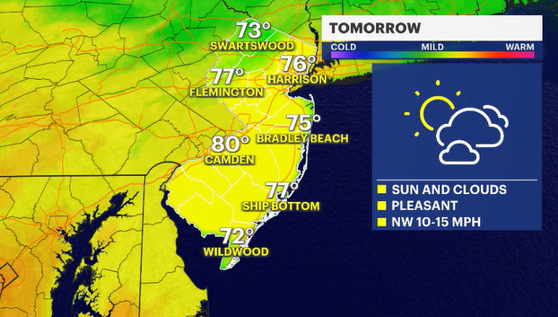
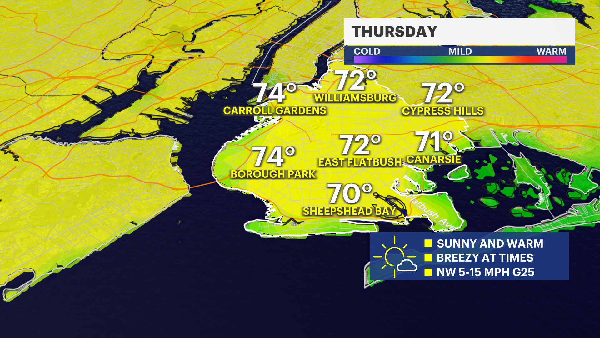
The fog will burn off by 9 a.m. The sun will shine brightly, and a favorable wind will allow temperatures to climb nicely into the low 70s. (66 degrees is a normal high for this time of year). There will be a stationary weather system just to our south that will waffle back and forth for the next few days. When it waffles north, like tomorrow night, we can expect some scattered showers. When it waffles south, the weather improves by Friday afternoon.
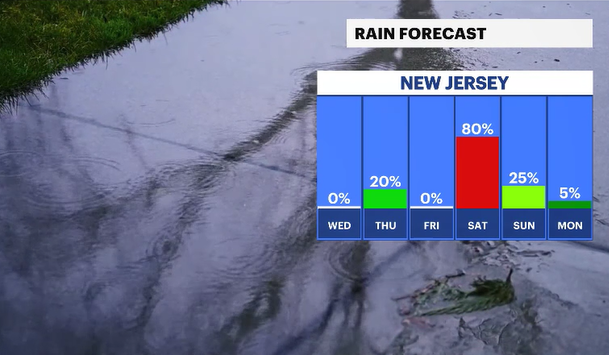
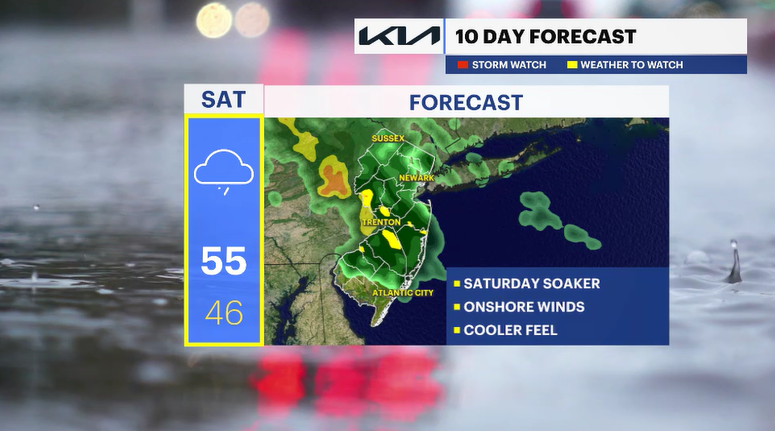
A more notable piece of energy will dive down from the Great Lakes on Saturday along this weather feature and allow a more sustainable bout of wet weather to linger through the day. The start of the weekend looks overcast and wet. Our forecasting fingers are crossed that the weather will clear for Sunday.