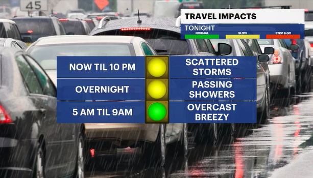
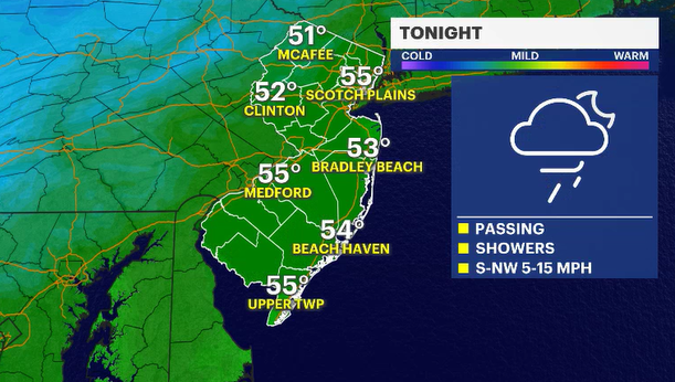
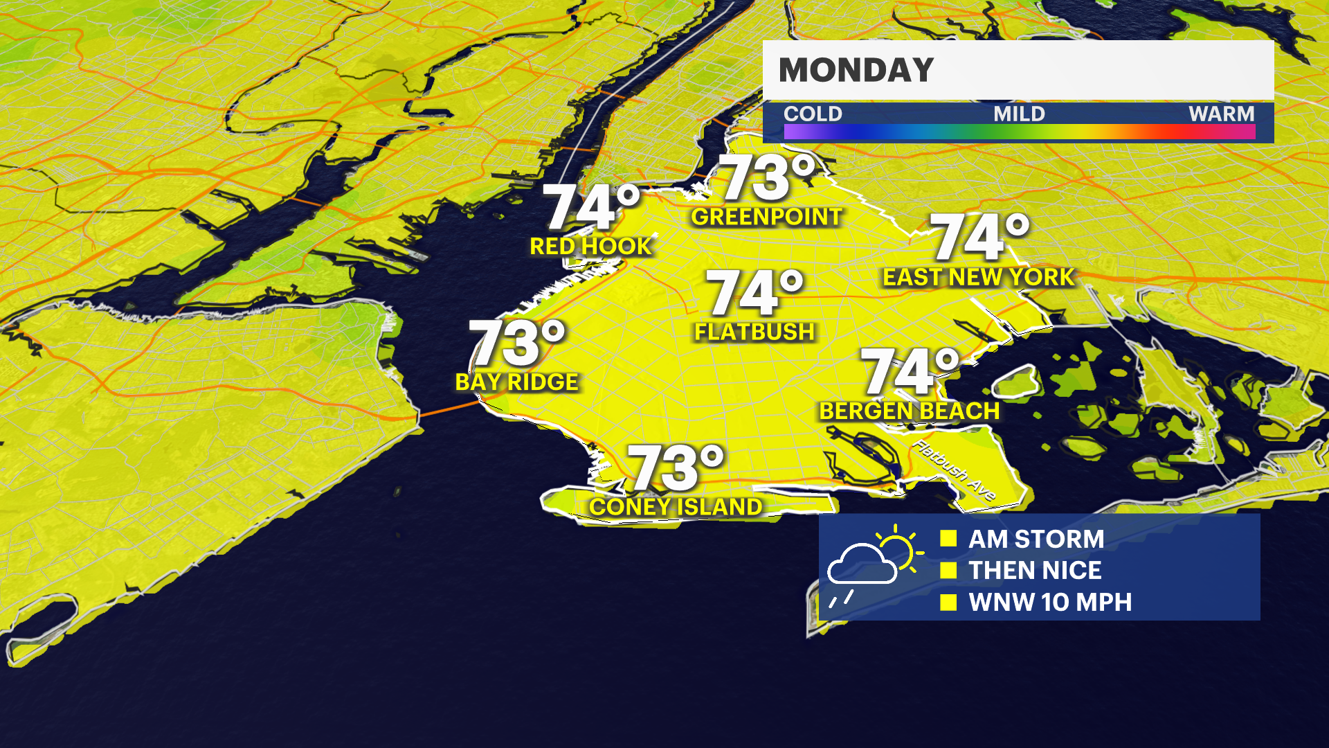
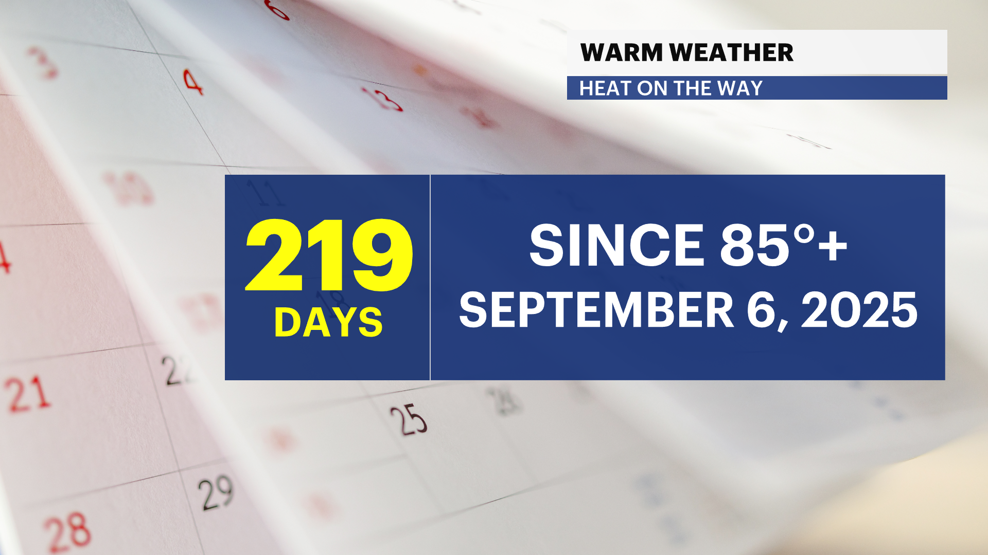
Passing showers late tonight; waiting on a warm-up
The rain will not be that impressive tonight. The bulk of it occurs just after midnight. What will be impressive is the bubble of warmth heading our way.
More Stories
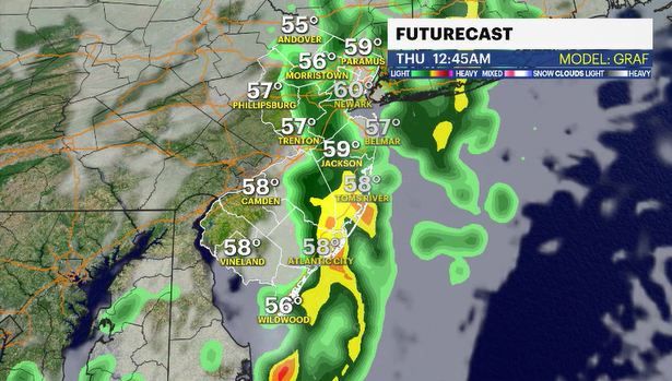
Newer computer guidance is still showing a batch of rain, maybe an isolated thunderstorm, moving through the area much later tonight. It is also showing that the widespread intensity and possible statewide soaking may not come to fruition. It looks like just some passing wet weather to wash the pollen off the cars tonight. The winds will be breezy and this should keep nighttime lows in the 50s for most of us.
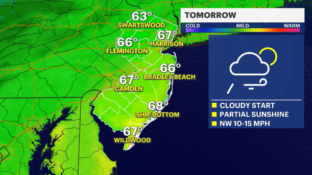
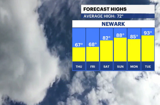
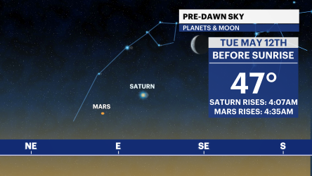
Thursday will start overcast. I can't rule out a lingering, leftover rogue shower as this weather system spirals away and into the ocean. Temperatures will briefly cool back off into the mid- to upper 60s as the wind shifts from the west, coming from western New York and Canada. But yet another wind shift late Thursday night will begin carrying very warm air up the eastern seaboard and from the Midwest, rain-free.
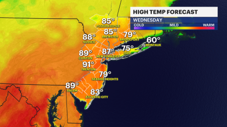
The weather to end the work and school week looks wonderful. Generally speaking, a mix of sun and clouds for Friday and seasonable temperatures in the low 70s.
The weather will continue to warm into the weekend, and it is looking rain-free for both Saturday and Sunday. The impressive warmth shows up early next week. For the third time this year, a pair of 90s could grace the forecast.