Pick of the week: Wednesday in Brooklyn
We remain dry and warm throughout the midweek, with heat and humidity rising later on.
Share:
More Stories


WHAT TO KNOW:
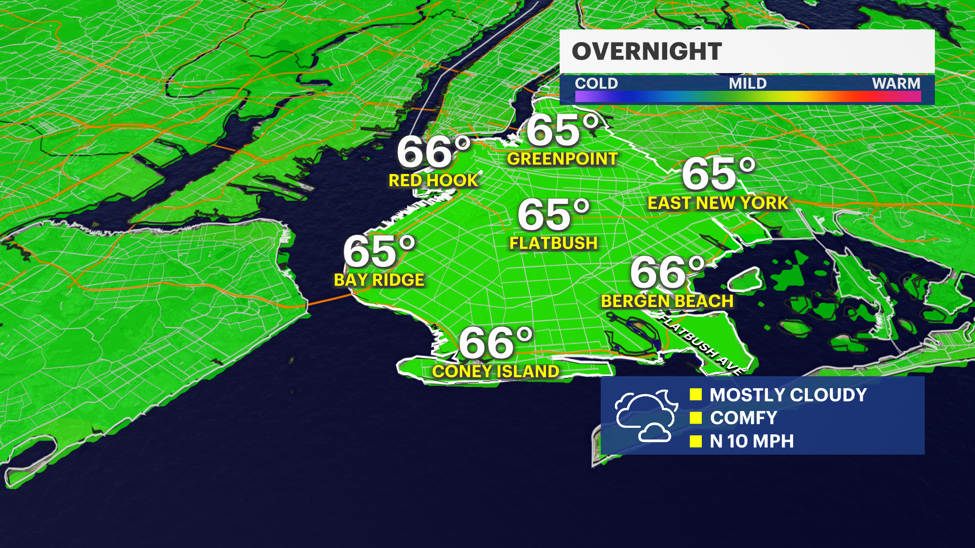
Tonight will be cool and comfortable, and most importantly, dry! It's a decent open-the-windows kind of night. Temperatures will be in the 60s and skies will be mostly cloudy.
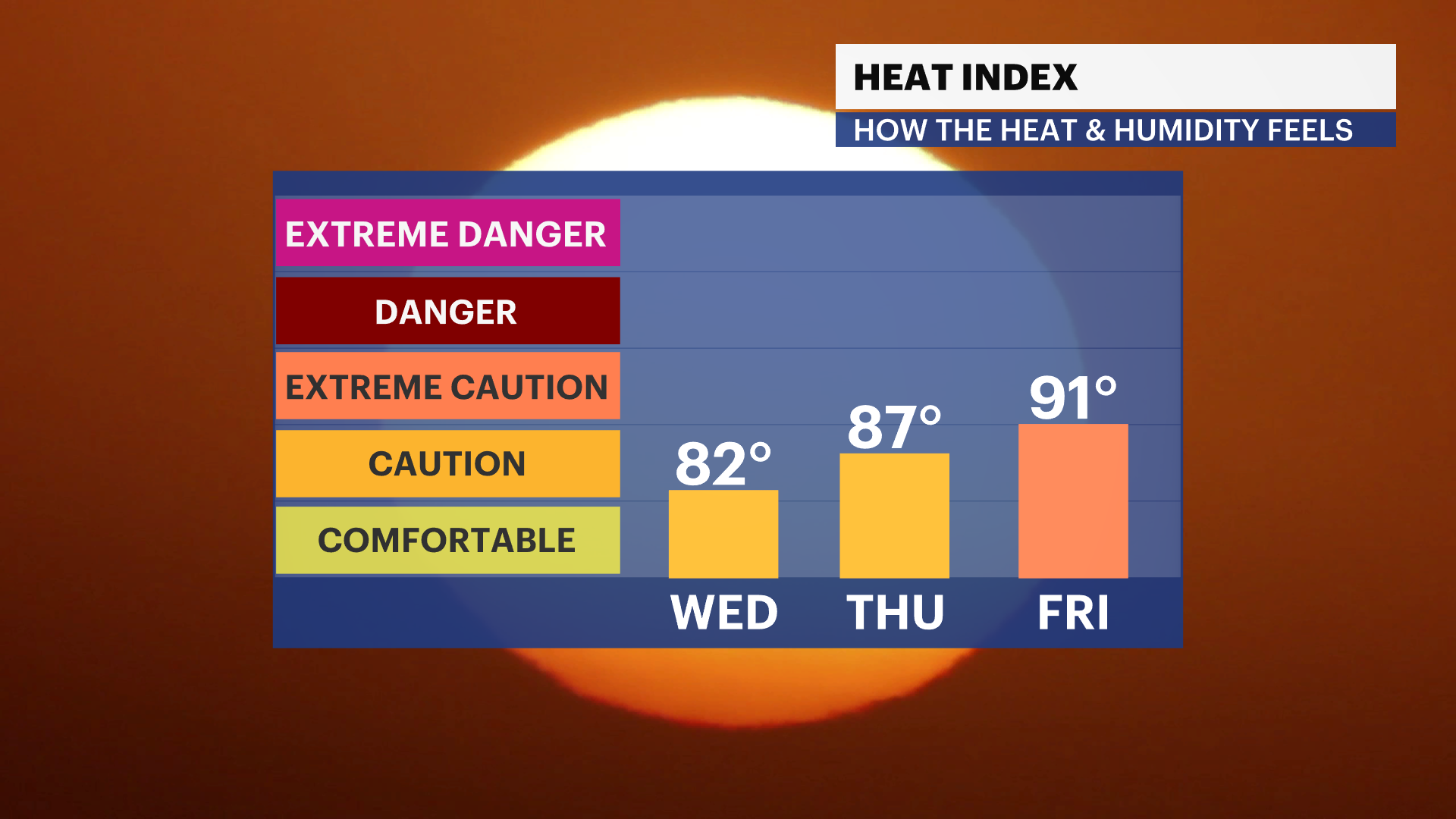
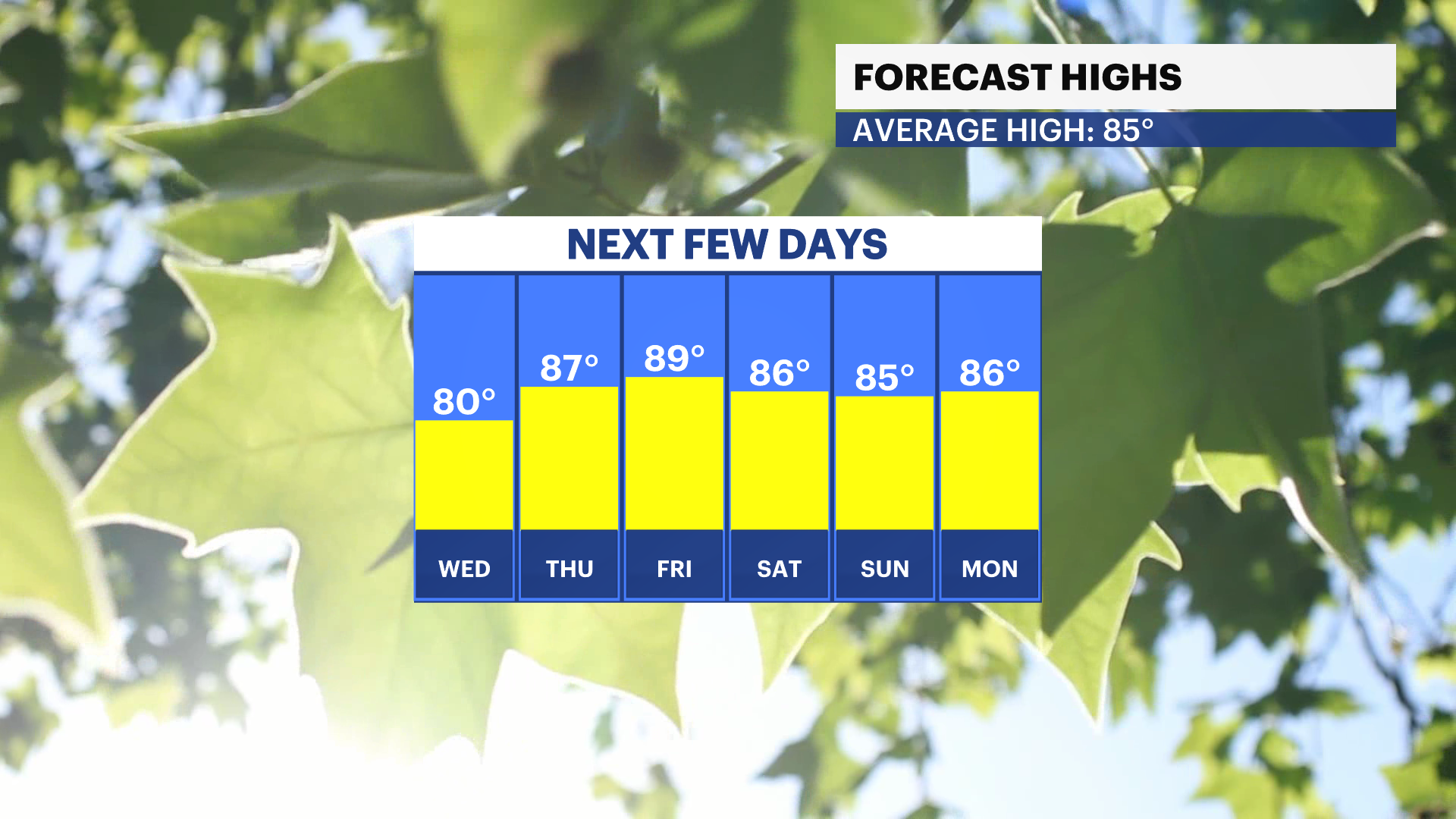
Wednesday will be the pick of the week! Temperatures will be in the low 80s with plenty of sunshine as we head throughout the day. Wind will be light and the UV will be very high, so it will be a great beach day, but don't forget the sunscreen.

Shower and storm chances return on Thursday and Friday, as well as heat and humidity. Temperatures will be in the 80s but could feel more like the 90s with humidity.