Improving Lower Hudson Valley weather follows significant Memorial Day weekend rain
The rest of the week looks nicer and warmer for outdoor plans in Westchester County and the Lower Hudson Valley other than a spotty shower late Wednesday into Thursday.
More Stories


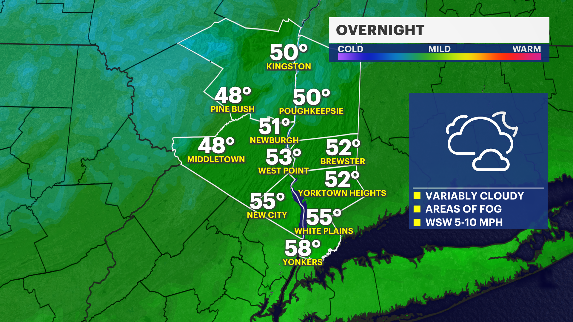
NICE OVERNIGHT WEATHER
It will be variably cloudy overnight with some breaks in the clouds off and on. Some patchy areas of fog will continue to be possible into Tuesday morning, so reduce speed if you encounter any of this into the morning. Low temperatures will range from the upper 40s to upper 50s into early Tuesday, but it will stay dry.
WEEKEND RAIN RECAP
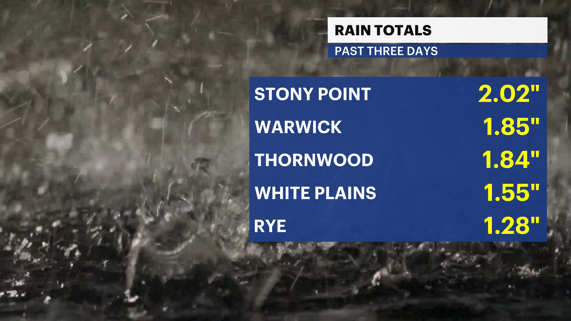
Check out these rain totals from the past three days. This is beneficial rain, but of course, just poorly timed for the holiday weekend. It will not completely fix the moderate drought, but it does help. Drought status updates come out every Thursday morning.
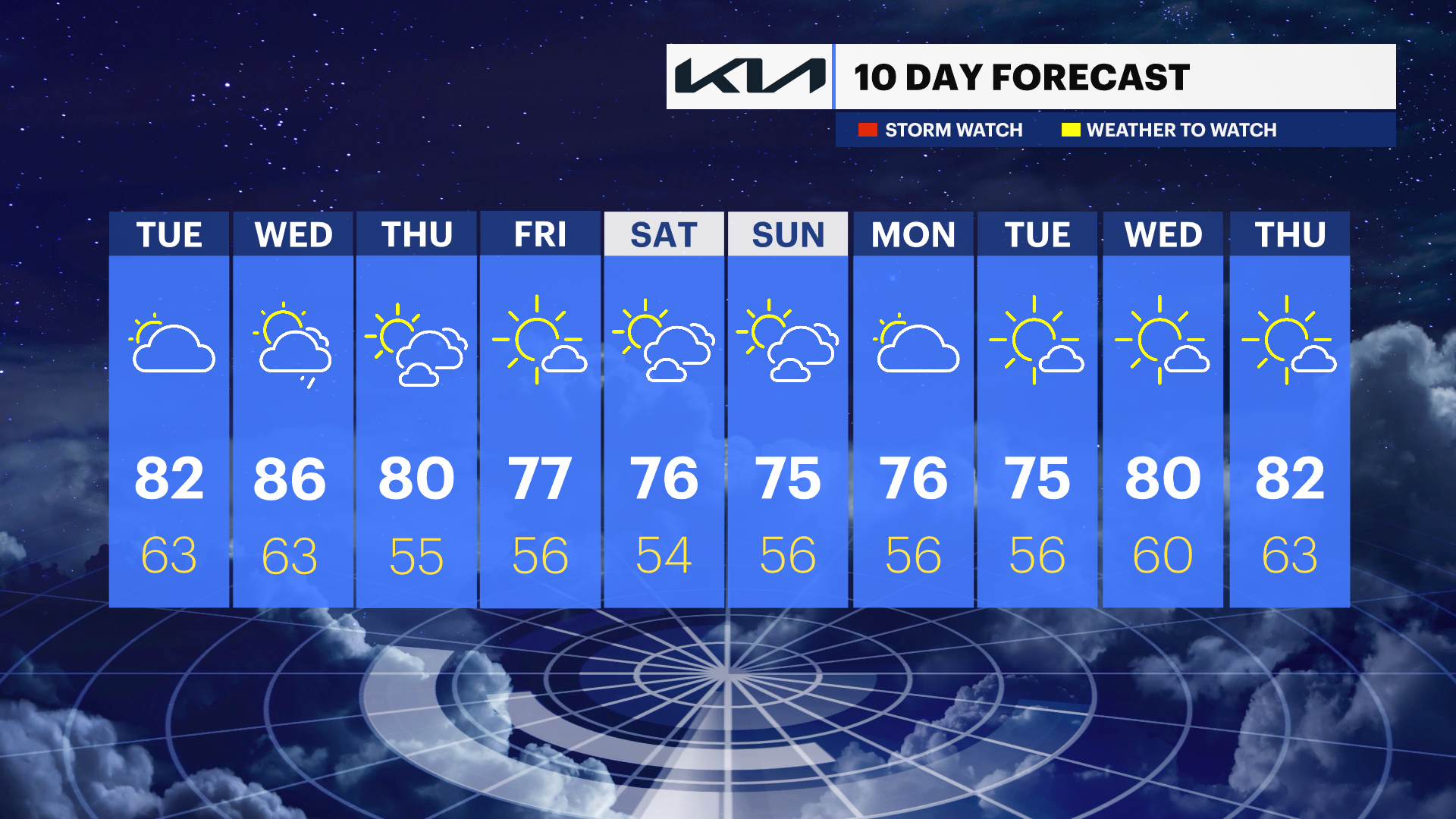
EXTENDED FORECAST
OVERNIGHT: Variably cloudy. Dry with areas of fog possible into Tuesday morning. Temperatures will range from the upper 40s to upper 50s.
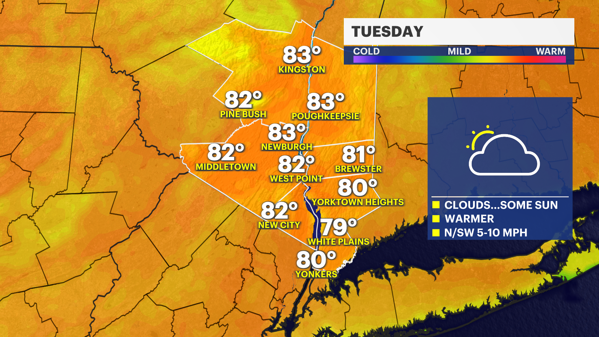
TUESDAY: A chance for early morning fog. Then, breaks of sun for the morning will give way to more clouds in the afternoon, but it will stay dry. It will feel warmer, too with temperatures in the upper 70s to lower 80s. Boating: Much calmer with no advisories for the Long Island Sound or Hudson River waters after 6 a.m. Overnight temperatures will be mild again in the upper 50s to low 60s.
WEDNESDAY: Partly sunny to mostly cloudy and summer-like with temperatures around 86. A spotty shower or brief downpour will be possible at night and into early Thursday morning. Low temperatures near 63.
THURSDAY: Chance for a spotty shower. Otherwise, partly sunny to mostly cloudy with temperatures around 80 degrees. Low temperatures near 55.
FRIDAY: Mostly sunny to partly cloudy. High temperatures around 77 degrees. Low temperatures near 56.
SATURDAY: Sun and clouds. High temperatures around 76. Low temperatures near 54.
SUNDAY: Sun and clouds. High temperatures around 75. Low temperatures near 56.
MONDAY: Partly sunny to mostly cloudy. High temperatures around 76. Low temperatures near 56.