Showery Saturday. Some sun on Sunday. We're sizzling next week
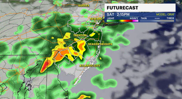
On-and-off showers for Saturday. Primarily south of the I-195 corridor. The weather improves slightly for Sunday. The next big story will be New Jersey facing extreme heat next week.
More Stories


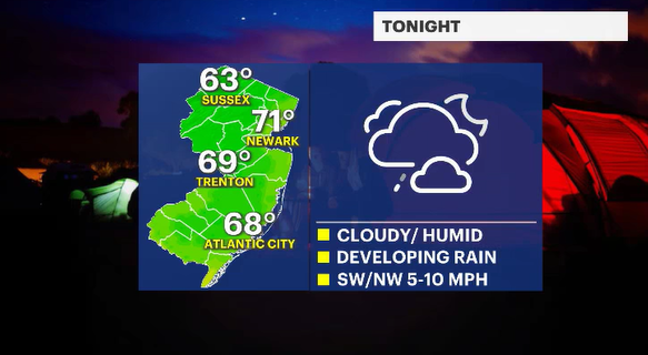
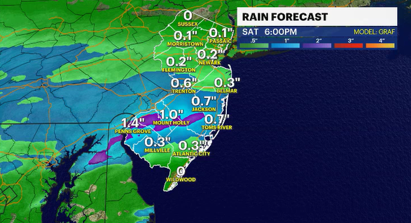
The humidity will be slowly rising tonight, making for slightly uncomfortable sleeping conditions. Nighttime lows will be a few degrees warmer than usual, but the mugginess makes it feel warmer. Passing showers will be developing towards daybreak. The weather pattern isn't the greatest set-up for a summer Saturday.
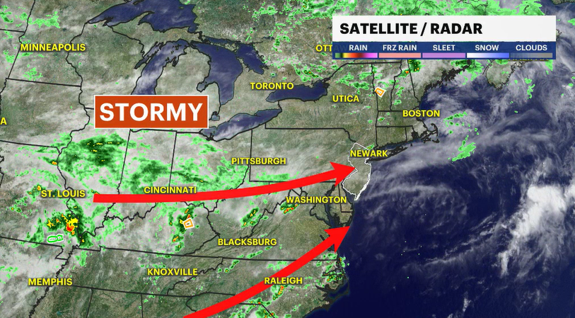
On-and-off showers are likely through most of the day tomorrow. The focus of the consistent rain looks to be from Point Pleasant southward. This focal point of wet weather could waffle some during the day as the pesky weather system lurches across the state. As a result of the clouds and showers, daytime highs will be below average, but the mugginess makes it feel warm.
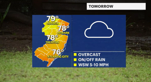
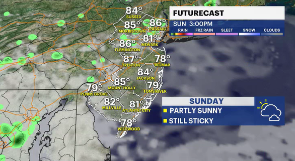
We should see some improvement on Sunday. I'll call for a partially sunny day. It is still on the stickier side. Some afternoon sunshine will help get those daily high temperatures back into the low to mid 80s. There is a small chance there could be a renegade shower that pops up after 2 p.m.
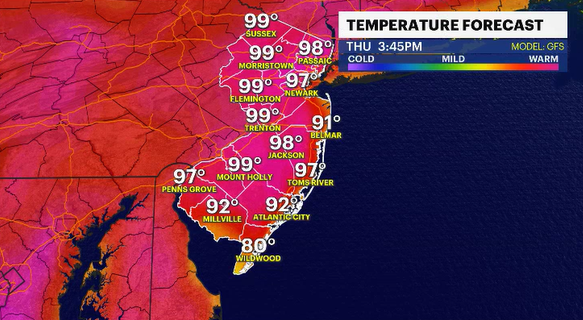
While inside on Saturday, maybe start thinking about how you are going to deal with the relentless late June sun baking us at near record temperatures for a few days straight. Starting on Tuesday, it looks like the daily highs are back into the 90s. A dome of intense heat will redefine summer for New Jersey with multiple days in the upper 90s, and maybe one or two days at triple digits.