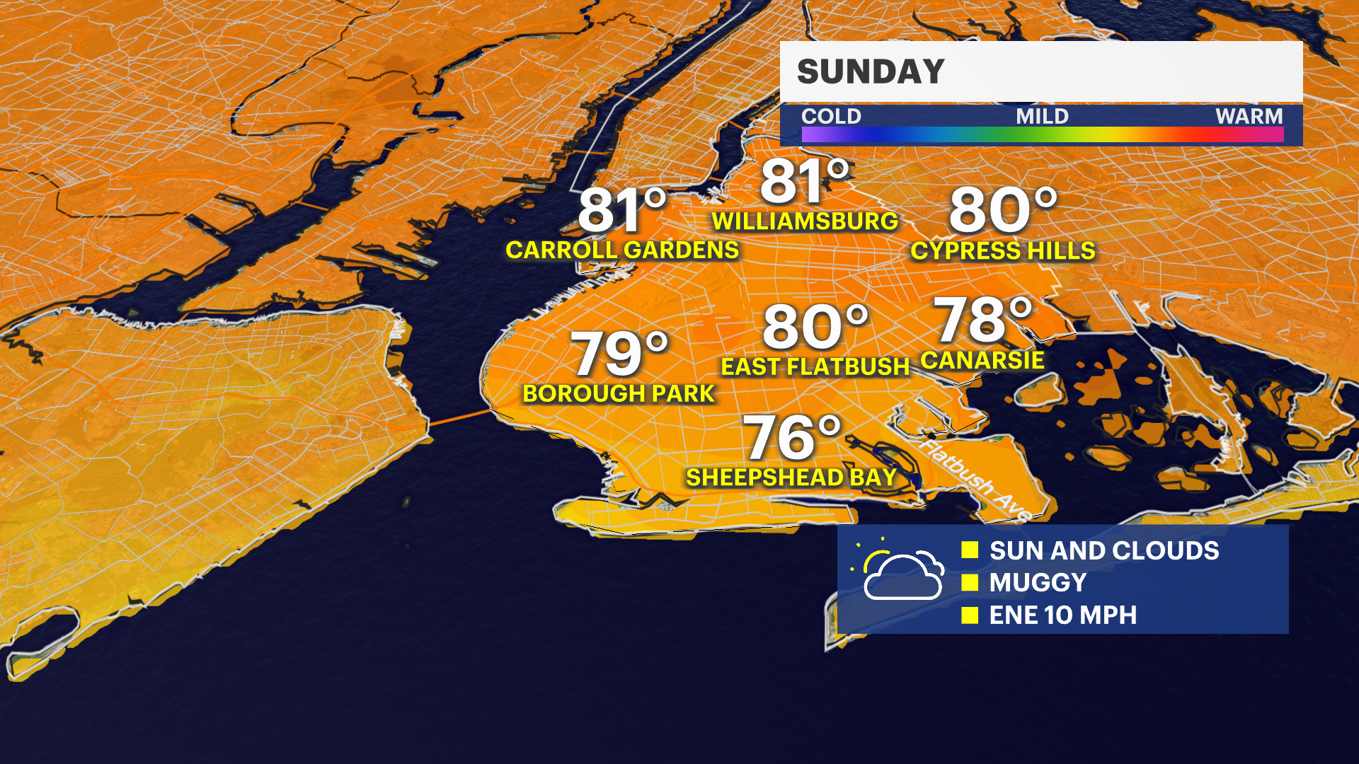
Mix of sun and clouds, with warm temperatures for Sunday for Brooklyn
Brooklyn will see a mix of sun and clouds for Sunday along with warm temperatures. Extreme heat is possible leading up to Independence Day next week.
More Stories


Weekend Headlines
Sunday is the better day out of the weekend with more sun
No weather related marine hazards in place. A moderate risk for rip currents on Atlantic facing beaches.
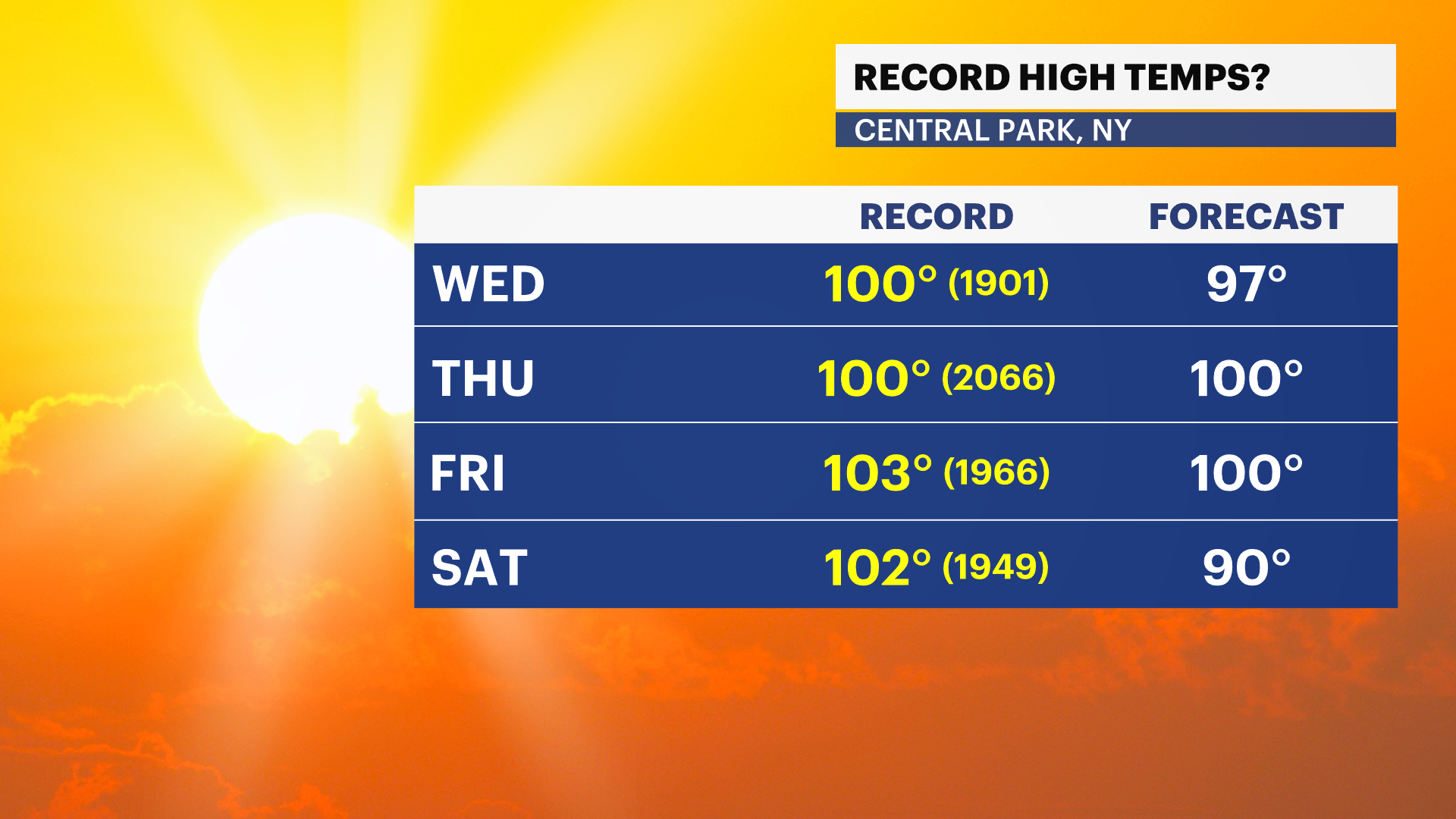
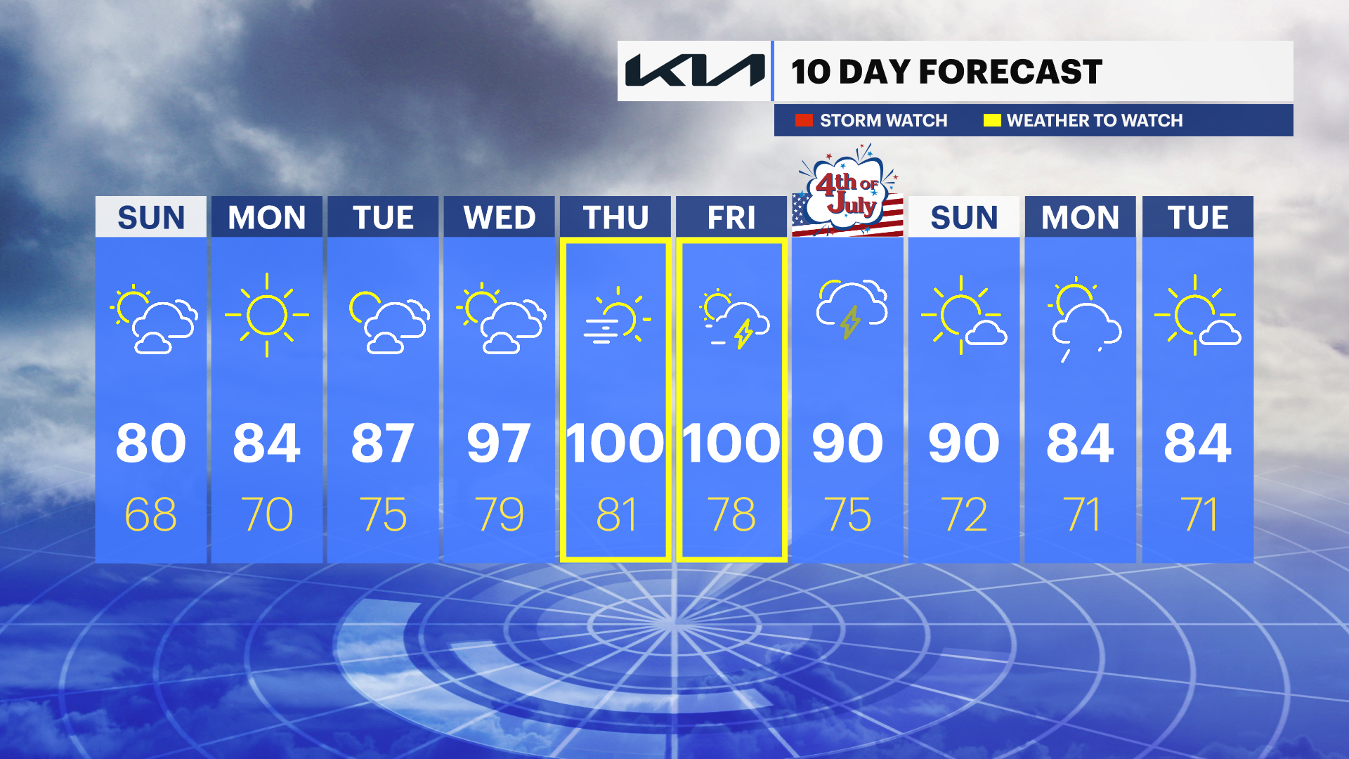
Extreme Heat expected Wednesday - Friday.
Pop up thunderstorms expected next Friday and for Independence Day.
FORECAST
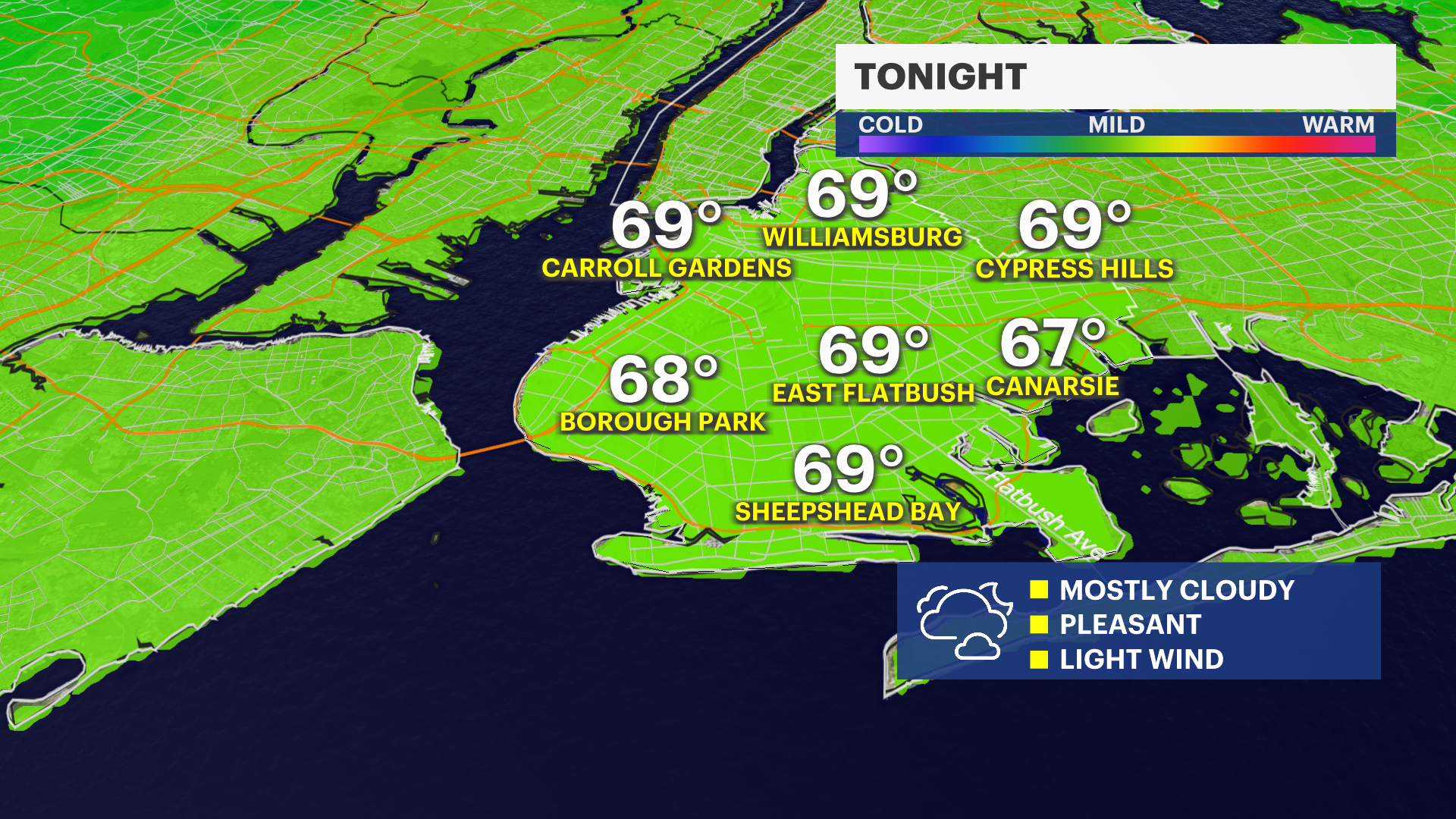
Overnight: Mostly cloudy, with light winds. Rain is not expected. Low temperatures are in the mid-60s.
Sunday: A mix of sun and clouds and a touch less humid. Temperatures near 80.
Monday: Plenty of sunshine and seasonable temperatures. Highs in the mid-80s.
Tuesday: Sunny and warm, with temperatures in the mid- to upper 80s. A thunderstorm is possible in the evening.
Wednesday: Mostly sunny, warmer and a bit more humid. Temperatures potentially hit 90.
Thursday & Friday: Hazy, hot and humid. Temperatures are in the mid- to upper 90s and could approach 100.
Saturday -- Independence Day: Hot and humid. High temperatures near 90, with pop-up storms possible.