Newark Information
☀️
UV Index Today
--
Loading...
🍃
Air Quality
--
Loading...
🌡️
Average High / Low
-- / --
1991-2020 Normals
EWR Climate
🏆
Record High / Low
-- / --
Loading...
EWR Climate
Loading latest Newark information...
Check coastal alerts and tide information
FORECAST:
Two fronts pass across New Jersey today - sending periods of rain and even sunshine to the Garden State. This morning's warm front delivers the warm air across New Jersey this afternoon. Sunshine emerges with temperatures and humidity rising. Highs reach near 80 this afternoon. A cold front and its associated squall line approaches New Jersey from the northwest at 5 p.m.
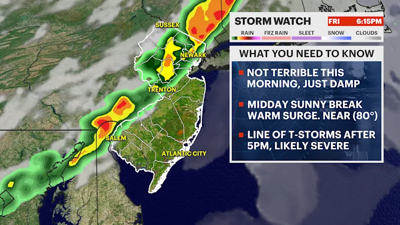
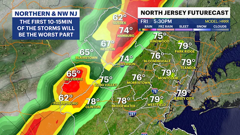
The first 10-15 minutes of the squall will be the most abrasive part of the weather today. The leading edge of this thunderstorm can produce gusts upwards 50-70 mph. There is a very sharp temperature difference from the air ahead of the front and the air behind it. Colder air is the driving force that's moving to lift the heat and humidity to produce lightning, strong gusts, and even a stray tornado. The tornado risk has increased for northern New Jersey as a result of the abrasiveness of the squall. Some showers linger south and east into Saturday morning as the front slows down, which causes the rain to spread out. It clears eventually.
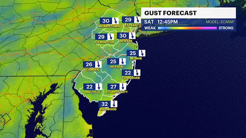
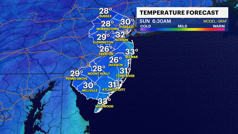
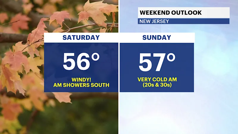
Windy weather arrives tomorrow with gusts near 30-35 mph throughout the day. This creates a wind chill that makes the air feel as cold as the 40s throughout the midday. Cold air sinks in for Saturday night into Sunday morning creating lows int he upper 20s in the higher elevations north and west. Frost is expected to impact other counties in New Jersey for Sunday morning. A freeze may occur in northwestern counties.
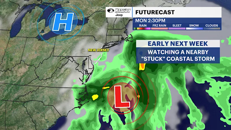
For next week, this same front that changed our weather pattern for this weekend will dwell offshore and churn into a coastal storm. This coastal storm will tease us throughout the week as an area of fair weather blocks it from coming to New Jersey. We anticipate a few southern showers - randomly at times - for next week, but impacts are minimal as of now. If the fair-weather pattern weakens, it could encourage this storm to move closer to New Jersey.
FUTURECAST:
TIDES:
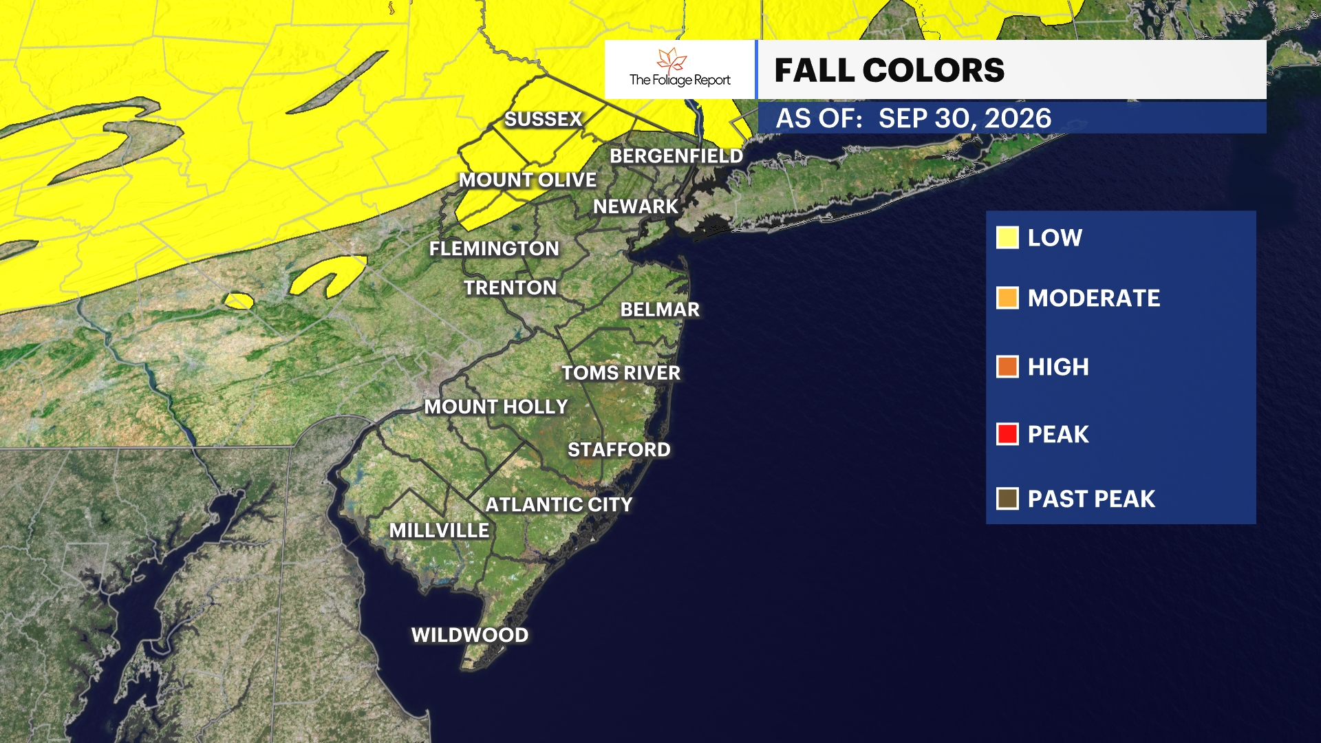
FOLIAGE UPDATE (New report every Wednesday):