Showers and storm chances overnight in The Bronx
Wet weather arrives overnight, with a drier weekend ahead.
Share:
More Stories


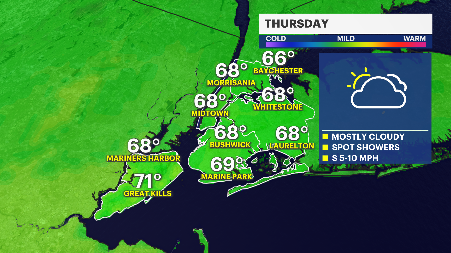
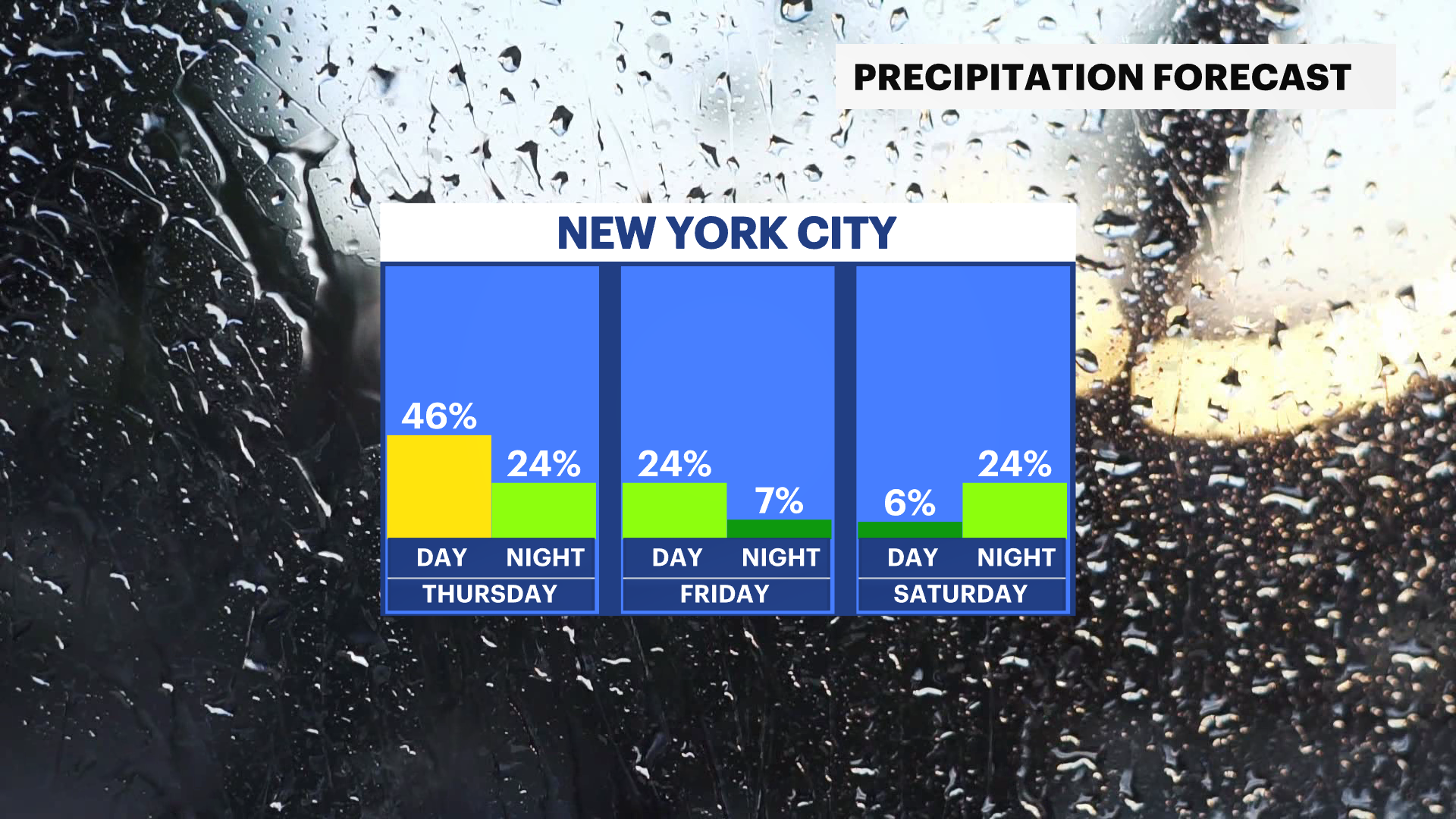
A soggy stretch of weather arrives tonight and continues into Friday. We aren't looking at a washout, but there are a few opportunities for some wet weather. Overnight, early showers and potentially thunderstorms push through, bringing meager amounts of rain into early Thursday.
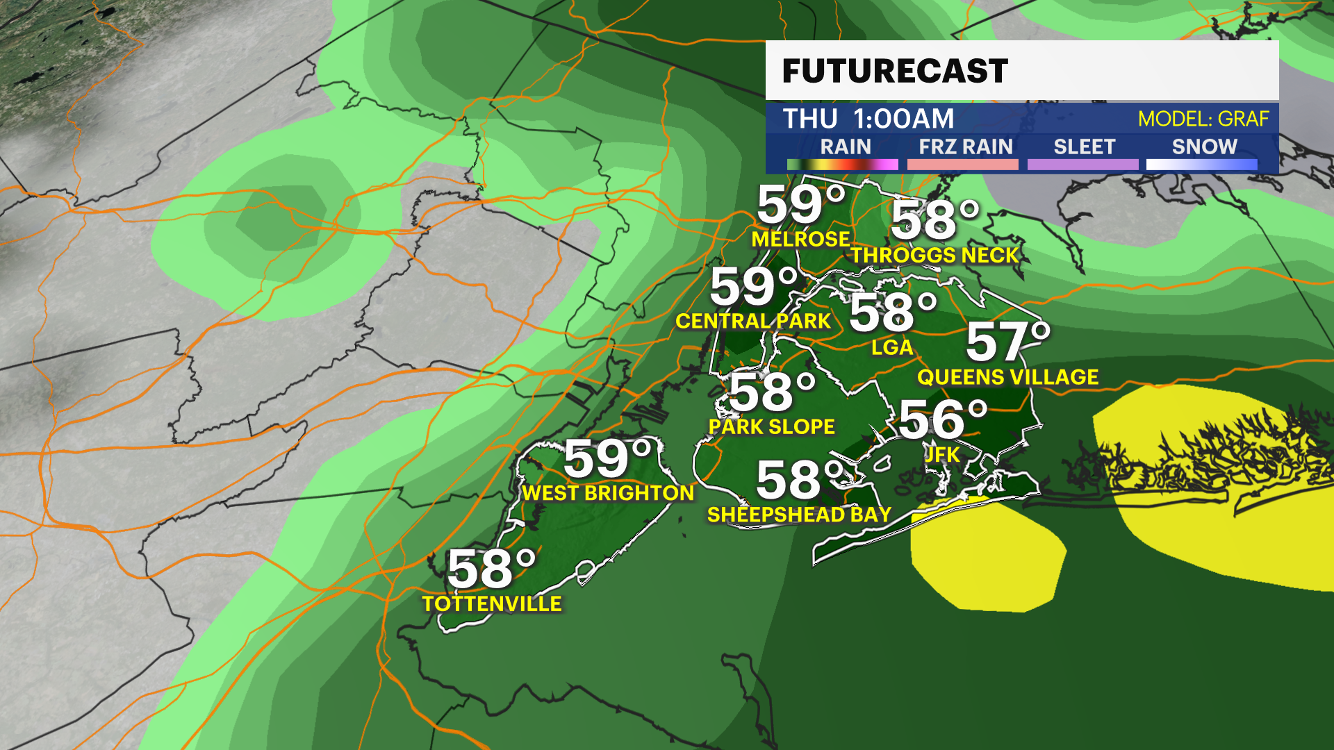
Most of this will likely be cleared out by the morning commute. Spot showers are possible throughout Thursday and into Friday as we deal with a few different systems pushing through.
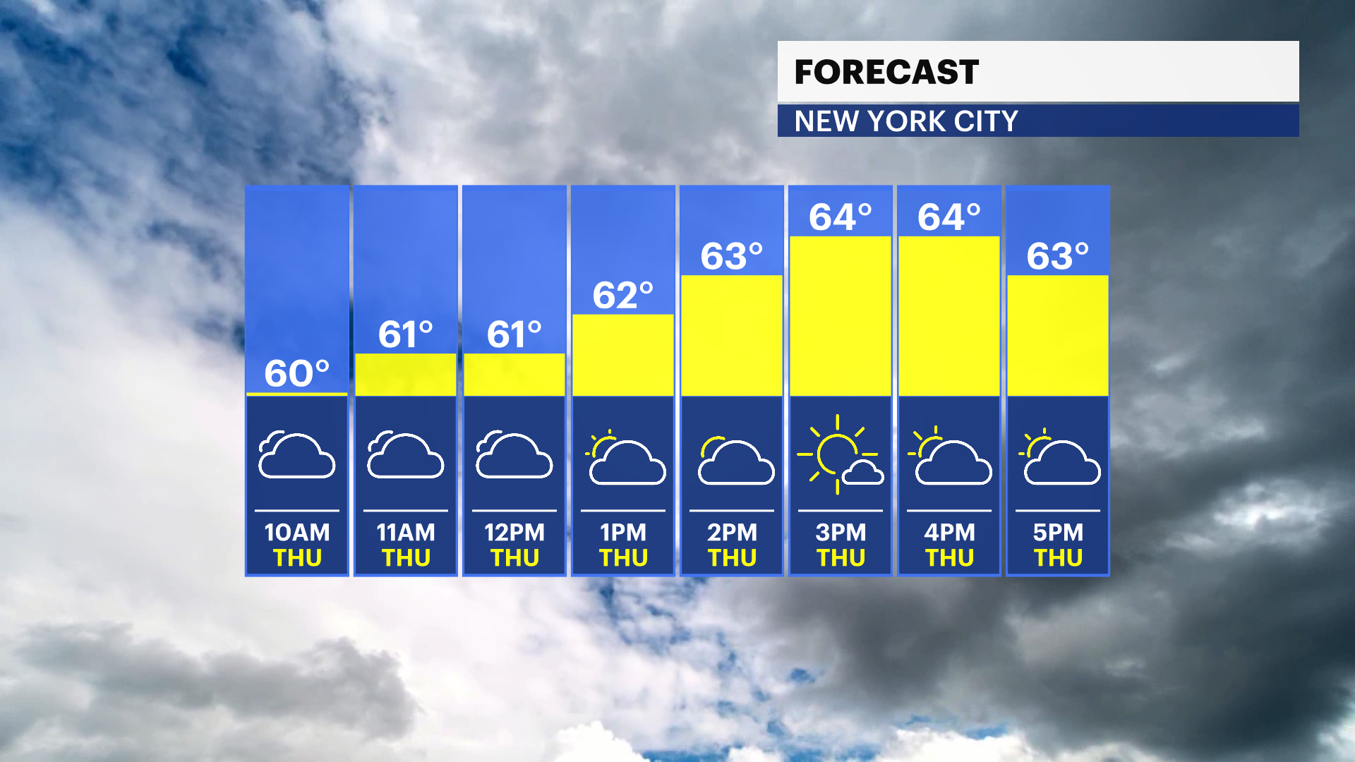
Temperatures remain cooler than normal through Friday with a major warmup on tap for the weekend! We're tracking temperatures cruising into the 70s and 80s by Sunday, with the mid to high 80s potentially into early next week.