Newark Information
☀️
UV Index Today
--
Loading...
🍃
Air Quality
--
Loading...
🌡️
Average High / Low
-- / --
1991-2020 Normals
EWR Climate
🏆
Record High / Low
-- / --
Loading...
EWR Climate
Loading latest Newark information...
Check coastal alerts and tide information
FORECAST
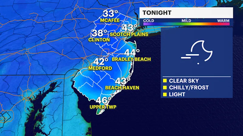
Another cold night is upon the Garden State. With a clear sky and lighter winds, temperatures will fall rapidly and back into the 30s and low 40s.
Frost is likely again and there are frost advisories for areas that may have not seen the widespread frost yet to end the growing season.
Protect cold sensitive plants again on Sunday night. Areas north and west of I-80 and I-287 may experience pockets of near freezing temperatures early Monday morning.
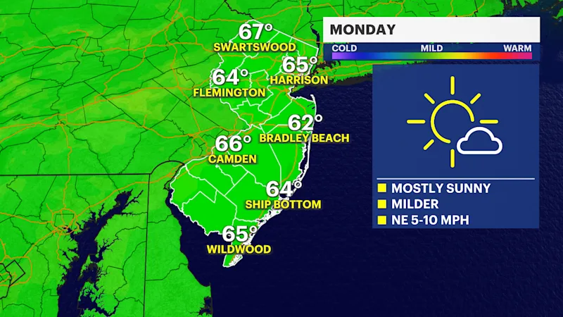
The sun will return and temperatures will bounce back for Monday and Tuesday afternoon.
Instead of widespread 50s over the weekend, temperatures will rise into the mid- and even upper 60s. This will give a more seasonable fall-feel for October.
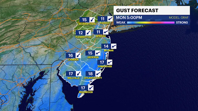
The rest of the week looks dry but could become breezier by Tuesday with a risk of some coastal flooding due to the storm developing offshore.
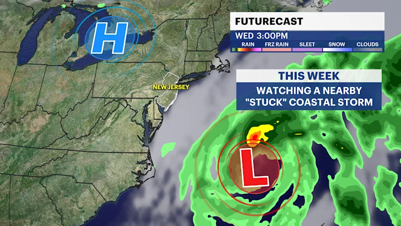
The clouds will increase as the winds tighten up a bit more by Tuesday. Winds will be coming out of the northeast and they will be persistent with the offshore storm that "gets stuck" for a few days off the northern Mid Atlantic Coast.
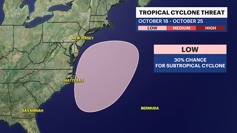
As of Sunday evening's forecast, it looks like any rain will stay away, but a wind and large surf will be the main impacts. The National Hurricane Center (NHC) gives this storm system a 30% chance of becoming a subtropical (hybrid) storm over the next seven days. In that case, it would be named.
Check back with the News 12 Storm Watch Team for more updates regarding the storm this week.
FUTURECAST:
TIDES:
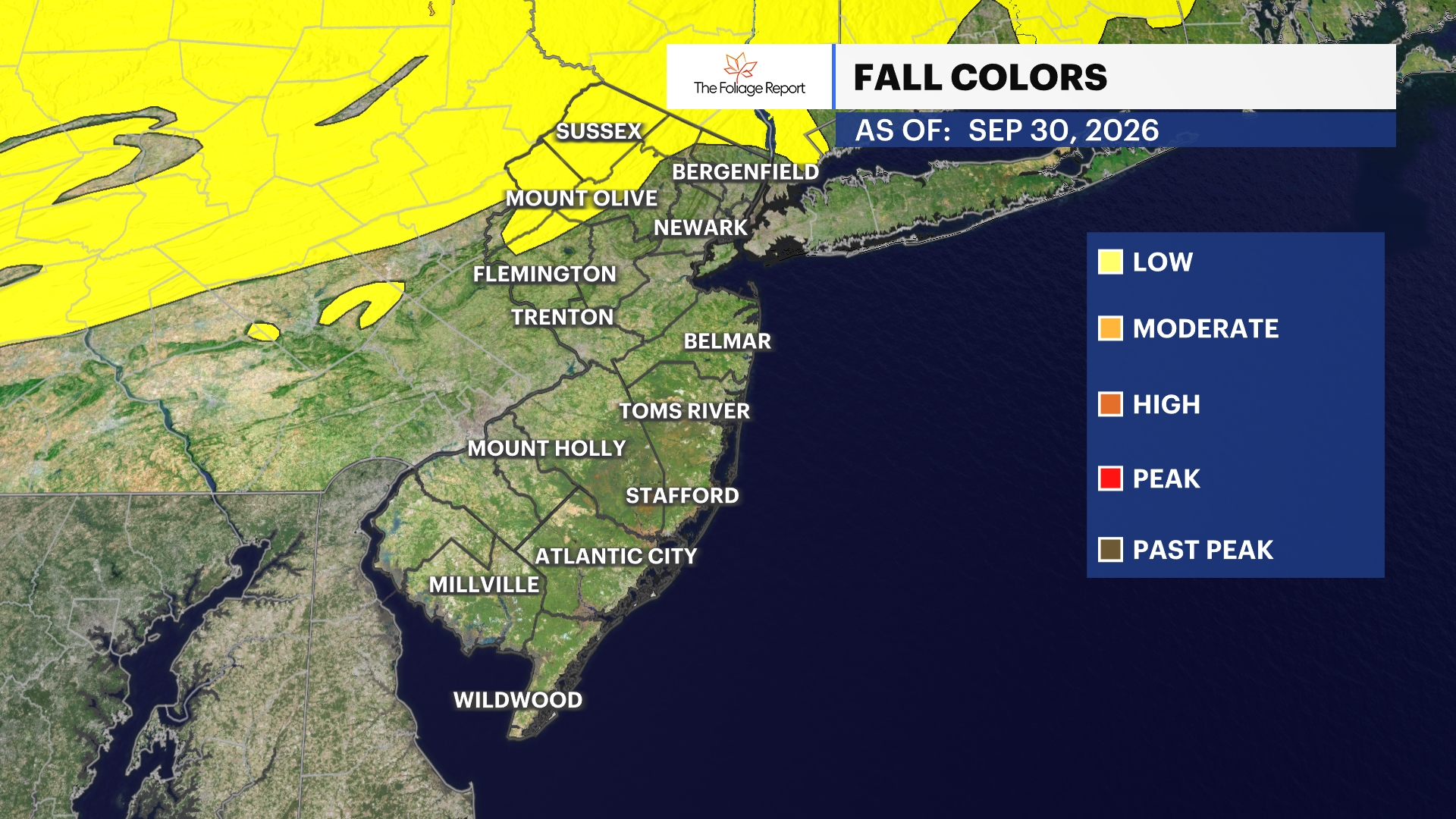
FOLIAGE UPDATE (New report every Wednesday):