Sunshine dominates in The Bronx before storm chances return
Sunshine prevails today before scattered afternoon and evening thunderstorms return Thursday and Friday.
More Stories


WHAT TO KNOW:
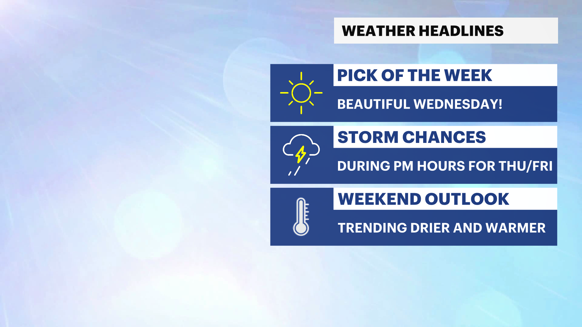
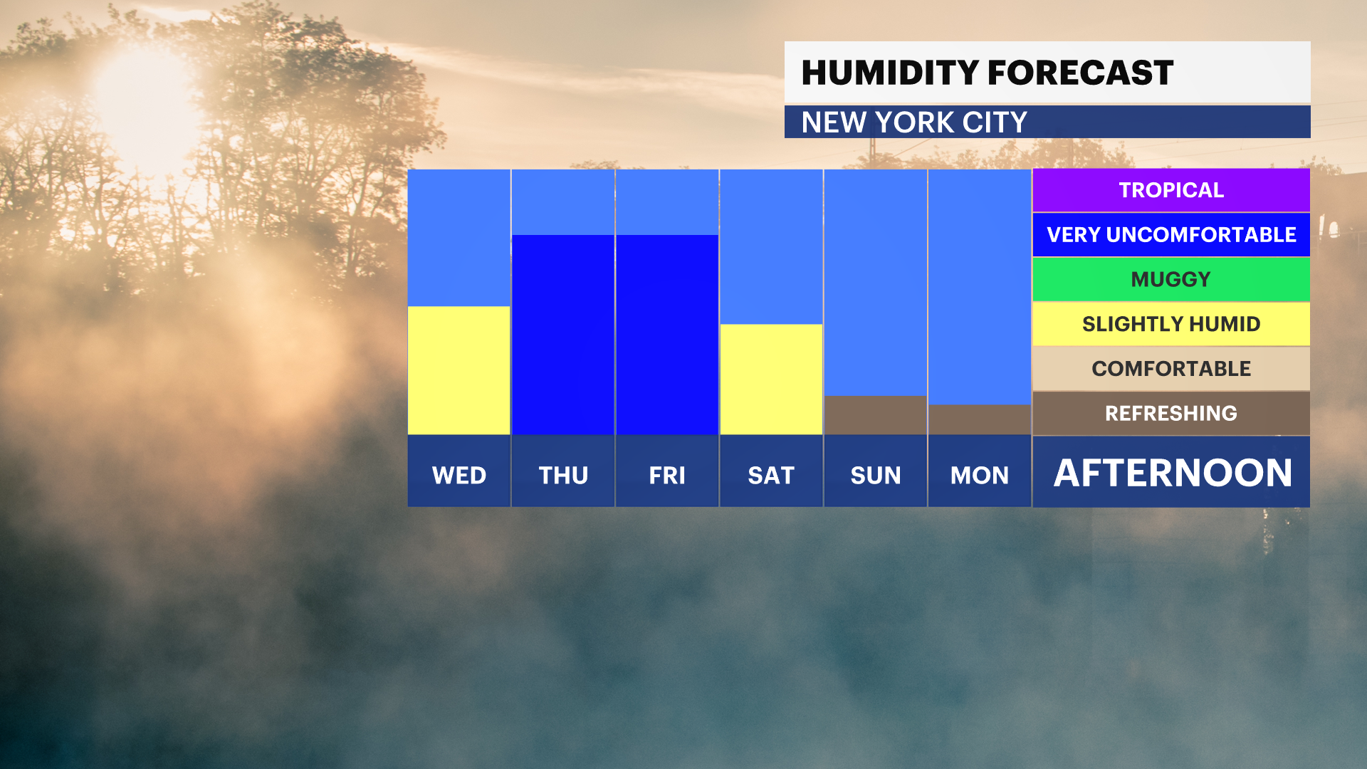
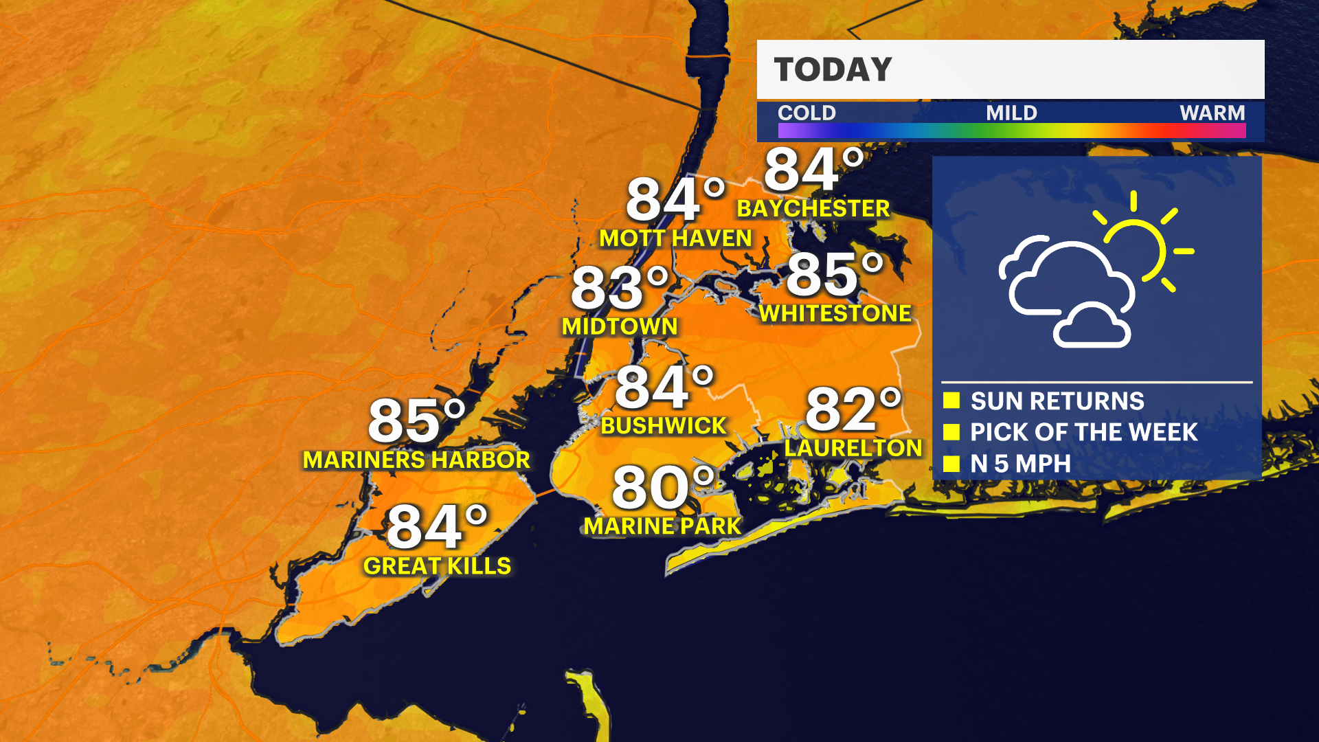
Pleasant summer weather continues this afternoon and evening with abundant sunshine and comfortable humidity levels. It will be a great day to get outside, with seasonable temperatures and light winds making for ideal conditions.
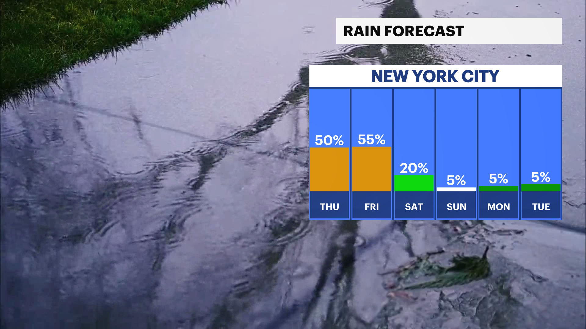
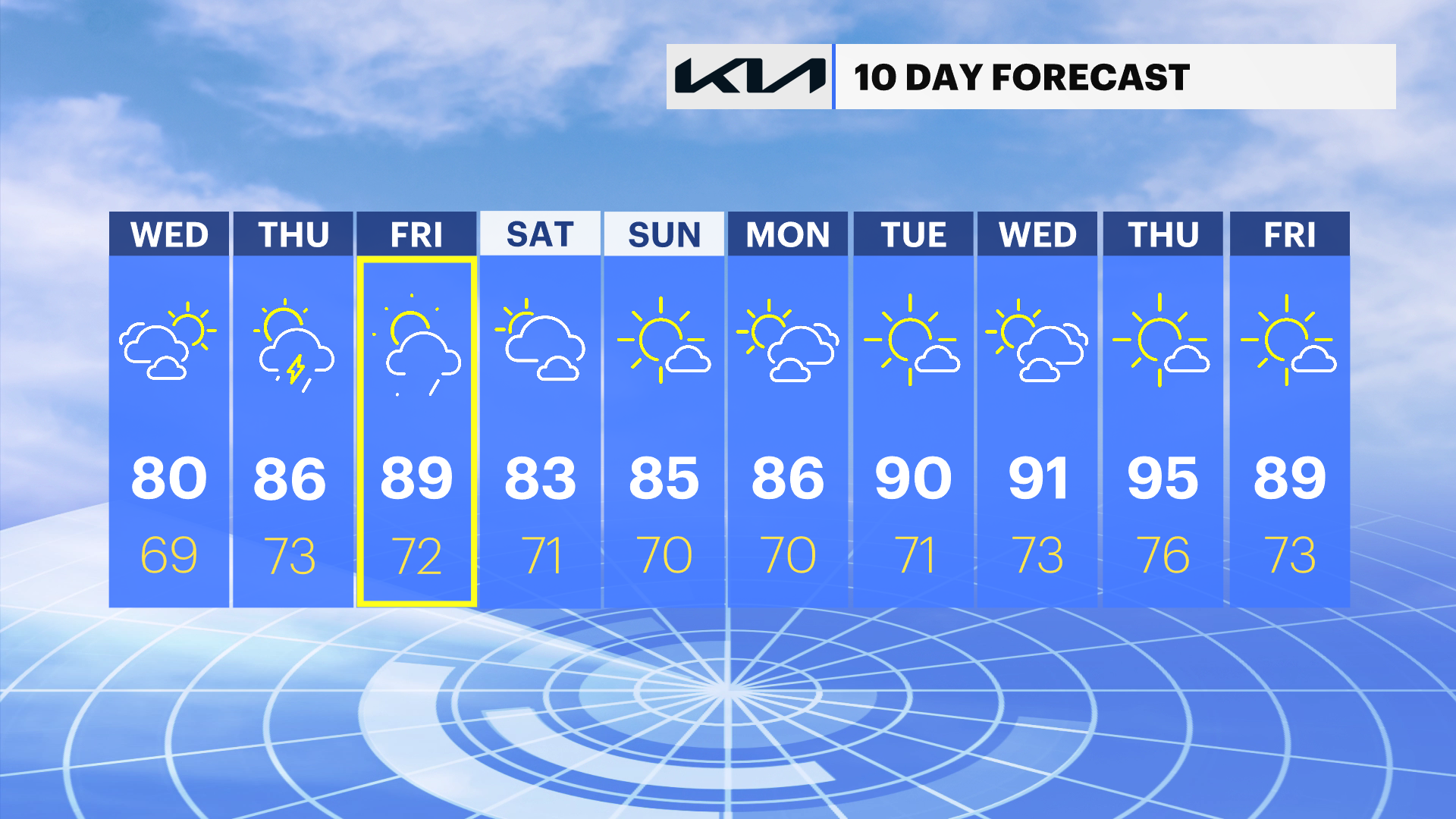
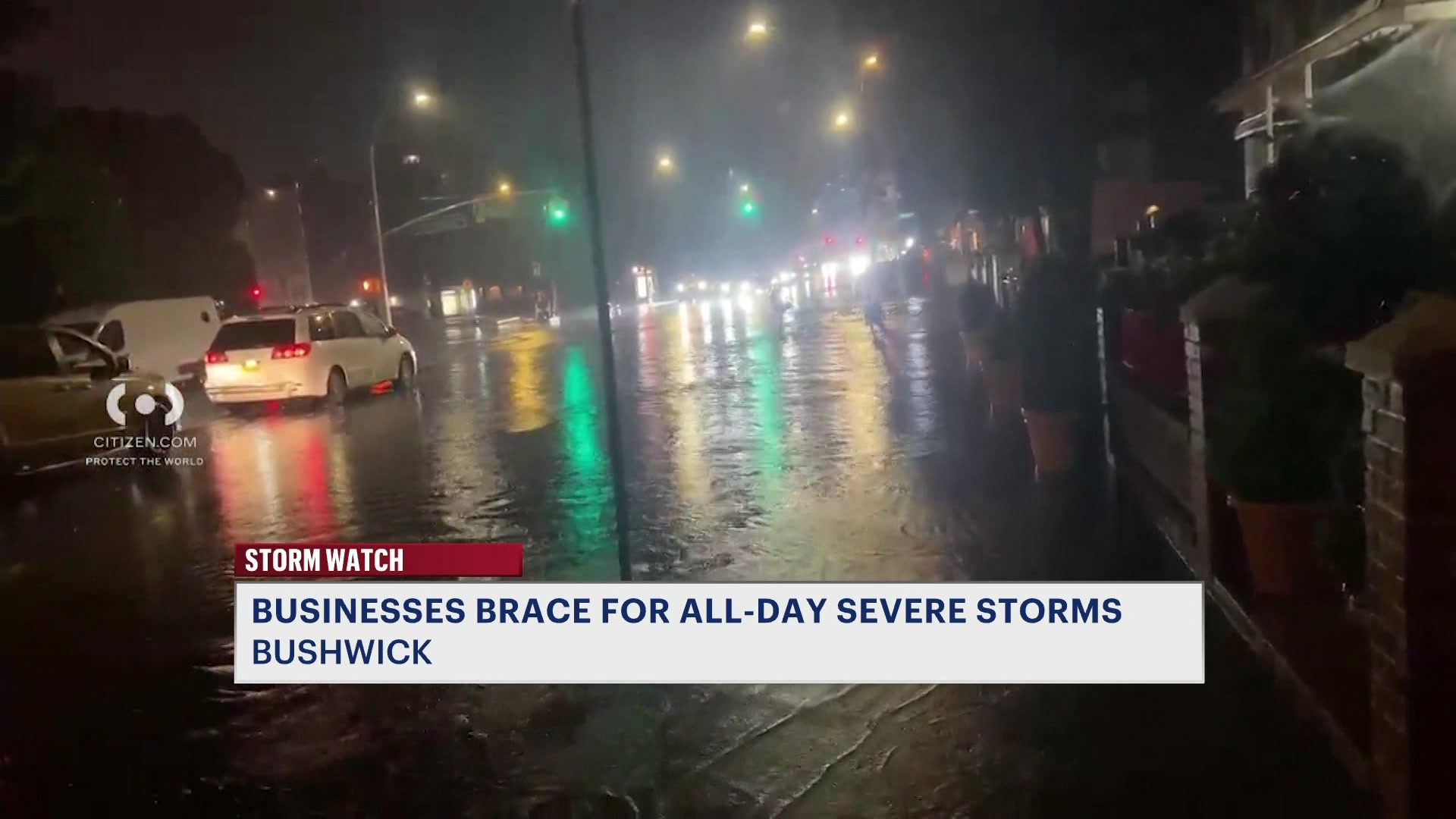
The next chance for unsettled weather arrives Thursday and Friday as warmth and humidity increase. Scattered afternoon and evening showers and thunderstorms are possible both days, with the greatest coverage expected Friday. Drier weather returns for the weekend, followed by a warming trend early next week that will send temperatures close to 90 degrees by Tuesday.
Today: Sunny and pleasant. Highs in the upper 70s.
Thursday: Mostly sunny, warmer and a bit more humid with scattered afternoon and evening showers and thunderstorms. Highs in the lower 80s.
Friday: Mostly sunny, warm, and humid with showers and thunderstorms likely during the afternoon and evening. Highs in the mid to upper 80s.
Saturday: Mostly sunny and comfortable. Highs in the lower 80s.
Sunday: Sunny and warm. Highs in the mid-80s.
Monday: Mostly sunny and warmer. Highs in the mid to upper 80s.
Tuesday: Sunny and hot. Highs near 90 degrees.