Storm Watch: Summerlike heat will fuel stormy weather across the Hudson Valley
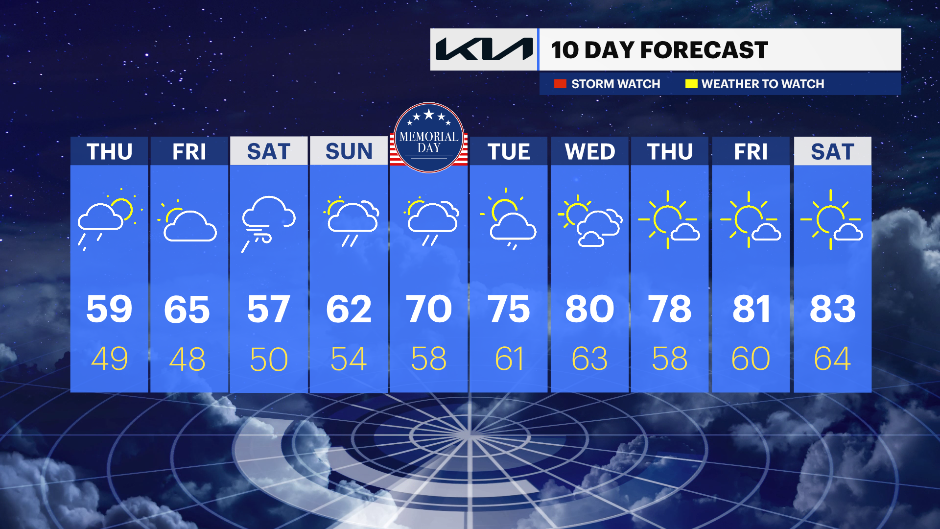
Damaging winds and small hail are the main concerns. A big temperature drop will follow the storms for Thursday.
More Stories
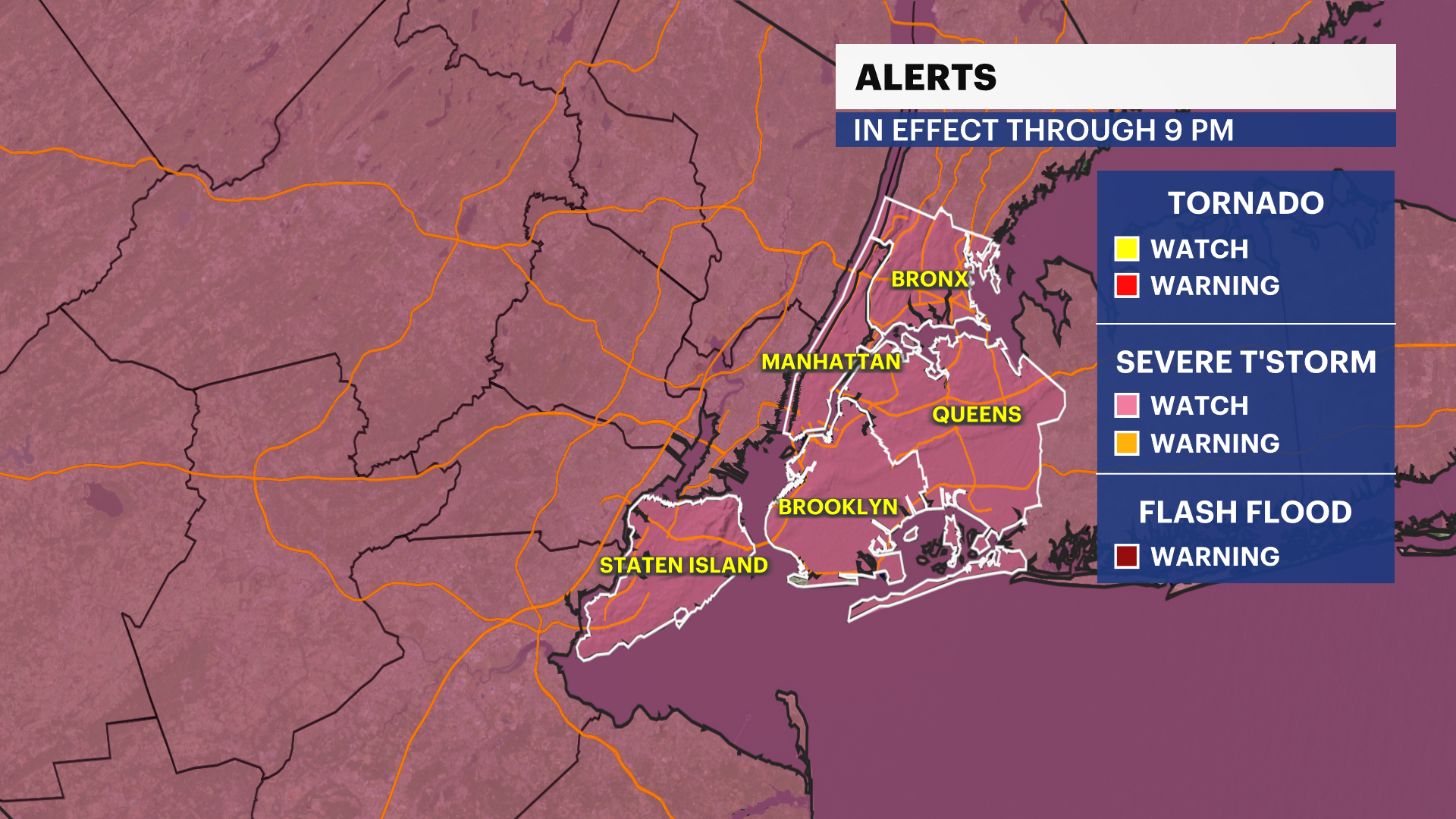


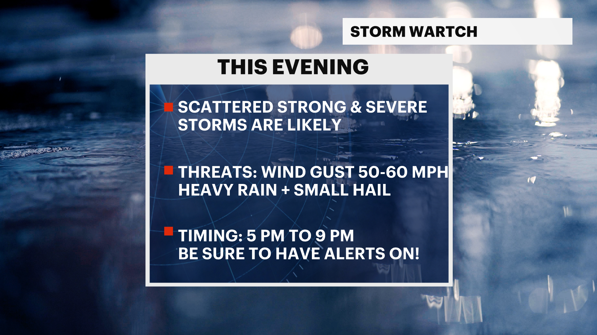
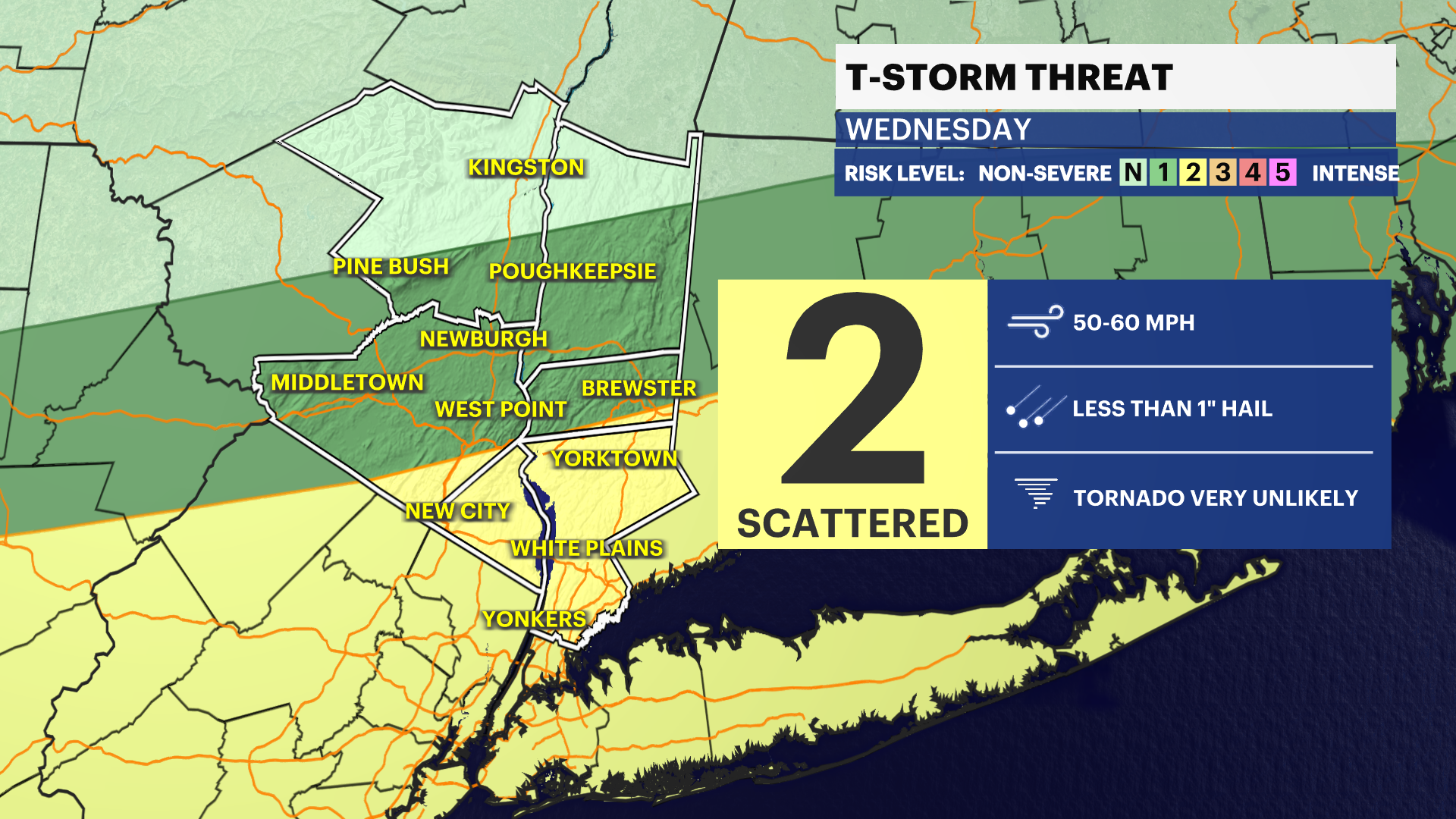
A severe thunderstorm watch has been issued for Orange, Putnam, Rockland and Westchester Counties until 9 p.m. tonight.
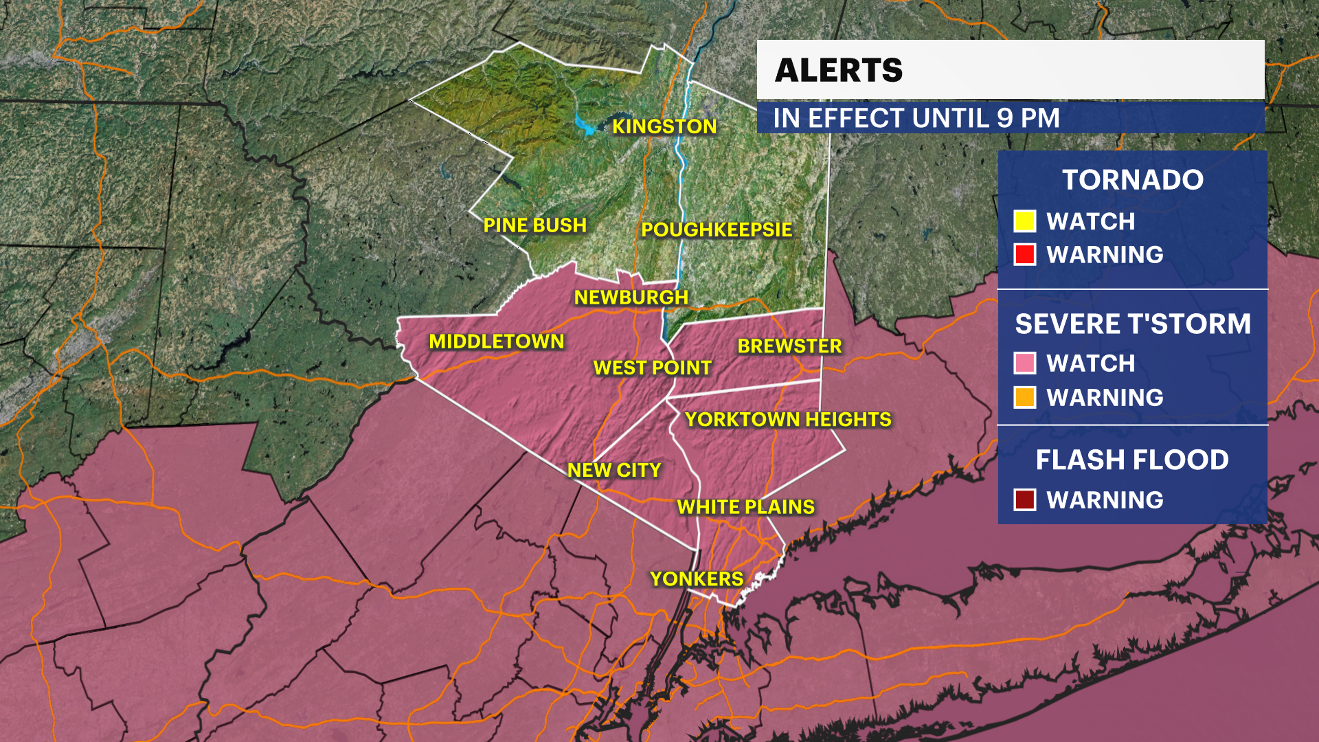
The timing for strong and severe storms is expected to be from 5 p.m. to 9 p.m., with damaging wind gusts from 50 to 60 mph, small hail and heavy downpours as the main threats.
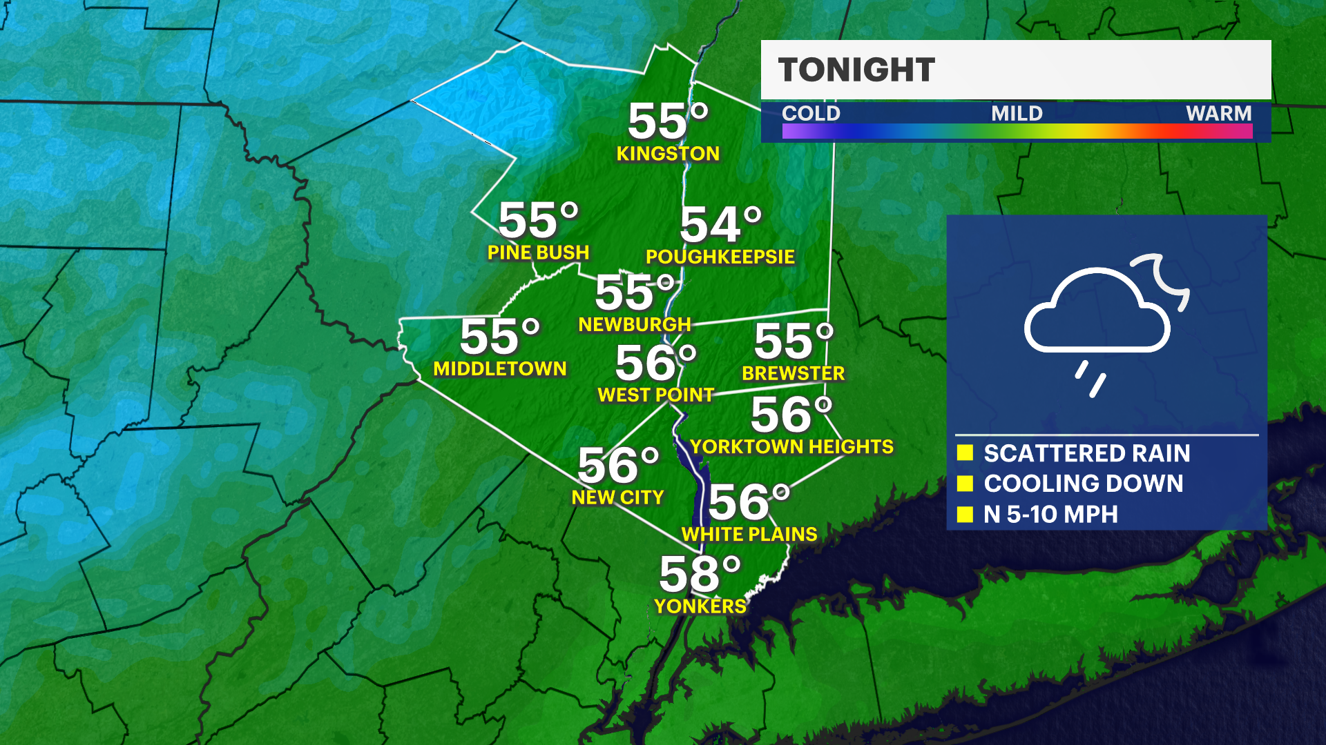
Once you hear that thunder roar, it is time to head indoors. A reminder that damaging winds are the main concern, with a chance of seeing small hail as well. Quick downpours may reduce visibility along the roadways. Be vigilant of downed tree limbs and possibly downed power lines this evening.
Rain showers will linger into Thursday midday before a drier trend comes our way to wrap up the work week.
Memorial Day weekend does not look to be the greatest for the "unofficial start of summer." Temperatures will be cool with scattered shower chances. Saturday could be the worst day of this upcoming holiday stretch.