HEAT ALERT: Immense heat and humidity arrive Wednesday in the Bronx
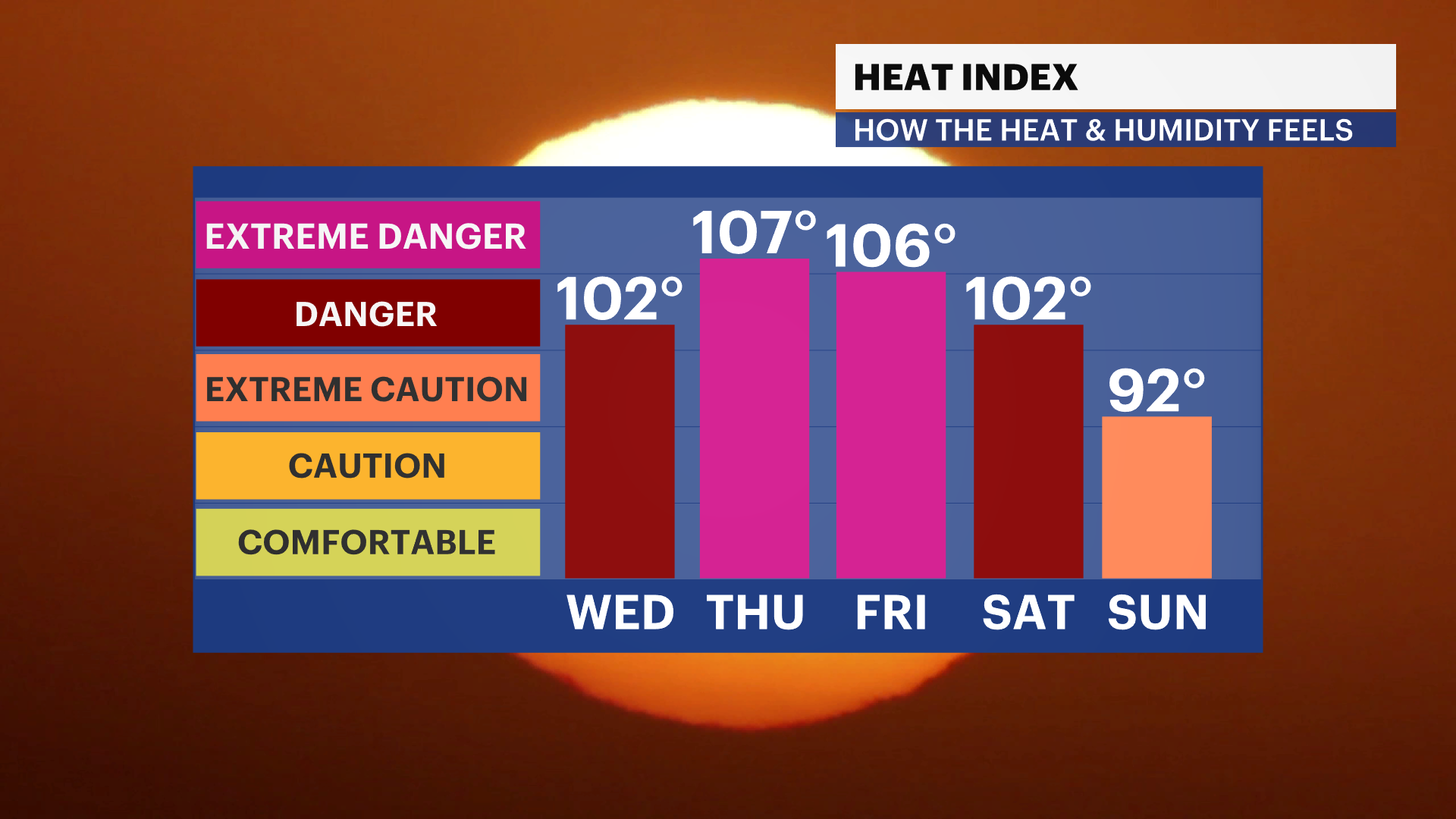
Temperature surge as humidity rises-- temperatures will feel between 105 to 108 by Friday.
More Stories

WHAT TO KNOW
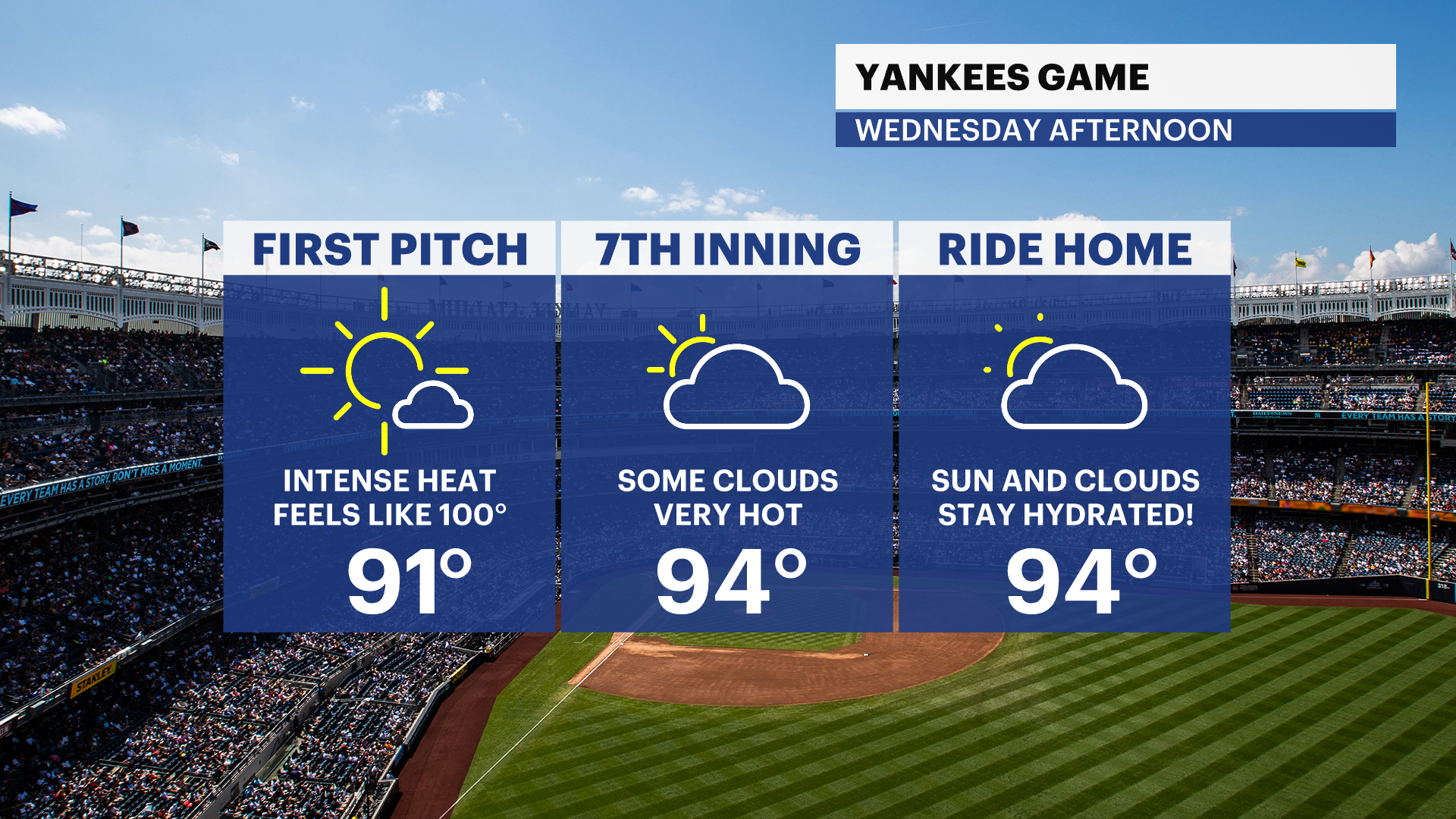
Heat and humidity surge in the borough, making temperatures feel dangerously hot. Starting on Wednesday, temperatures will feel around 100, with heat and humidity combined. Crowds at the Yankees game Wednesday afternoon will feel the hot temperatures. Make sure you stay hydrated and take breaks where you can.
Temperatures will feel between 105 and 108 degrees by Thursday and Friday -- this is serious heat and will be dangerous.
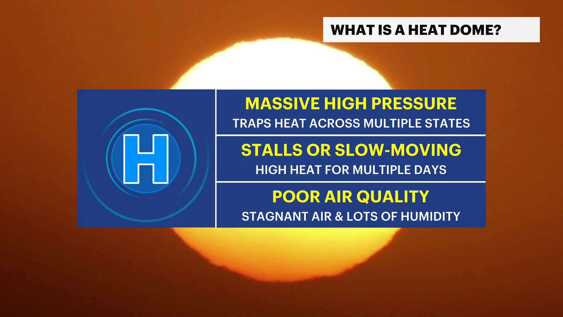
Have a plan for how to stay cool and inside in air-conditioned area as much as possible. When there are major heat domes like this, it can limit wind, leading to a build up of air pollutants like ground level ozone. This lowers air quality and can make it difficult for people who are sensitive to that. Elderly people, babies and pets are extra sensitive to this level of heat so please check on neighbors, friends, and family members.
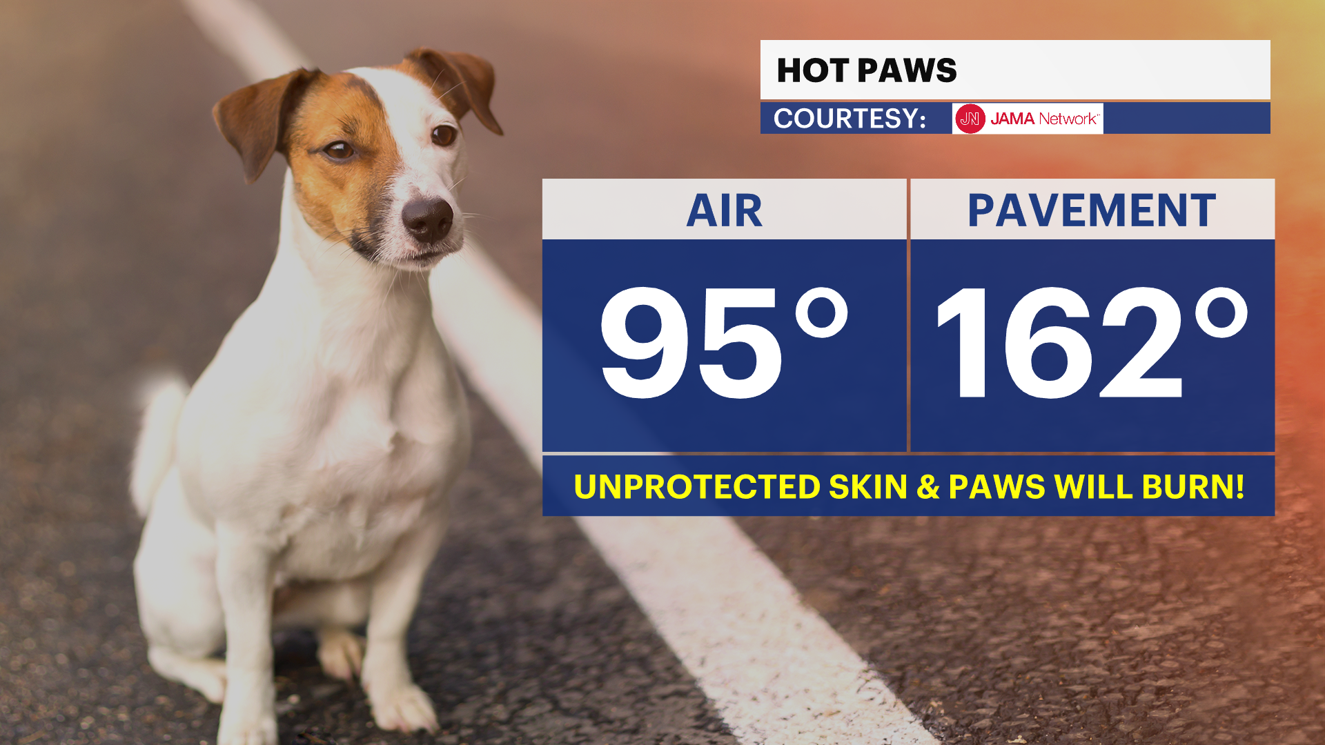
Remember that when the air temperature is in the mid-90s, the pavement and asphalt can reach over 160. Make sure to check pavement temperatures before letting your dog walk on it. Keep those paws safe and in booties to protect from burns if necessary.
A break in the heat is expected by the second half of the weekend, but the first half will still be brutal. This includes the Fourth of July. Temperatures will be near 100 and feel even hotter, so make sure you have plans to stay cool during celebrations. There could also be a chance of some showers and storms, which would help with the heat, but may impact firework shows. If you have beach plans, remember that the sand will be very hot underfoot.


