Sunny and warm Father's Day for Brooklyn
Brooklyn will see sunny skies and warm temperatures on Sunday before the arrival of heavy rain on Monday.
Share:
More Stories


WHAT TO KNOW
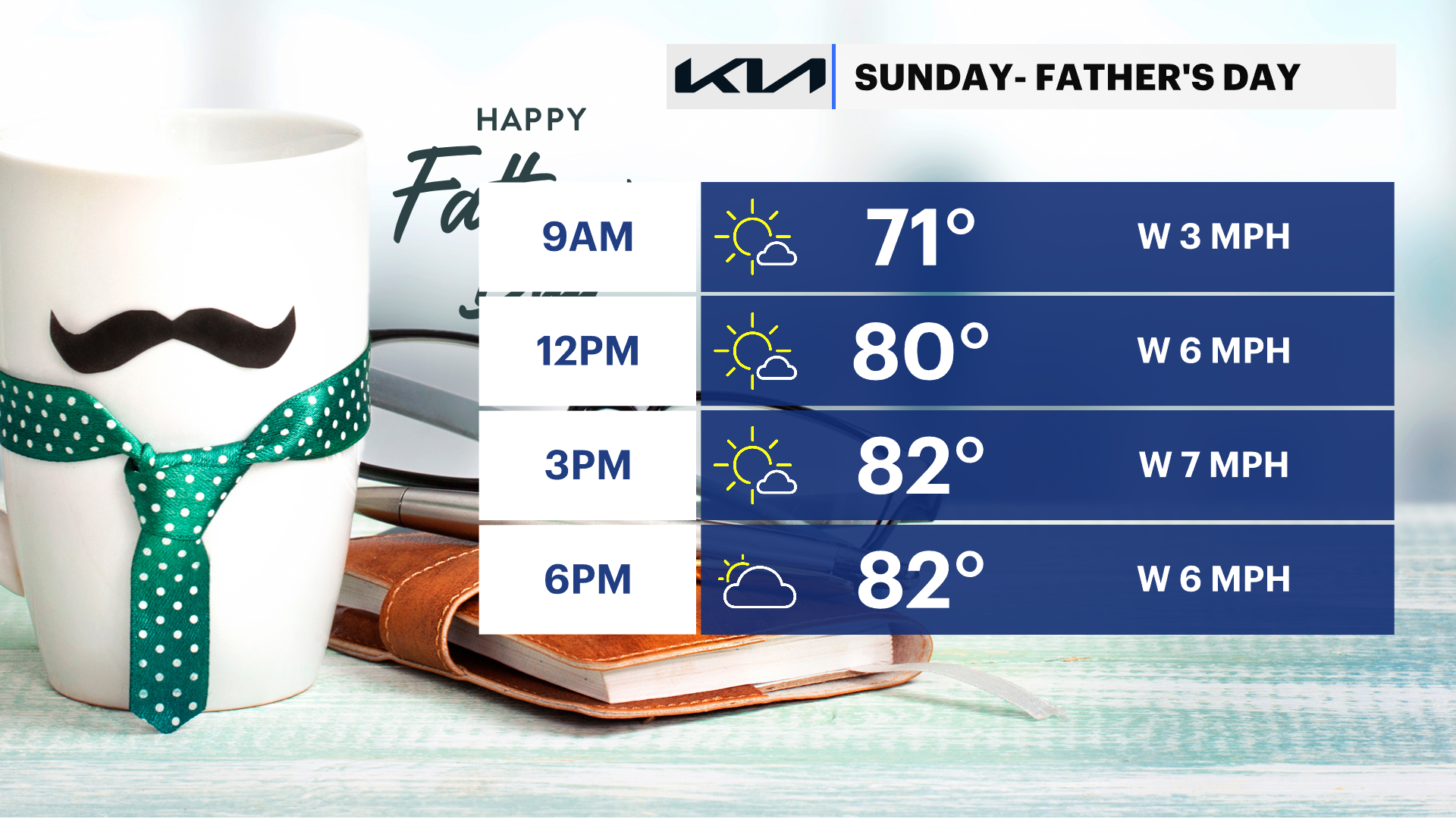
Sunday: Nice for Dad
Sunny skies are expected with less wind. Clouds will thicken later in the day, but rain is not expected. Temperatures are in the low 80s. There is a low risk for rip currents and sea conditions will be better for boating.
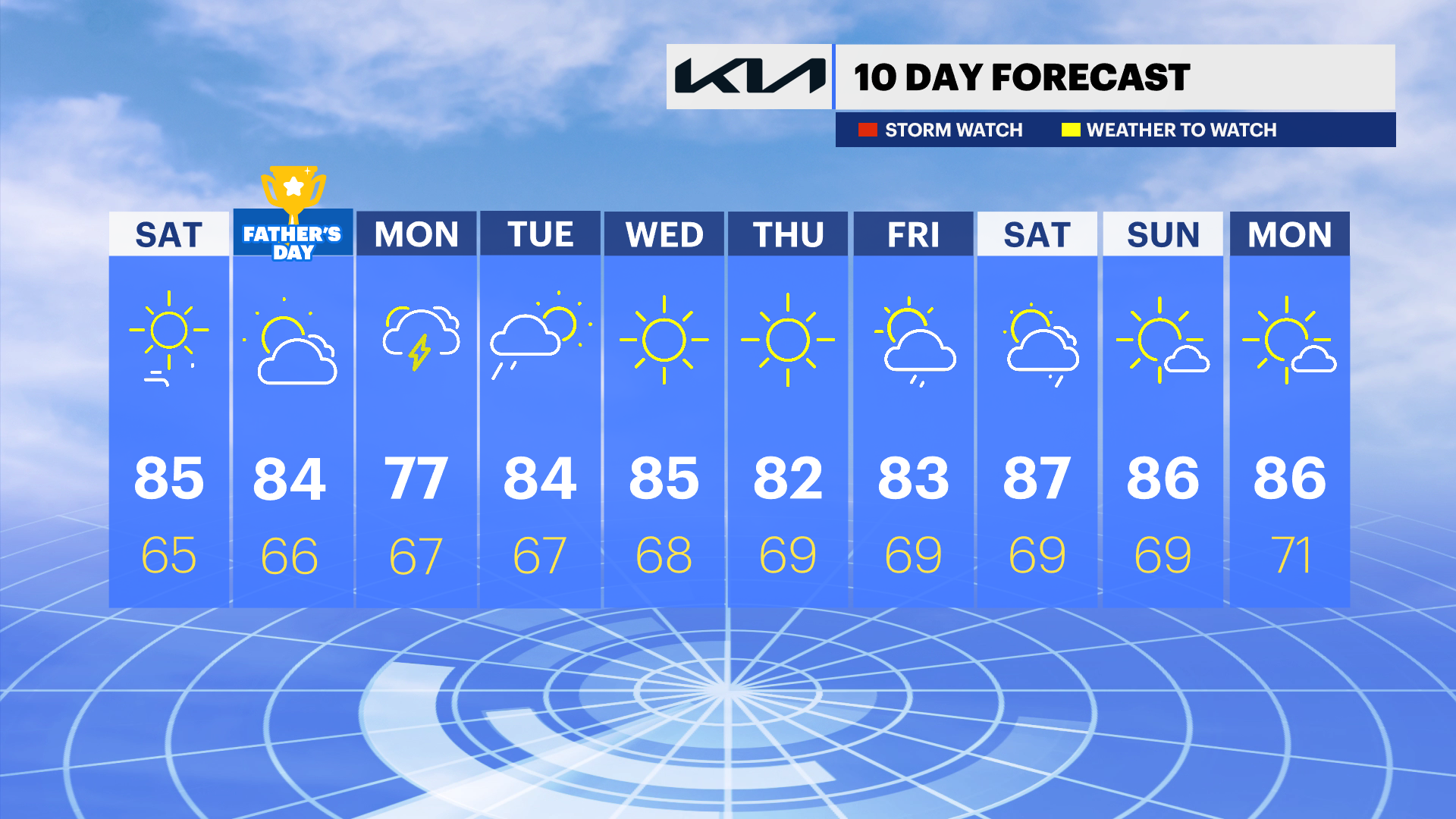
Monday: Heavy rain is possible
Mostly cloudy skies are expected, with showers in the morning and heavy rain in the afternoon. Thunder is possible. High temperatures are in the 70s.
Rest of the week: Seasonable Summer Weather
Drier weather and less humidity returns Tuesday afternoon. A few stray storms are possible Thursday into early next weekend, but it does not look like a washout. High temperatures will be in the 80s, with overnight lows in the 60s.