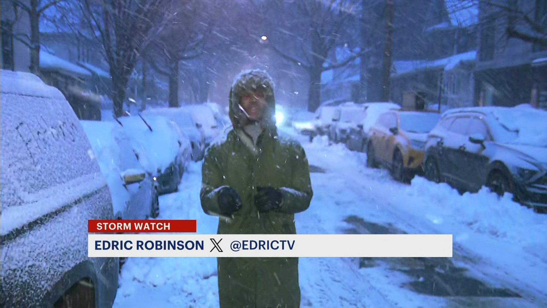
STORM WATCH: Showers and storms taper off by Wednesday; watching impacts from Debby toward weekend
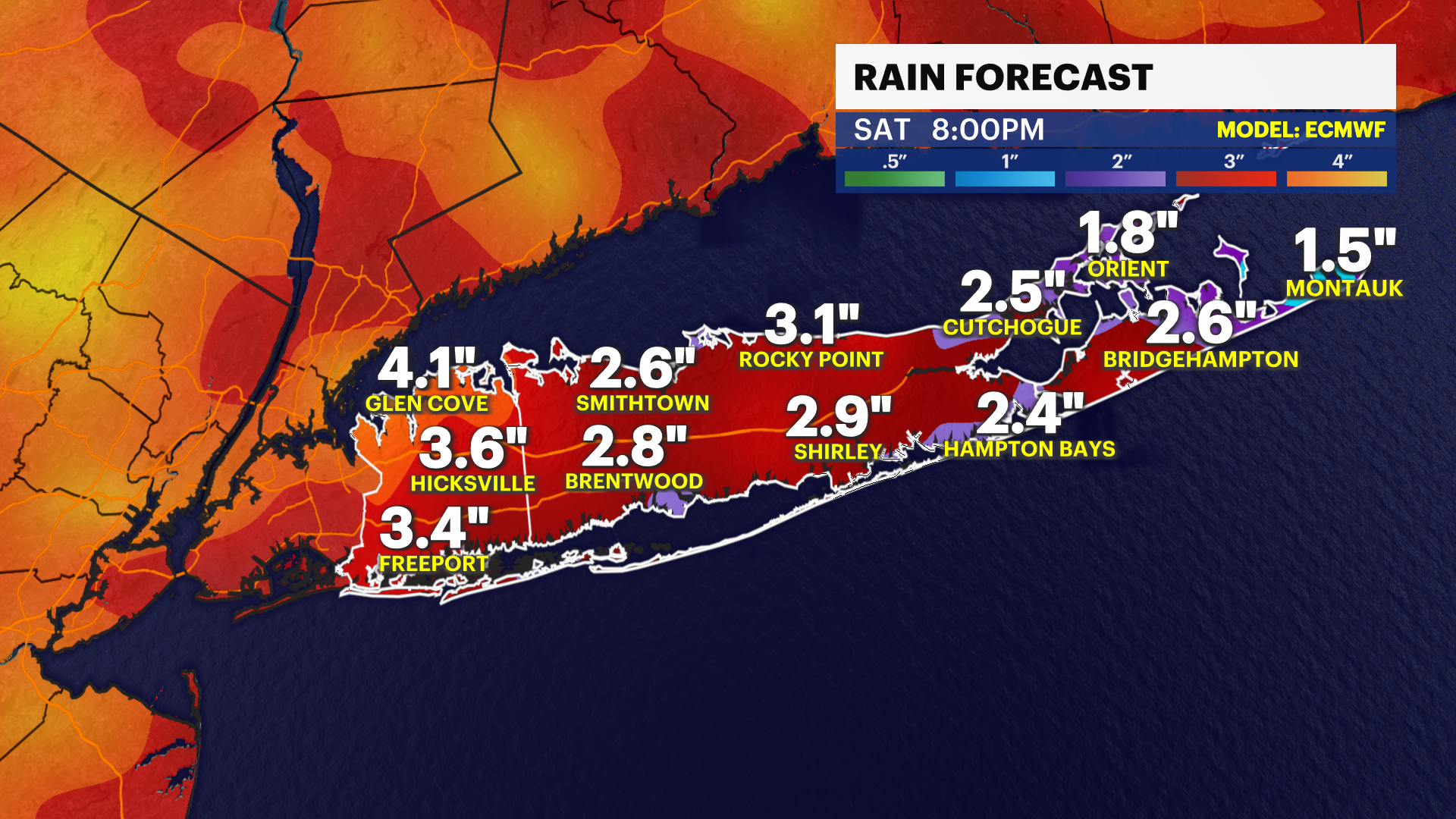
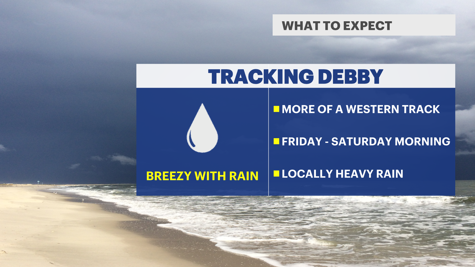
News 12 Storm Watch Meteorologist Sam Augeri says there is an improving forecast for Long Island as Debby’s track trends further west. Scattered showers and storms expected Friday into Saturday with locally heavy rain.
More Stories


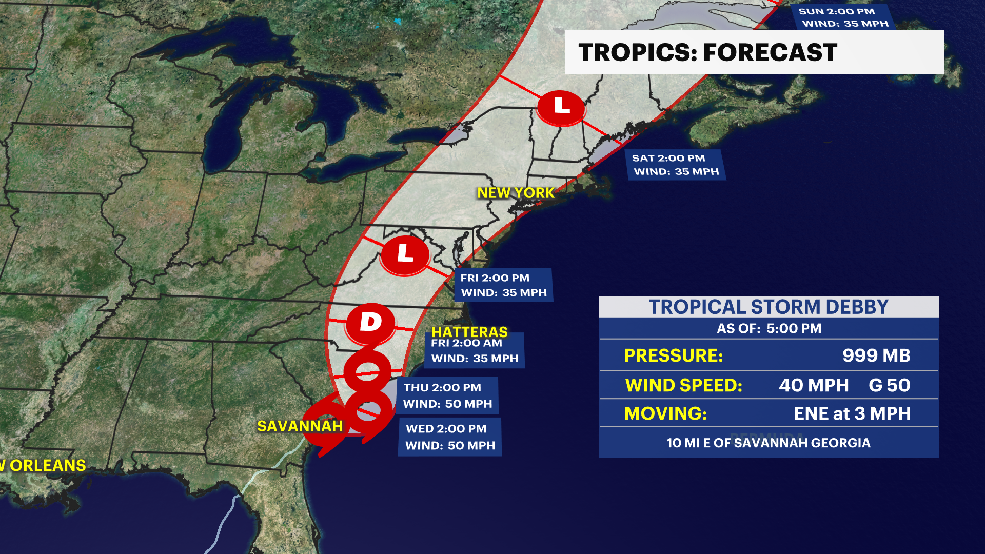
TRACKING DEBBY: Looks like an active weather week as we are tracking storms and unsettled weather over the next couple of days. We are tracking Debby and how the storm tracks heading toward this weekend.
While there will not be a direct hit from Debby as a hurricane or tropical storm, there is a growing threat of significant flooding and heavy rain from the storm's remnants toward the weekend.
The forecast will continue to evolve. Exact timing, track and impacts will change this week. The News 12 Storm Watch Team will deliver updates on Debby's impact as they develop.
News 12 Storm Watch Meteorologist Sam Augeri says there is an improving forecast for Long Island as Debby’s track trends further west. Scattered showers and storms expected Friday into Saturday with locally heavy rain.
HEADLINES:
Flood Watch in effect through Wednesday morning.
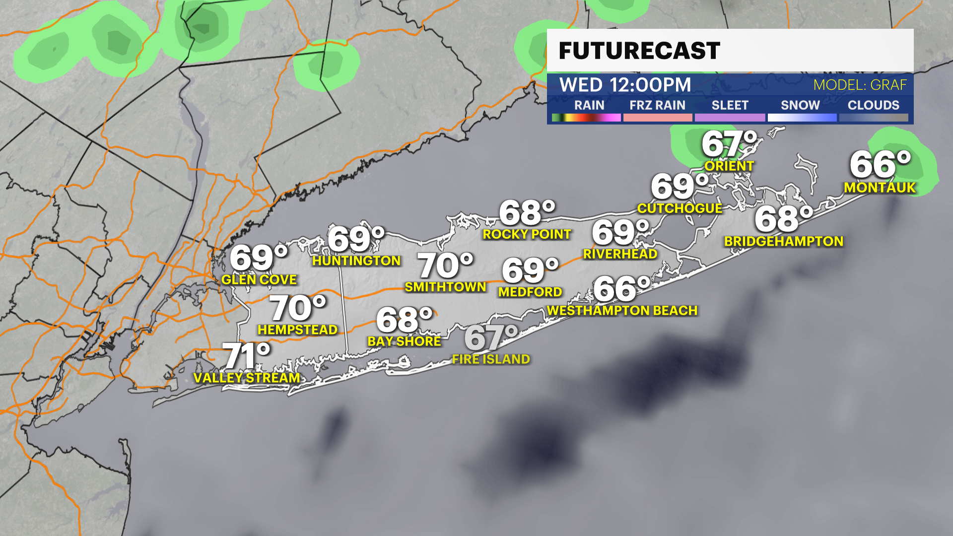
Scattered showers and storms this evening and overnight could bring locally heavy rain and some street flooding. Showers and storms taper off by Wednesday morning with some drier weather for the afternoon.
TRACKING DEBBY: The track of the storm is trending farther west which means a faster storm and an improving forecast for Long Island. Expect scattered showers and storms Friday into Saturday with locally heavy rain. Southerly winds will be 10 to 25 mph with some rough conditions on the ocean. With the storm speeding up, our weather could improve by Saturday afternoon.
A great stretch of weather with comfortably warm temperatures and sunshine follows for Sunday and much of next week.
OVERNIGHT: Cloudy with scattered showers and storms. Chance for heavy rain. Lows near 67 degrees with southeast winds 5 to 10 mph. Sunrise: 5:55 a.m.
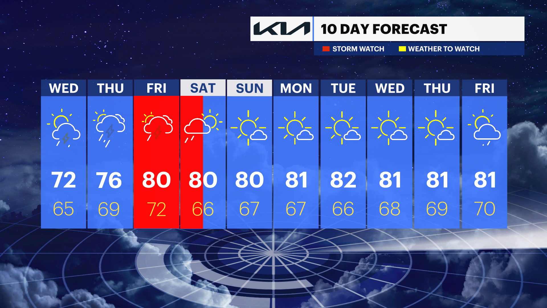
WEDNESDAY: Partly sunny to mostly cloudy with the chance of showers and storms in the morning. Not as warm or humid. Highs near 72 degrees. Northeast wind 10 to 15 mph. Sunset 8:00 p.m. Partly cloudy at night with the chance of showers. Lows near 65 degrees.
THURSDAY: Partly sunny with the chance for a shower or storm. Highs near 76 degrees. Lows near 67 degrees.
FRIDAY: Mostly cloudy with showers and storms. Chance for locally heavy rain, especially Friday night. Highs near 80 degrees. Lows near 72 degrees.
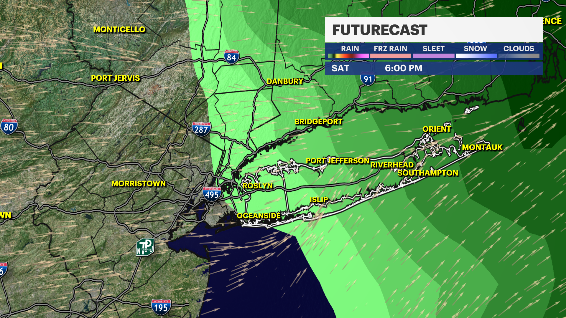
SATURDAY: Mostly cloudy and breezy with rain likely in the morning. Partly sunny and improving for the afternoon. Highs near 80 degrees. Lows near 66 degrees.
SUNDAY: Sun and clouds. Nice with highs near 80 degrees. Lows near 67 degrees.