Rain showers this evening and overnight; wet conditions linger Thursday morning
Lighter showers this evening will give way to a brief round of more moderate rain overnight with drier weather returning through Thursday morning.
More Stories


SHOWERS DEVELOP THIS EVENING
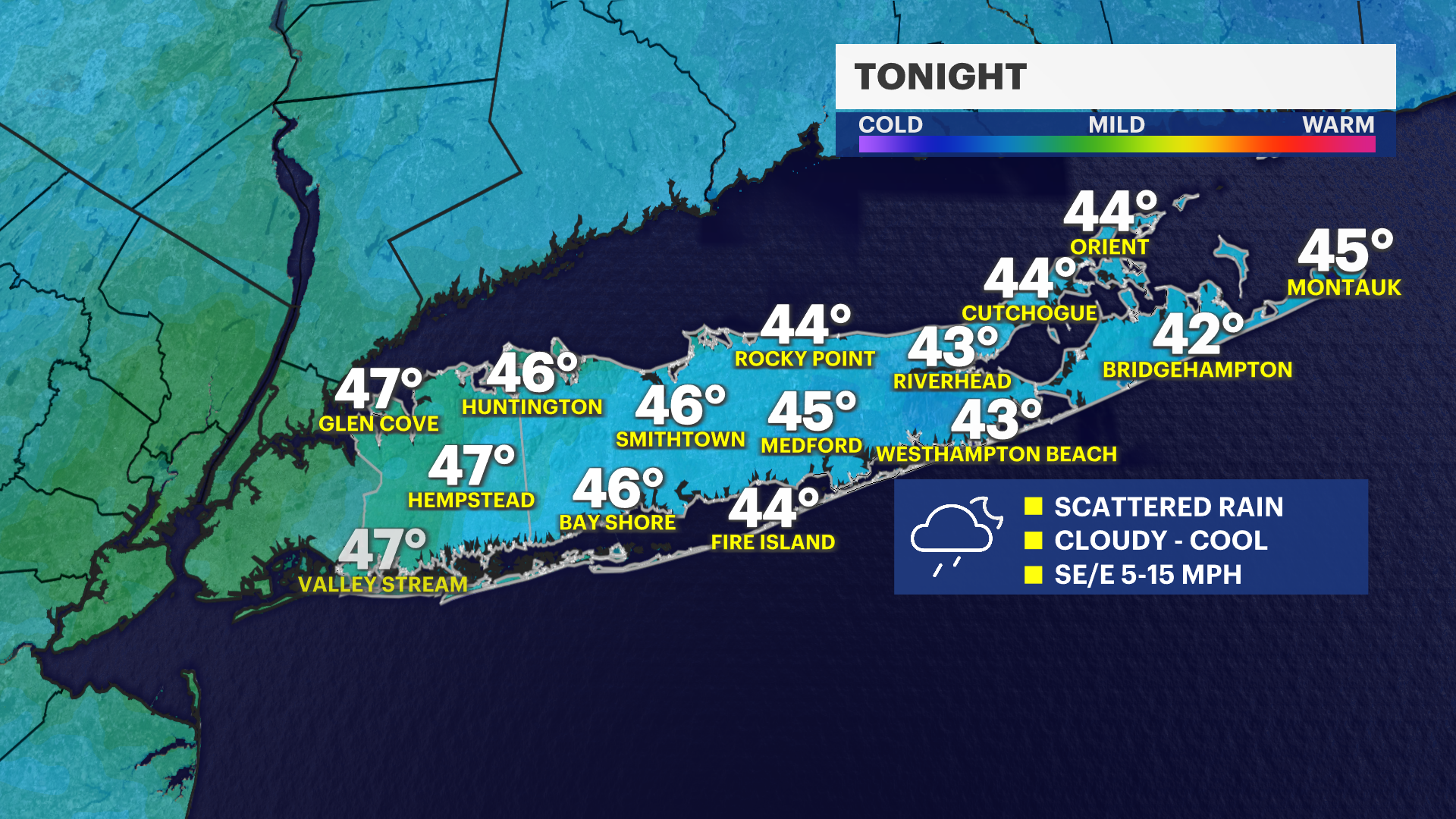
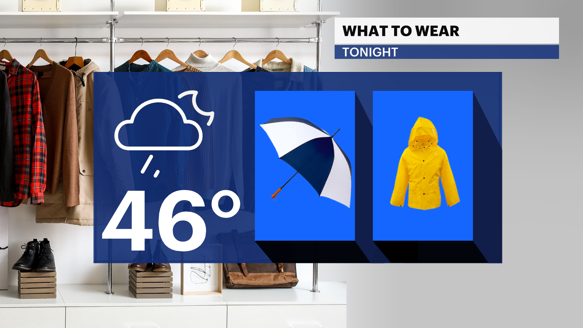
This evening will bring clouds and scattered light rain showers, after most of the day saw comfortable temperatures in the 50s to near 60. Keep a rain jacket and umbrella with you. Temperatures are dropping into the upper 40s for the first part of tonight.
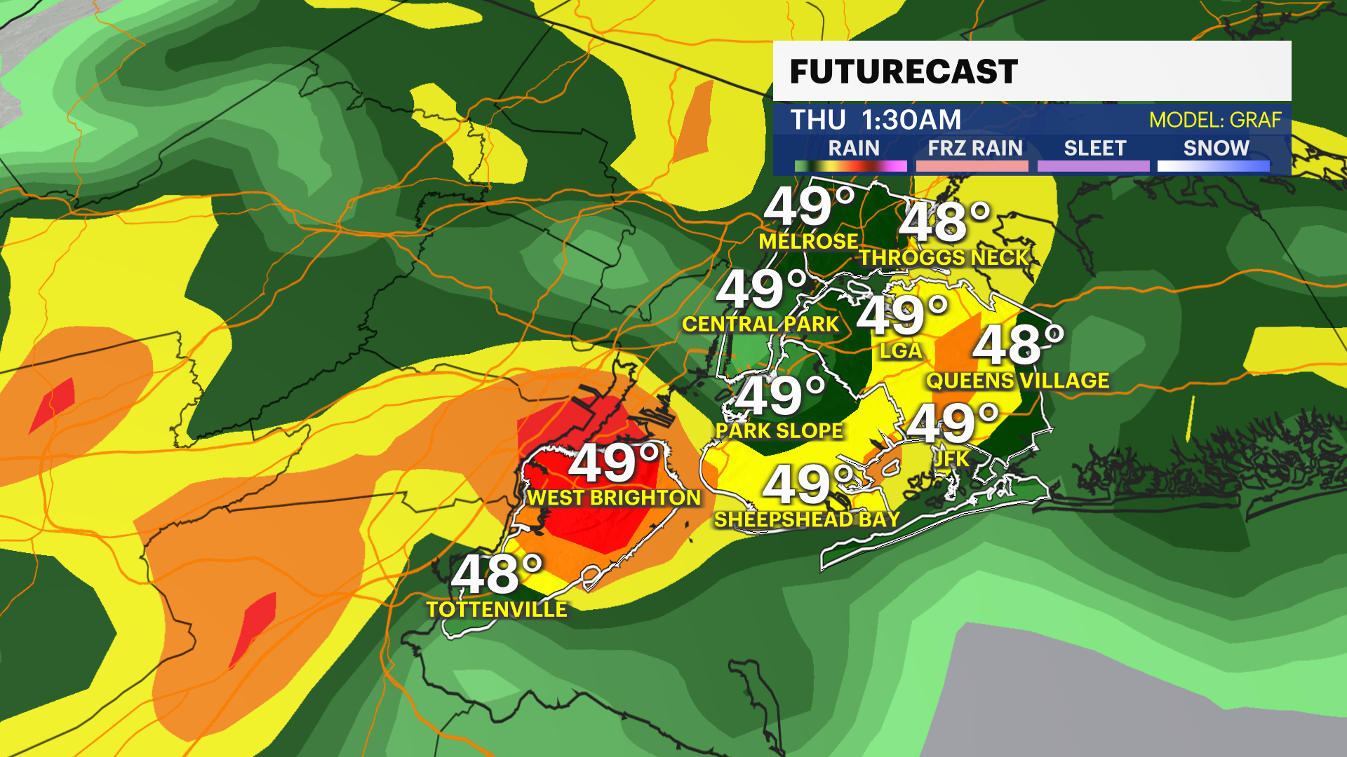
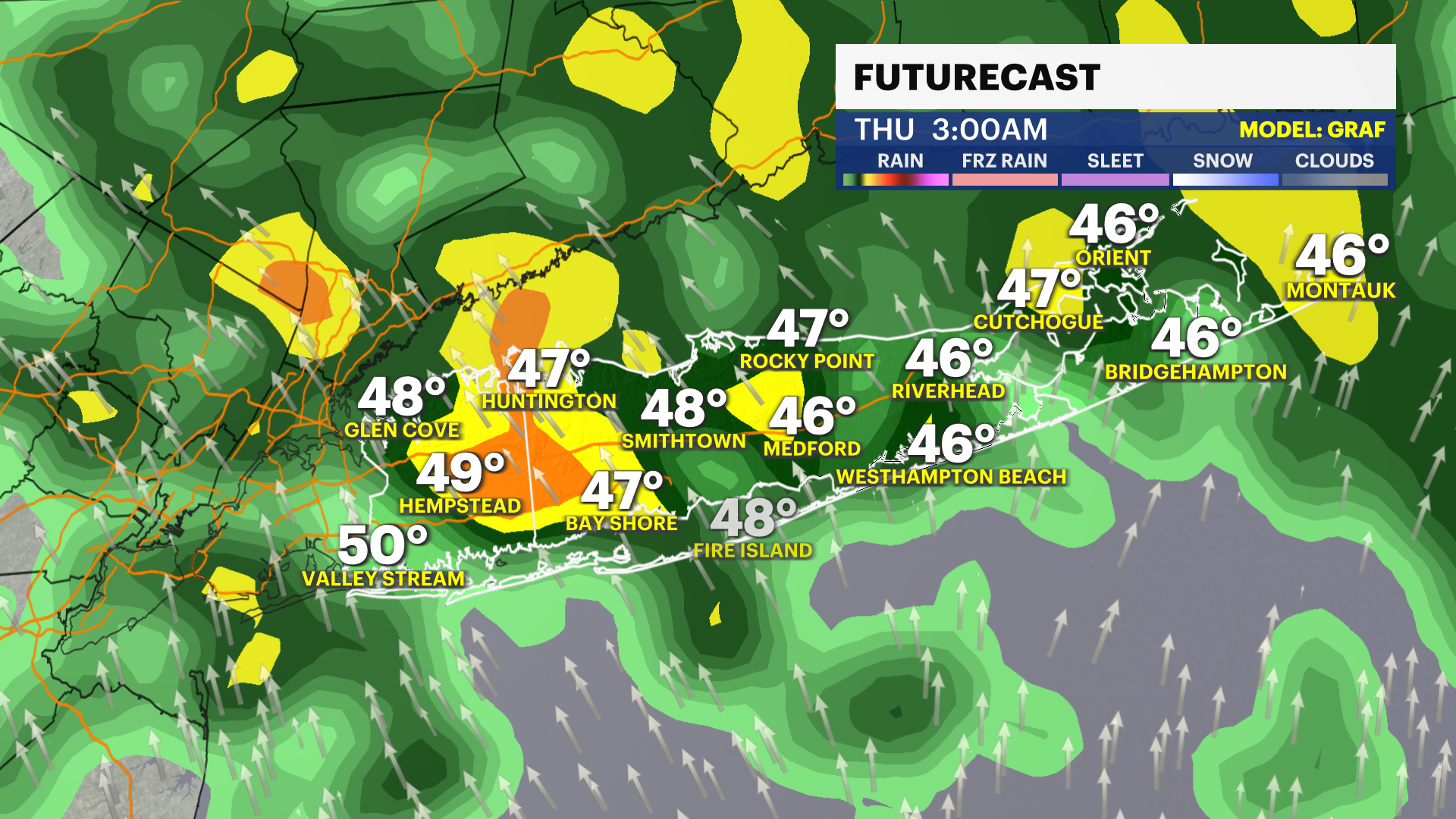
STEADIER RAIN OVERNIGHT
A round of more moderate to briefly heavy rain is possible from around 11 p.m. and through around 5 a.m. Thursday. Steadier rain will taper to lighter spotty showers into the start of the Thursday morning commute. Around half an inch of rain on average is still expected. If you are traveling overnight, expect to slow down driving due to the wet road conditions and some areas of puddles.
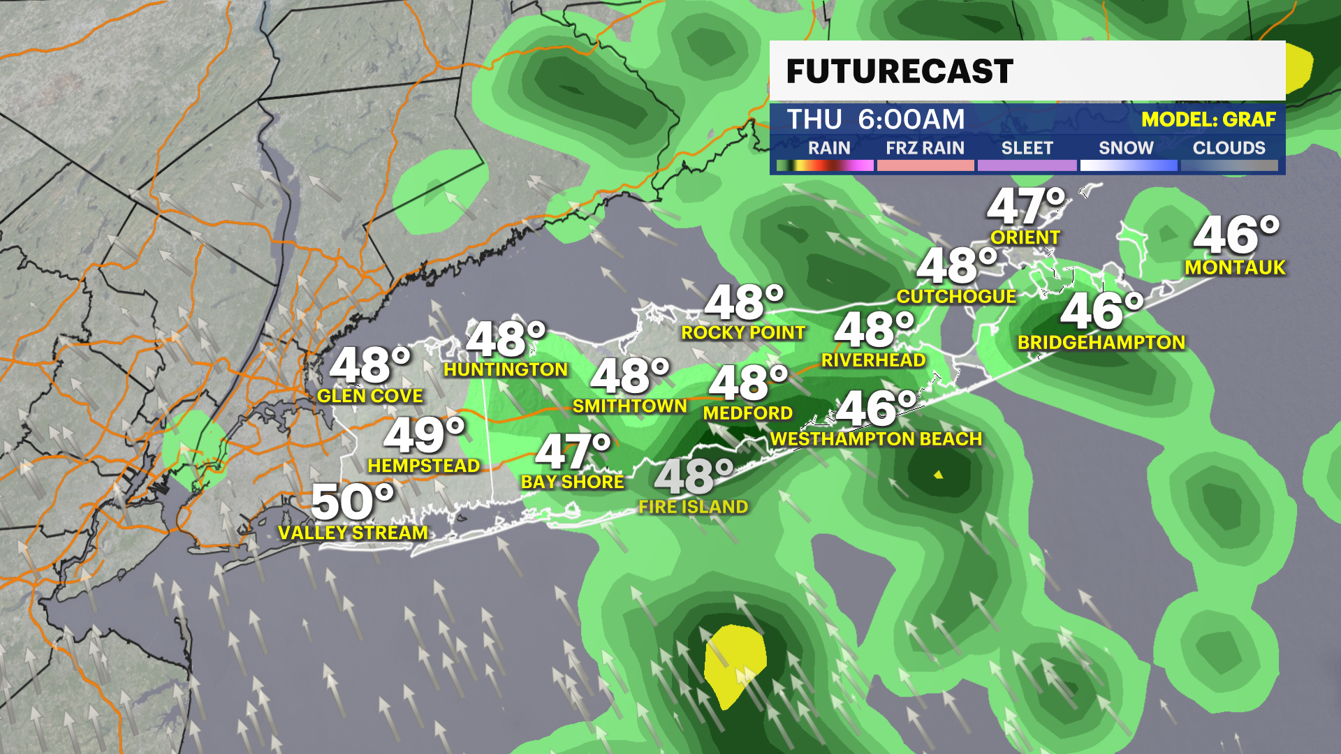
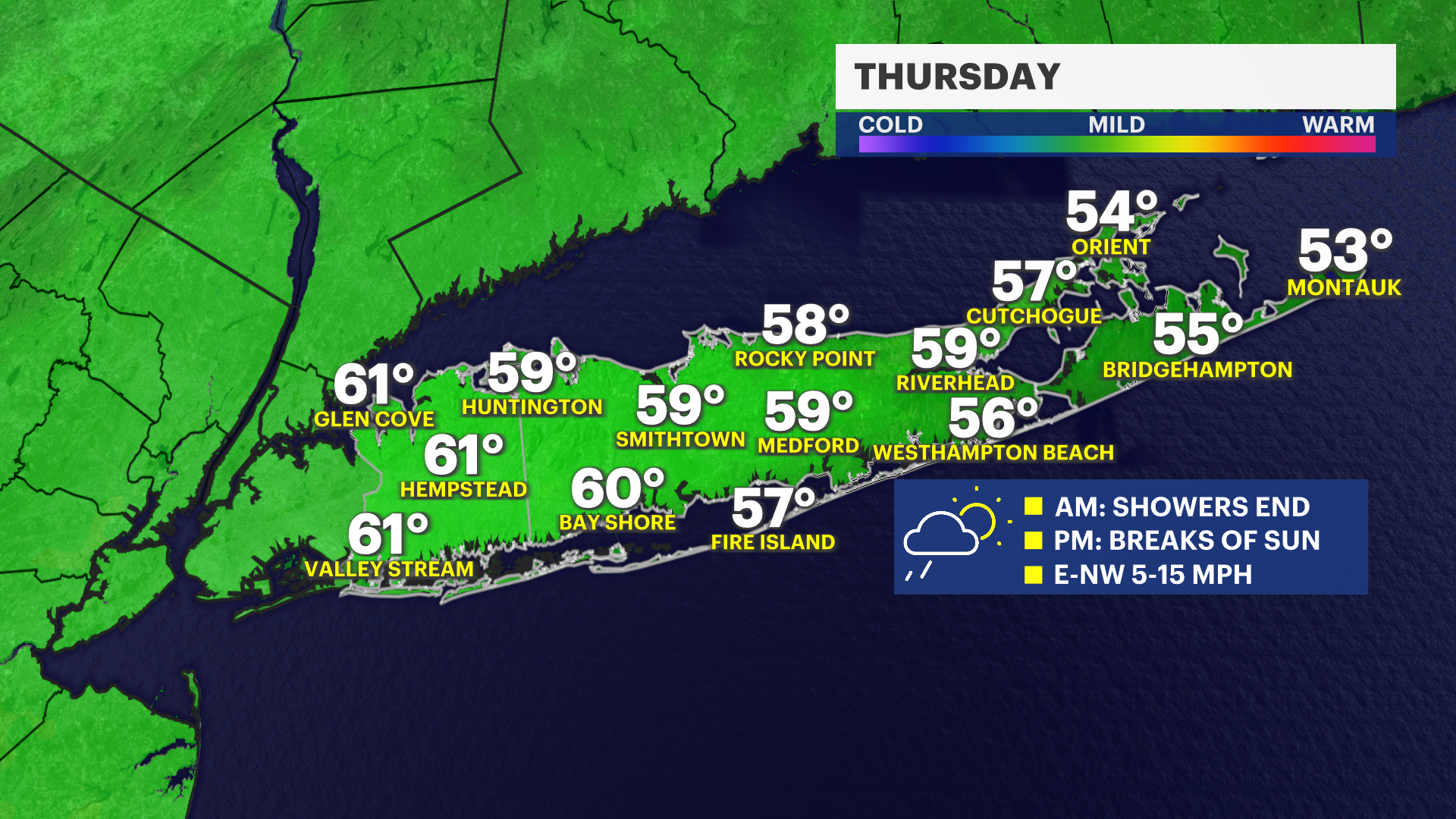
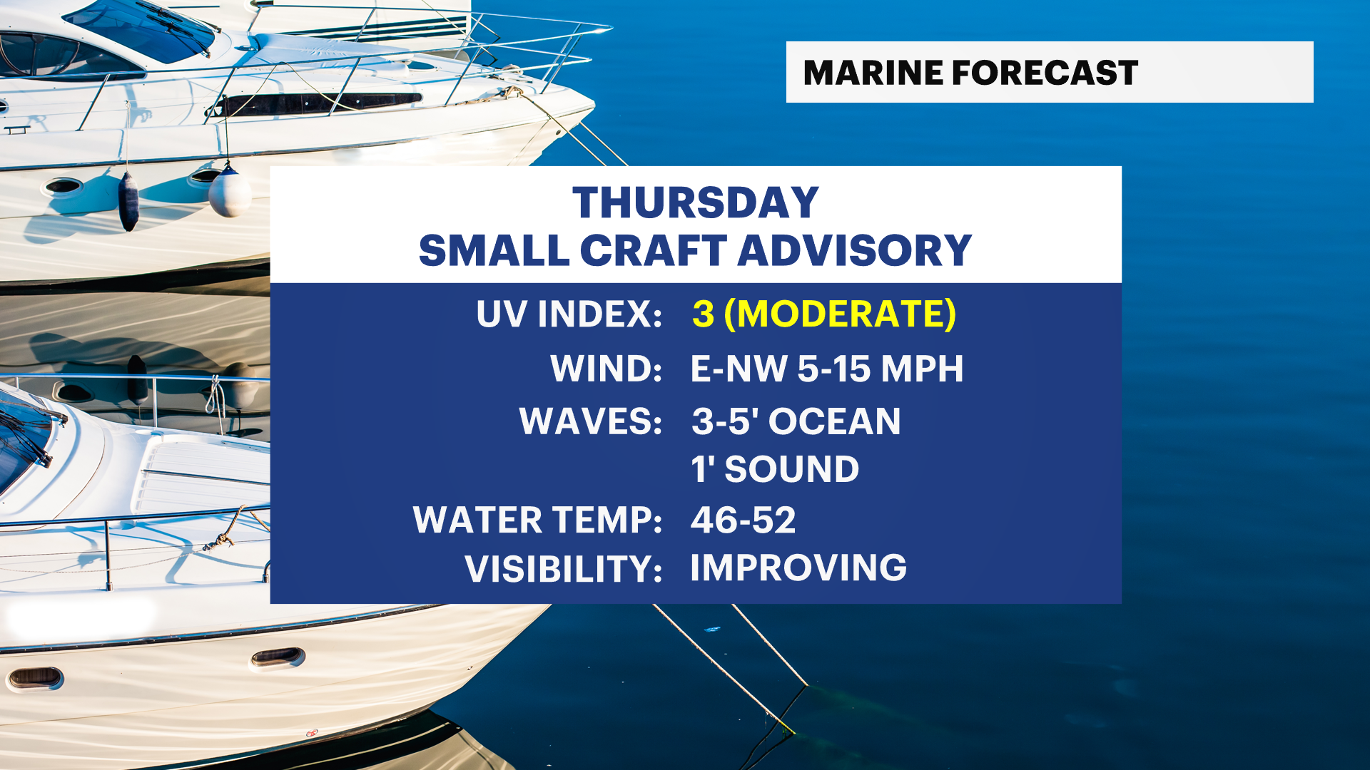
SLOW IMPROVEMENTS THURSDAY
Clouds and a stray shower will linger through Thursday morning, with some slow clearing after 4 p.m. and into the evening. Highs on Thursday will be around 60 degrees. Overnight lows with a partly cloudy sky will be around 44 degrees into Friday morning.
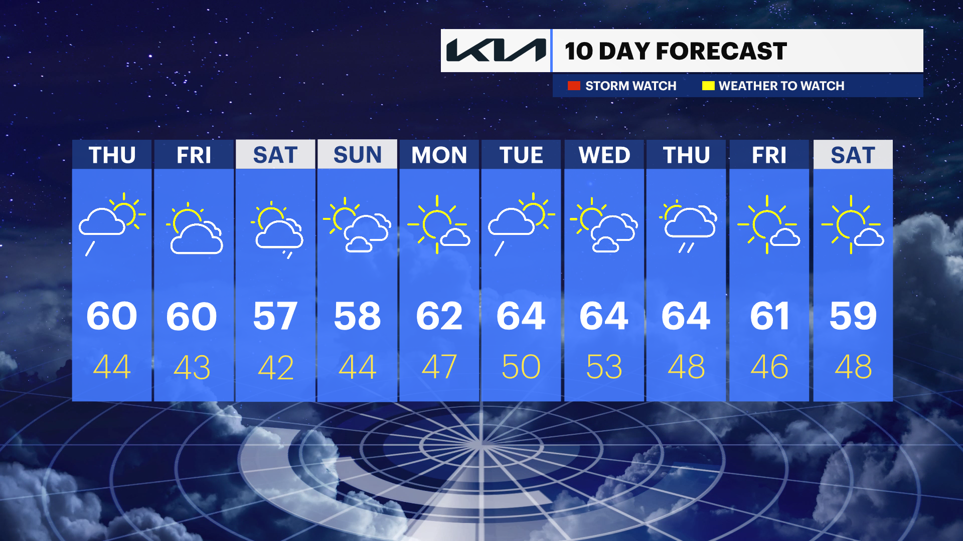
EXTENDED FORECAST
FRIDAY: Sunny in the morning with gradually increasing clouds in the afternoon and evening. Highs around 60 degrees. Lows near 43 degrees.
SATURDAY: Partly sunny to mostly cloudy. Close call on some spotty rain showers, but it should not be a washout. Highs around 57 degrees. Lows near 42 degrees.
SUNDAY: Sun and clouds. Highs around 58 degrees. Lows near 44 degrees.
MONDAY: Mostly sunny. Highs around 62 degrees. Lows near 47 degrees.
TUESDAY: A few morning rain showers. Then, becoming brighter heading toward the afternoon. Highs around 64 degrees. Lows near 50 degrees.
WEDNESDAY: Sun and clouds. Highs around 64 degrees. Lows near 53 degrees.