Summer-like heat to reach New York City by this weekend
Storm Watch Team Meteorologist Allan Nosoff says temperatures this week will be warm. Here's what to expect.
More Stories


Storm Watch Team Meteorologist Allan Nosoff says today we'll see summer-like conditions in New York City by this weekend.
TONIGHT: Mostly clear and mild. Open the windows! Lows near 66.
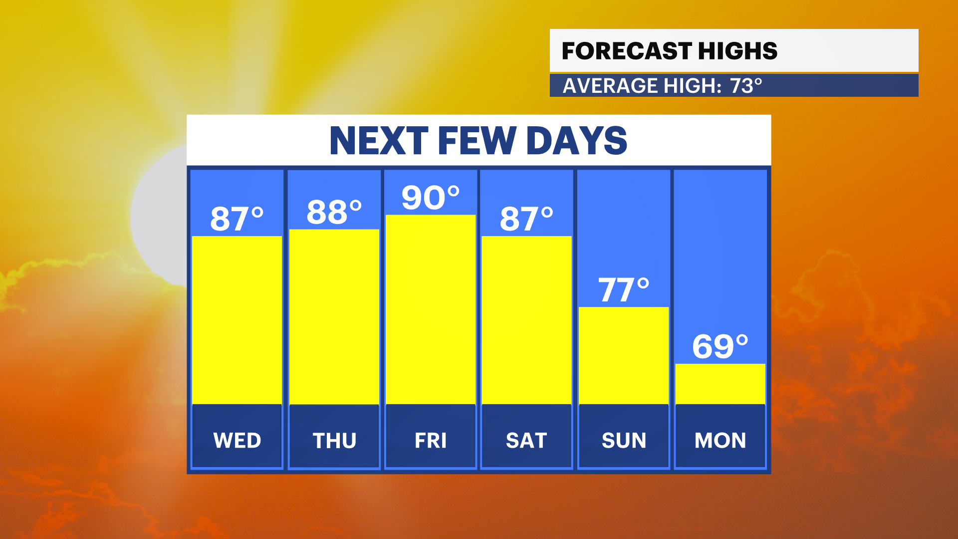
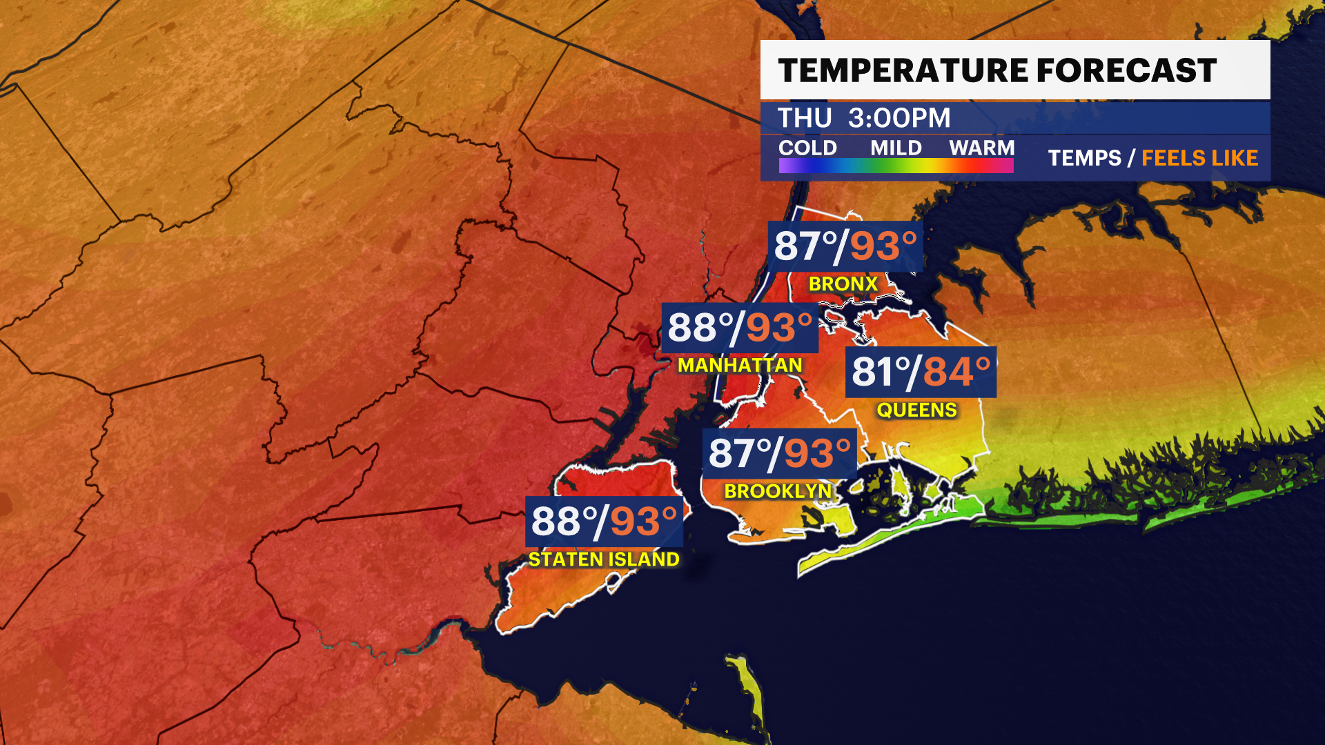
WEDNESDAY: Sunny, hazy and hot. A tad more humid. Temperatures will peak around 1 p.m. before the sea breeze cools us off. Highs up to 87. Could be 90 farthest away from the water in neighborhoods like Greenpoint and Kingsbridge.
Only 75 to 80 in neighborhoods like Throgs Neck and Sea Gate. Lows down to 71. A rogue passing t-shower can't be ruled out after midnight.
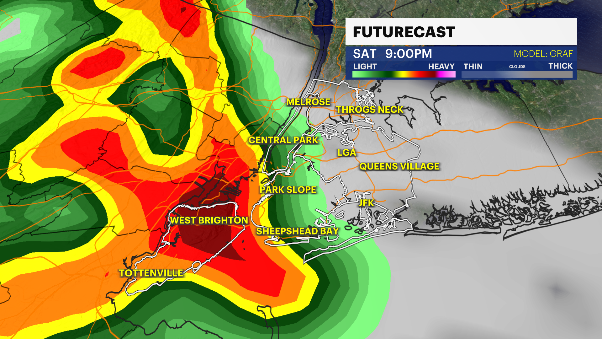
THURSDAY: Partly cloudy with a line of thunderstorms likely during the afternoon & early evening. There may also be a pop-up storm or two midday, but that is not as likely. Highs spike to near 90, feeling like the low-to-mid 90s because of high humidity.
Storms could contain over 60 mph gusts, torrential downpours and small hail. Lows near 66 with a clear sky by midnight.

FRIDAY: Hot and sunny behind the storms with a dry heat. Highs up to 90 for everyone because of no sea breeze. Lows near 67.
SATURDAY: The best of the three weekend days. Sun gives way to a few clouds, still hot and dry. Highs near 87. Lows near 65 with showers possible at night.
SUNDAY: Mostly cloudy and cooler. Showers are possible mainly during the morning. Highs in the upper 70s. Lows near 59.
MEMORIAL DAY: Cloudy with showers possible. While there is not a washout, more rain is possible. Cooler with highs on either side of 70. Lows down to 57.