What’s a heat dome? Here’s what to expect when it arrives next week
Some of the most-intense heat domes can stall and pump high heat for up to half of the country for a couple of weeks.
More Stories
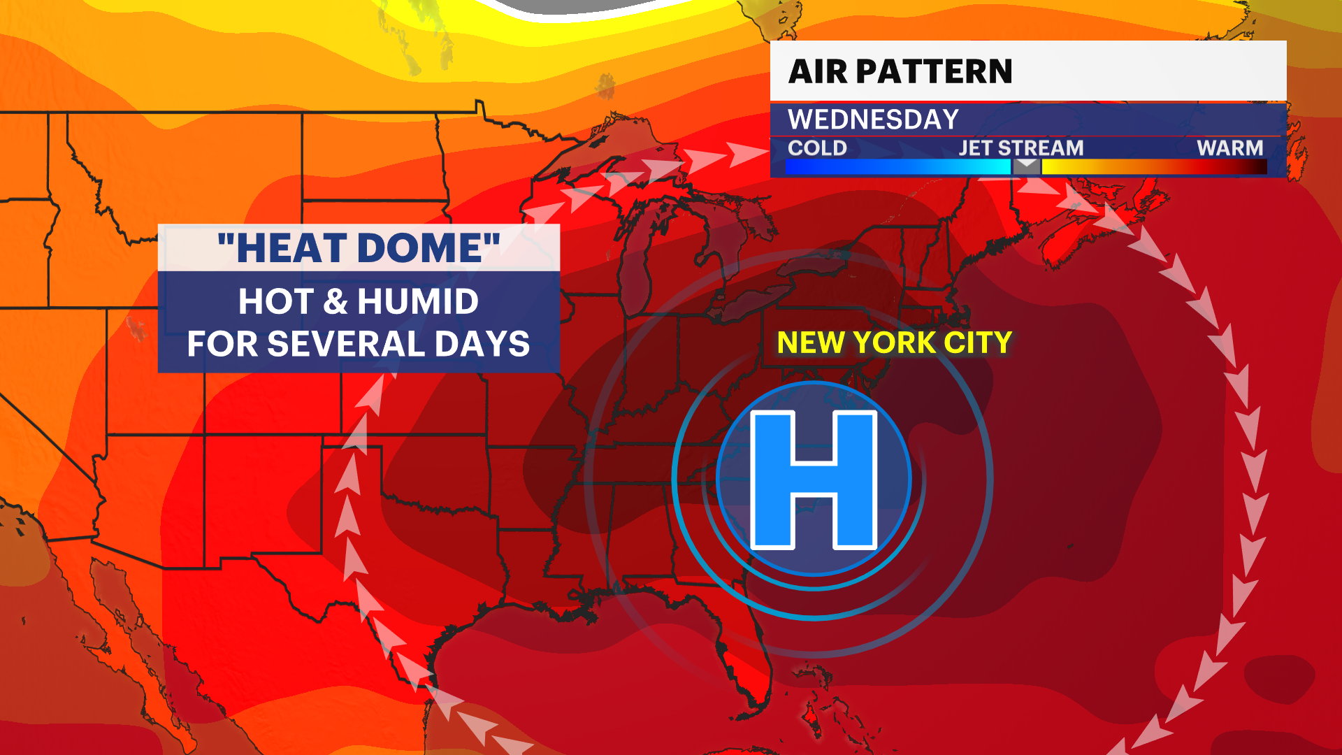
Get ready for the hottest weather of 2024 so far, and it could be dangerously hot for several days. This is all thanks to a “heat dome” that is expected to arrive and stall across our area next week.
While some may have already heard the term, what actually is it?
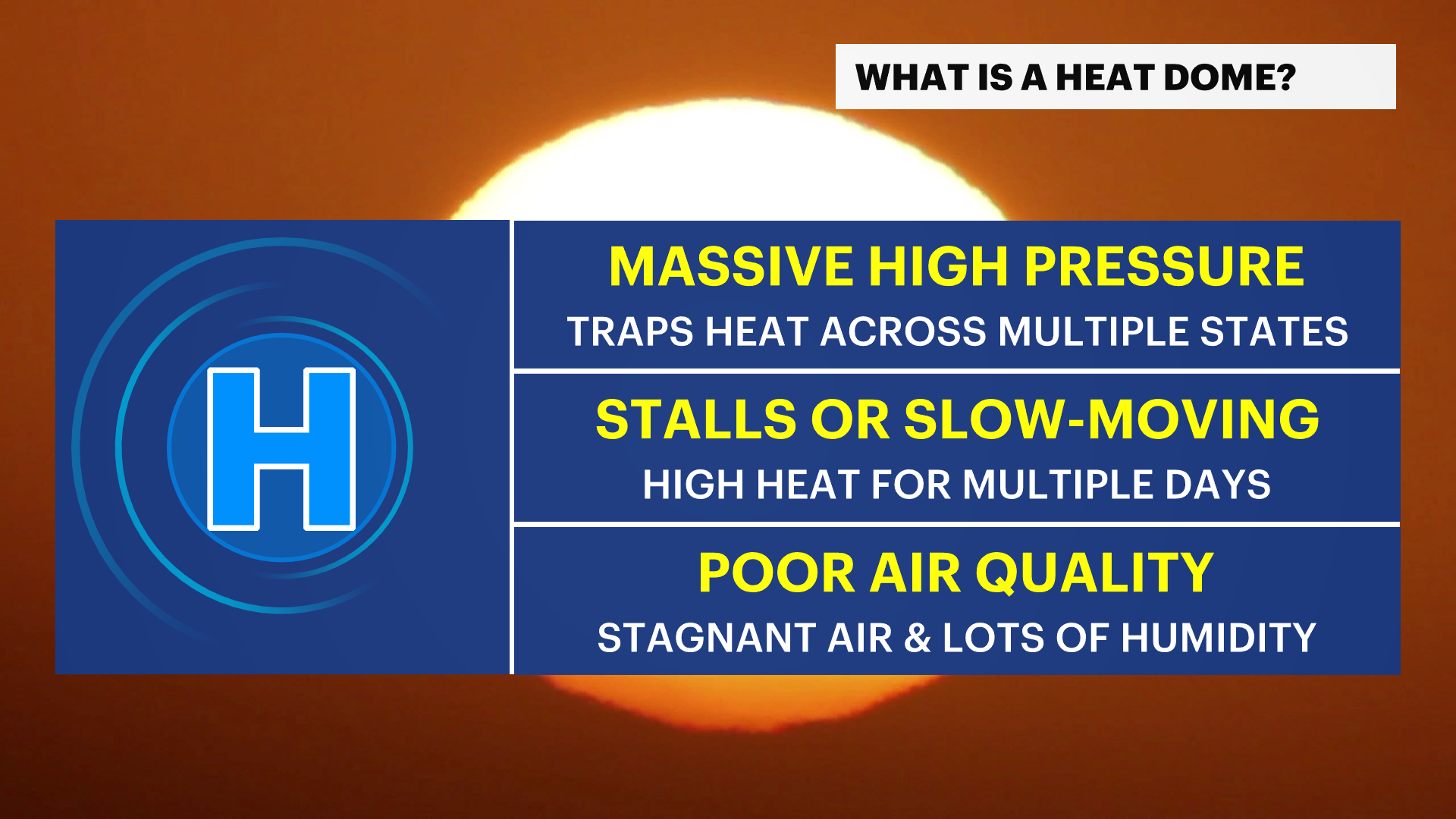
A heat dome is a high-pressure system that slows down and traps heat over a large area during the summer. Some of the most-intense heat domes can stall and pump high heat for up to half of the country for a couple of weeks.
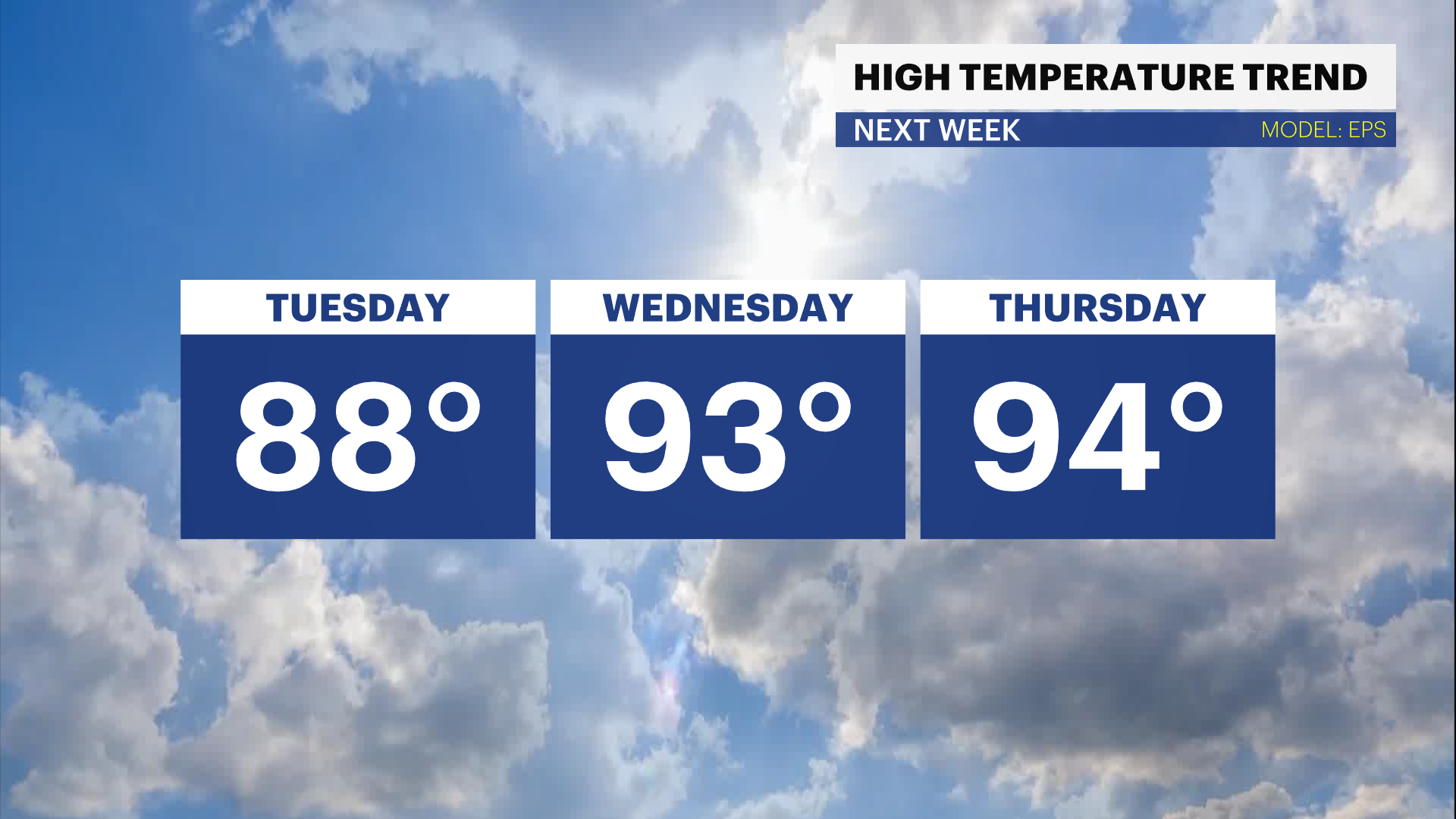
While it is too early to know the exact size and strength of next week's heat dome, there is a strong signal for a large heat dome developing across the Northeast starting Tuesday, June 18. Some of the latest computer model guidance suggests this upcoming heat dome will grow through at least next Thursday, June 20, with high temperatures nearing 100 degrees, according to the European model. It is too soon to guarantee triple-digit heat, but this shows the potential for extreme heat.
The last time New York City's Central Park hit the century mark was in 2012. This is the second-longest 100-degree drought in New York City records, and this streak may finally end depending on the extent of the heat dome. There is also a chance this heat dome sets up a little farther south and/or weaker, limiting the dangerous impacts from the heat.
Heat is the leading cause of weather-related deaths in the U.S., higher than from flooding, tornadoes, and even cold. That is why it is very important to monitor the forecast changes over the next several days and check back with the News 12 Storm Watch Team as more information comes in about next week's heat dome and what it means for your neighborhood.
