Rebuilding Brooklyn
News12 New York
Where to Watch
Download the App
Local
Crime
Weather
Taking Action
beWell
The East End
Crime Files
LIRR latest

Storm Watch: Summer-like heat will fuel summer-like storms later today

Storms could bring damaging winds and hail. Cooler temps return tomorrow.

Addison Green

May 20, 2026, 6:40 AM

Updated

Share:

More Stories

Heat and humidity will be around today, this last day of this very warm stretch of weather we have been dealing with. It has felt more like a summer than a spring since the weekend. We'll feel more like spring after today though, once a cold front passes by tonight.

The cold front will bring a chance for strong to severe storms to come through between 2-11 p.m. Basically, all afternoon and evening, keep your eyes on the skies for some threatening sights. Once you hear that thunder roar, it is time to head indoors.

Much like over the past several days, temperatures may continue to challenge daytime high records today. Here are the current records in White Plains, where weather data records are kept for the Hudson Valley

WHITE PLAINS

Sunday - 91 (1974) - we hit 87

Monday - 87 (2017) - we hit 84

Tuesday - 95 (1962) - we hit 93

Wednesday - 95 (1996) - forecast high: 91

Any storms that come through today could bring damaging gusts and small hail if they turn strong to severe. Rain showers will linger into Thursday midday before a drier trend comes our way to wrap up the work week.

Memorial Day weekend does not look to be the greatest for the "unofficial start of Summer." Temps will be cool with scattered shower chances. Saturday could be the worst day of this upcoming holiday stretch.

ALMANAC:

Average High: 70 | Average Low: 51

Record High: 95 (1962) | Record Low: 37 (2009)

Sunrise: 5:33 a.m. | Sunset: 8:10 p.m.

THE FORECAST:

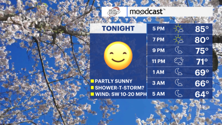
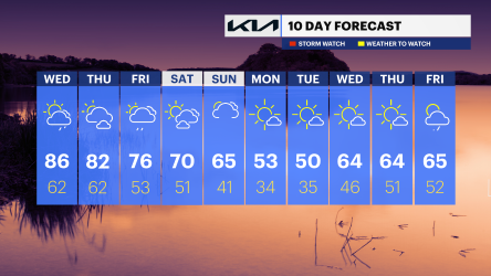
TODAY: STORM WATCH (PM) - Hot and feeling humid. There is a chance for showers and storms in the afternoon to evening hours with some potentially severe. Highs: upper 80s to low 90s.

TONIGHT: Cloudy with rounds of rain and a gradual cool down in temps. Lows: mid to upper 50s.

THURSDAY: Showers fade by the midday hours with a mix of sun and clouds to follow along with cooler temps. Highs: upper 60s. Lows: upper 40s to low 50s.

FRIDAY: A mix of sun and clouds to mostly cloudy skies with a cool feeling in the air. Highs: mid-60s. Lows: upper 40s to low 50s.

SATURDAY: Rainy and windy conditions are expected through much of the day. Temps will trend well below average. Highs: mid to upper 50s. Lows: upper 40s to low 50s.

storm watch headlines and futurecast HV.JPG
today HV.jpg
t-storm threat WED.JPG
daily rain chances HV.JPG
tomorrow HV.JPG
10day HV.JPG

More Stories

More From News12

App StoreGoogle Play Store

info

Newsletter

Send Photos/Videos

Contact

About Us

News Team

News 12 New York

follow us

Twitter

Facebook

Instagram

more resources

Optimum Corporate

Optimum Service

Advertise on News 12

Careers

Content Removal Policy

© 2026 N12N, LLC

Privacy Policy

Terms of Service

Ad Choices