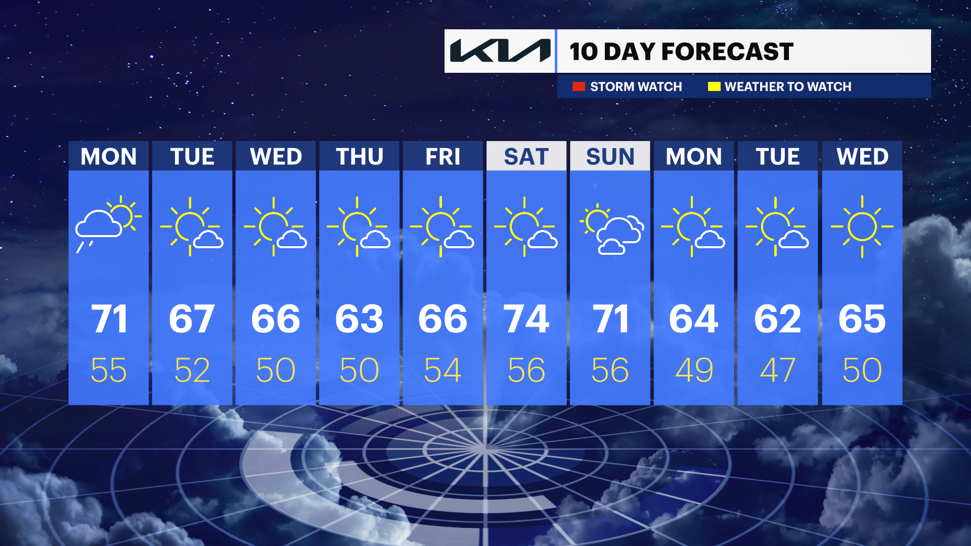
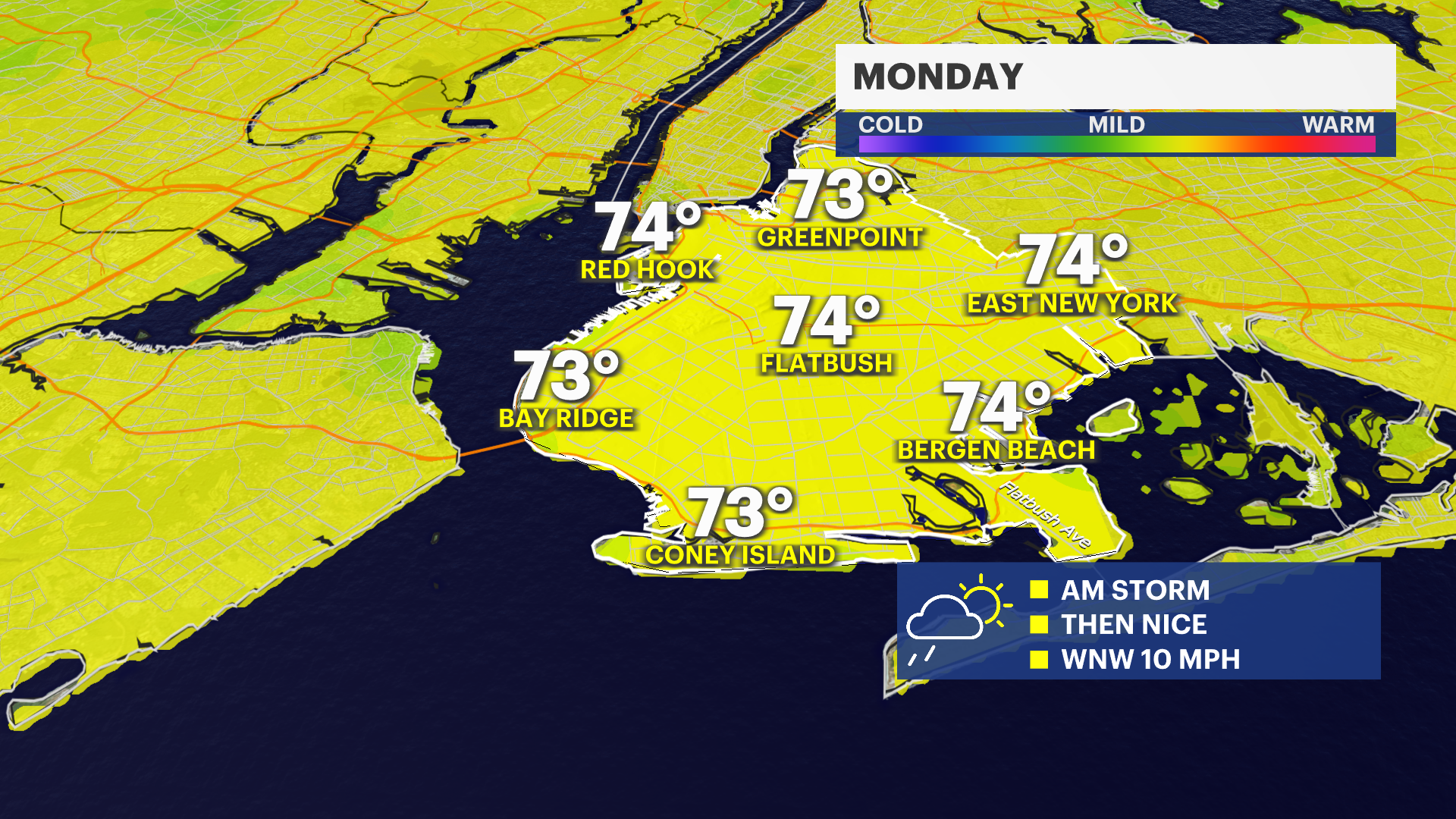
Morning rain, mild temperatures Monday in Brooklyn
A small rain system will move through just near sunrise bringing scattered showers and a possible thunderstorm. This will end before the late morning hours giving way to clear skies and another milder day in the afternoon.
Share:
More Stories


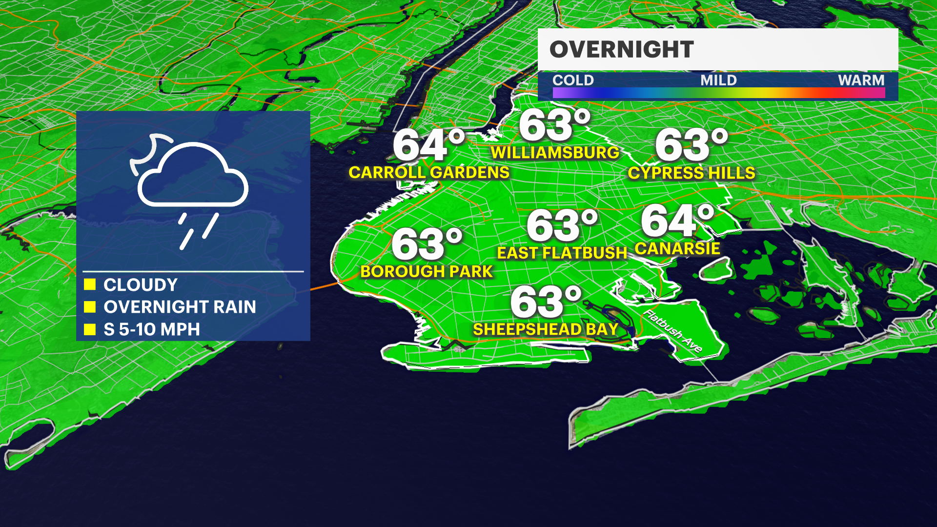
OVERNIGHT: Cloudy with passing showers and a possible thunderstorm. It will not be as cool – lows in 50s.
MONDAY: Morning showers and cloudy to start. By the afternoon, skies will clear with milder temperatures and dry conditions. Highs near 70 degrees.
TUESDAY: Mostly sunny and cooler. Highs in the middle 60s. Lows in the upper 40s.
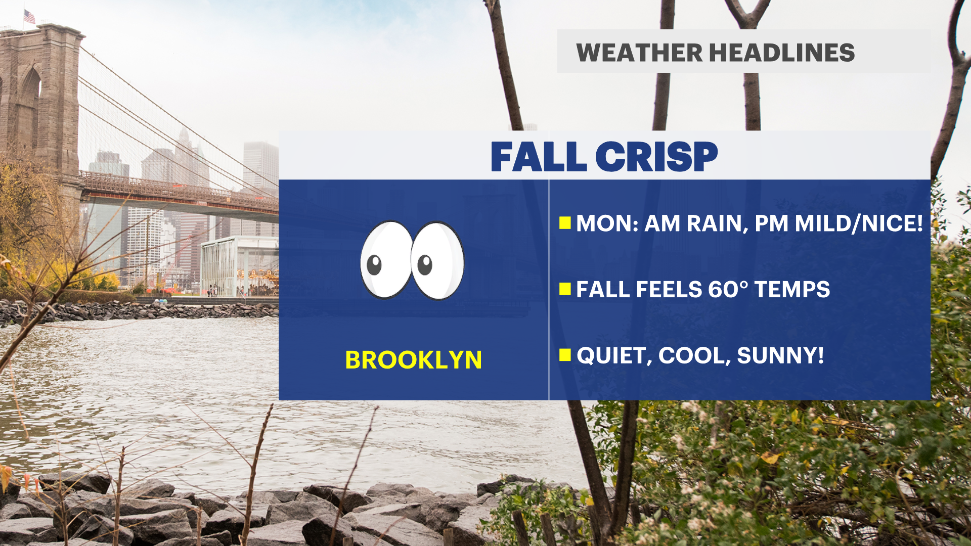
WEDNESDAY: Mostly sunny and cooler. Highs in the middle 60s. Lows in the upper 40s.