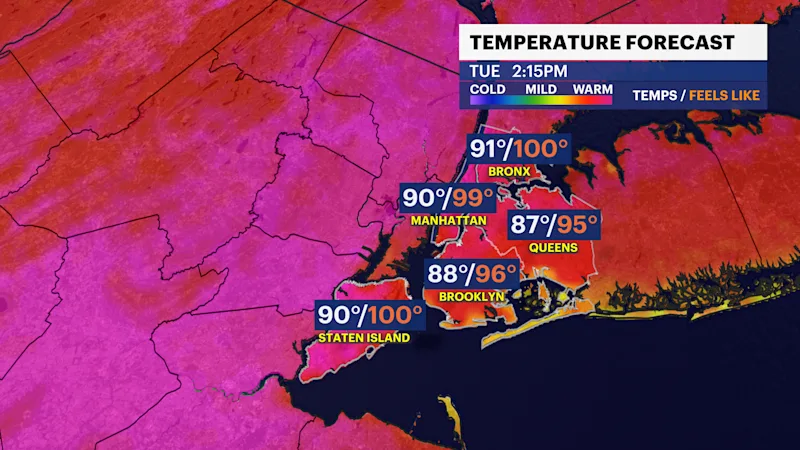
HEAT ALERT: Hazy, hot and humid with feels-like temps at 95+ degrees in Brooklyn; Beryl remnants arrive midweek
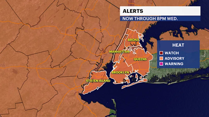
News 12 Storm Watch Team Meteorologist Hope Osemwenkhae says a heat advisory is in effect from 12 p.m. Monday through 8 p.m. Tuesday.
More Stories


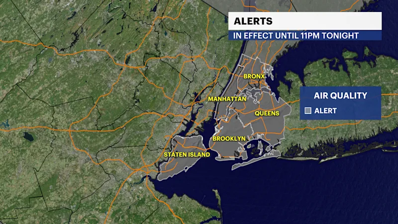
Watch for patchy, dense fog in the skies of Brooklyn tonight. An AIR QUALITY ALERT remains in effect through 11PM tonight, with a possibility of another alert being issued tomorrow.
A HEAT ADVISORY is in effect through 8PM on Wednesday.
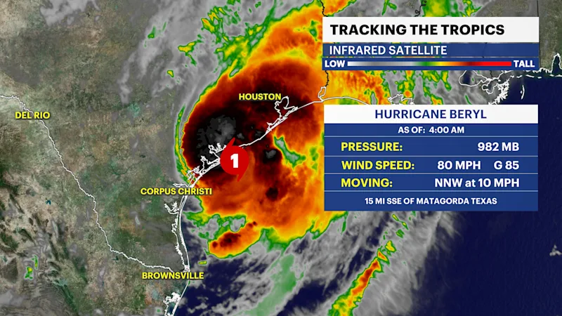
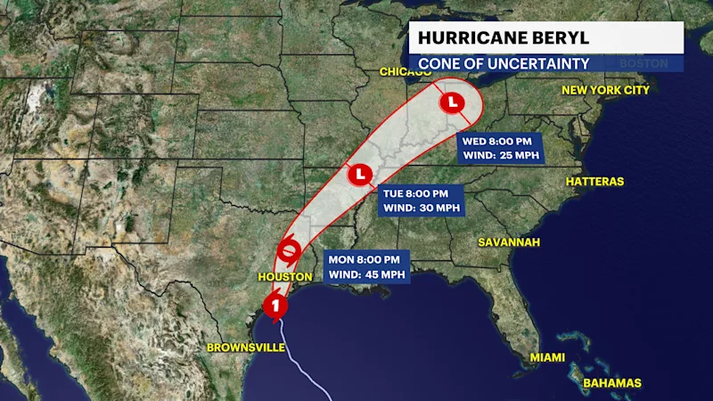
TROPICS: Beryl made landfall near Matagorda, Texas as a Category 1, killing at least 2 Americans. It is now a weakening tropical storm and will become simply remnants by tomorrow, but it continues to bring a flash flood threat across a dozen-plus states from Texas into the Great Lakes.
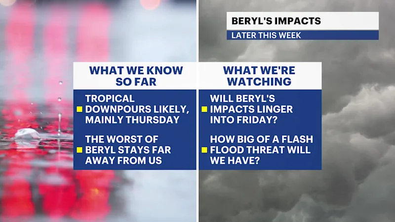
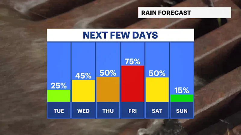
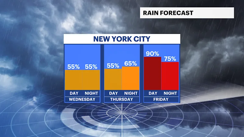
While the center of Beryl's remnants will track WELL AWAY from us in Bronx/Brooklyn, a lingering front packing lots of moisture will spark the storm chances Wednesday night through at least Thursday night. I am most worried about the risk of flooding downpours on Thursday.
TONIGHT: Warm and humid. Lows near 77. Patchy fog possible late, mainly along the water.
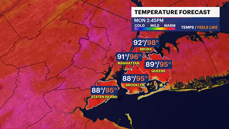
TOMORROW: Mostly sunny, hot and humid. Highs near 91, feeling like 95-100. Pop-up storm or two possible from late afternoon through sunset, better chance staying west of us. Lows down to 76 with an isolated nighttime downpour.
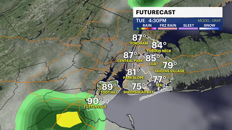
WEDNESDAY: Hot and very humid, with highs close to 90, feeling like 95+. Late-day t-storms are possible, more likely after midnight, with the main threat being flooding downpours. Lows near 75.

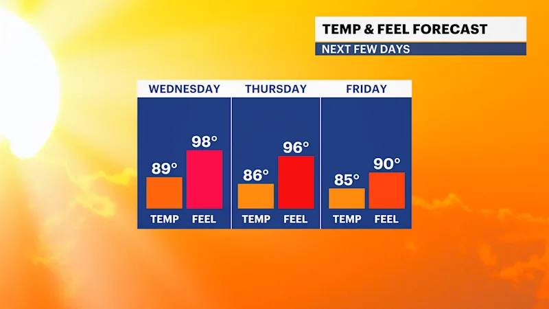
THURSDAY – POSSIBLE STORM WATCH: Very humid with afternoon & evening downpours/t-storms. Highs around 85. Lows near 75.

FRIDAY: Similar story, but not as widespread with t-storms/downpours possible. Details remain limited, all depending on the exact track and speed of Beryl's remnants. Highs near 85. Lows near 74.
NEXT WEEKEND: Leftover t-showers possible Saturday but back to the heat by Sunday with 90s feeling like near-100. Lows in the upper 70s.