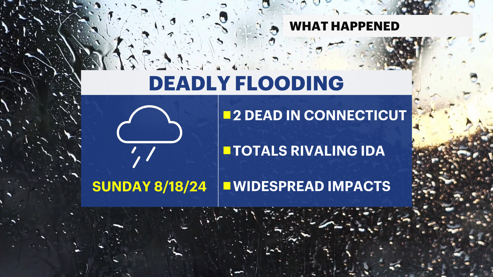
Record rainfall: The deadly flooding by the numbers
Stay with the Storm Watch Team as we continue to guide you through the extreme weather across your community.
More Stories


The slow-moving, drenching downpours Sunday became deadly and broke records in rainfall intensity and totals across different parts of the tri-state area.
Just how impressive? Some of the rain seen across parts of the area was more impactful than the remnants of Ida in 2021.
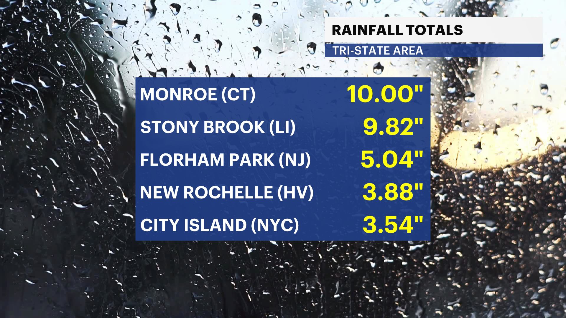
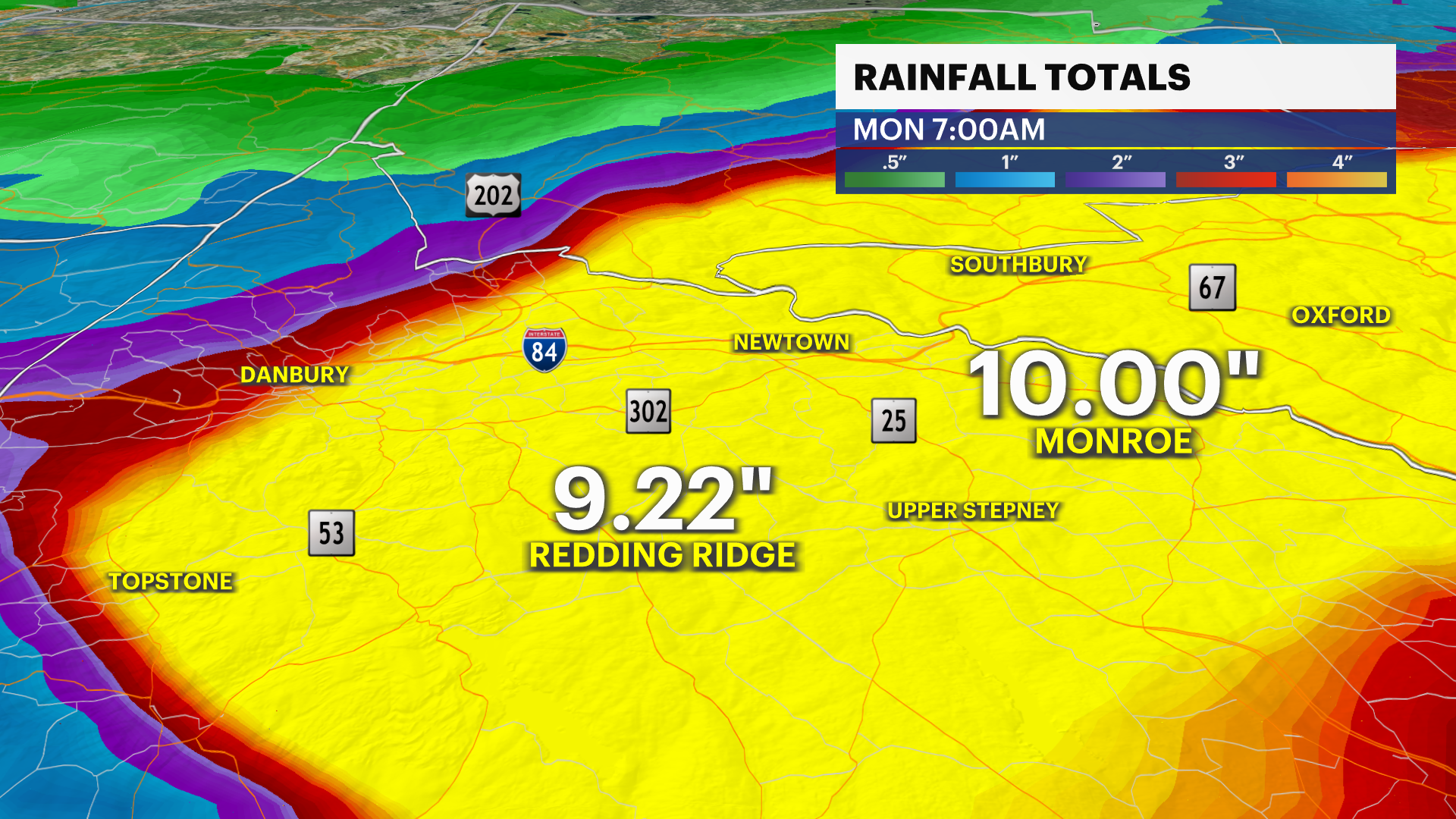
There are two deaths as of noon Monday, both in Connecticut, in the Oxford area. Radar estimates of over 10 inches of rain there, as well as 10 inches of rain confirmed in Monroe, is a sight that has not been seen since Ida in 2021, and is rarely seen on record.
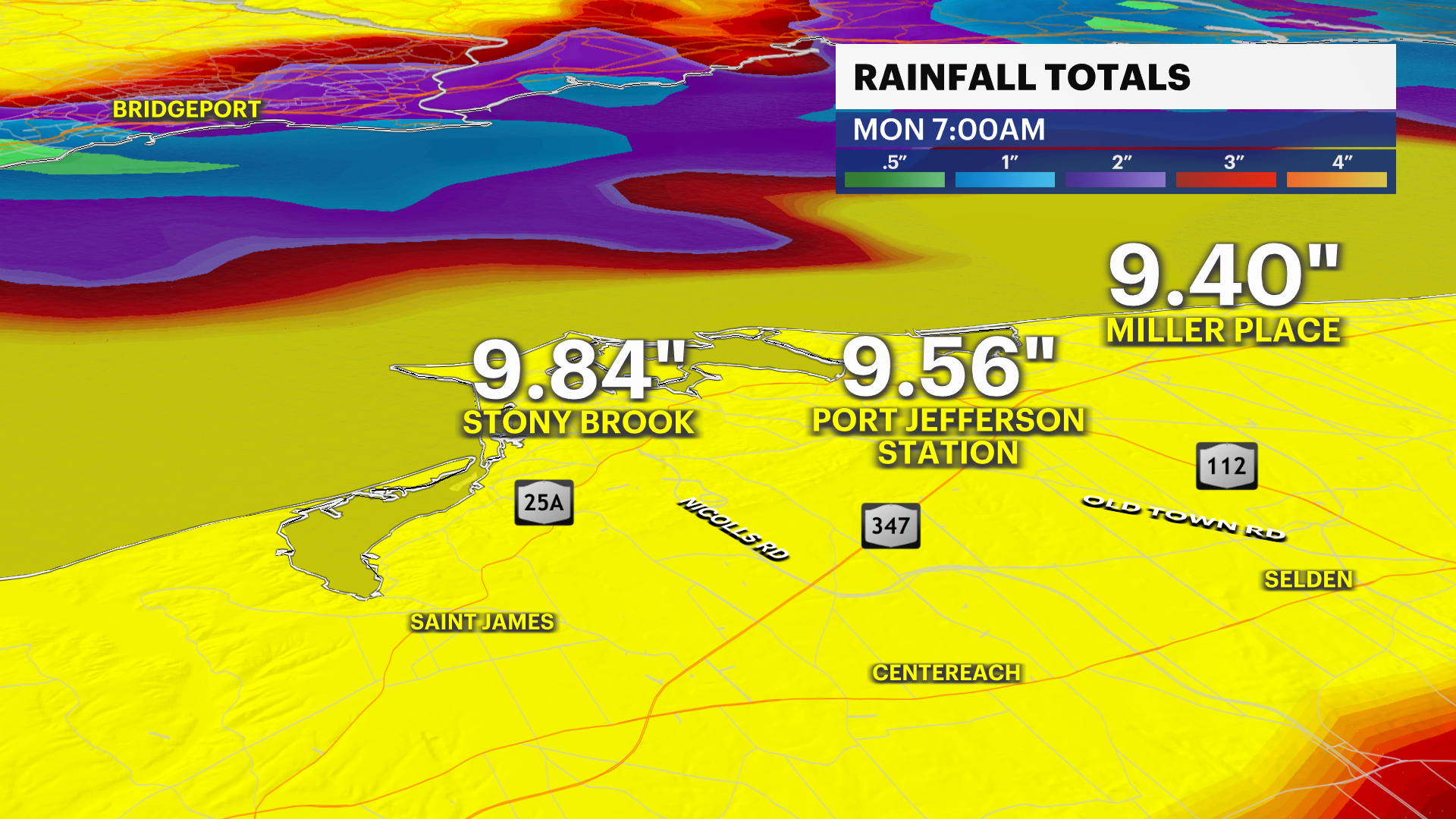
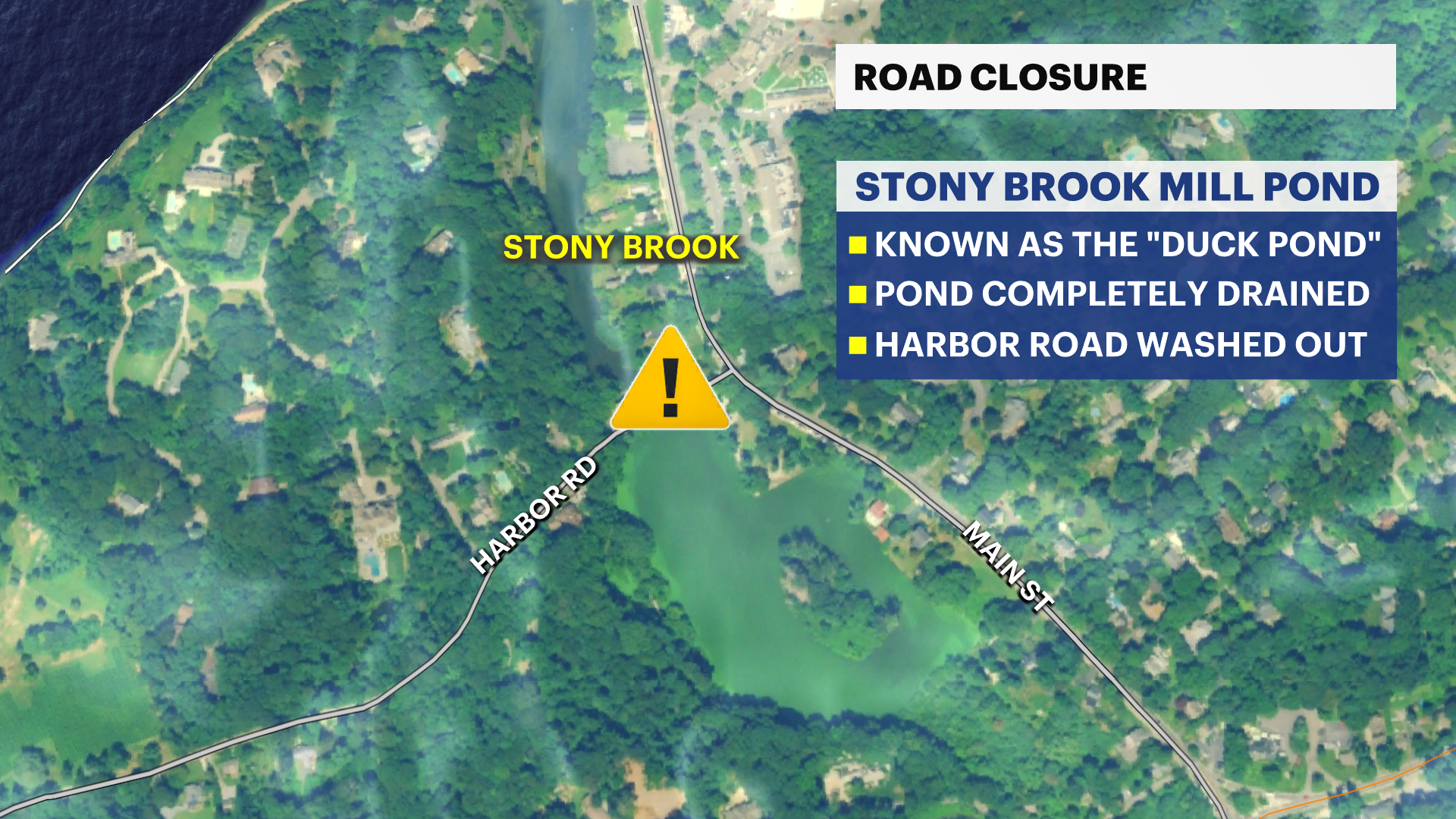
Across Long Island, this storm brought flashbacks to a similar setup nearly 10 years ago to the day. On Aug. 12-13, 2014, rainfall amounts of 10 inches or more fell across Central Long Island, including nearly 14 inches in Islip. A consistent 9 to 10 inches of rain fell in northern Suffolk county, including in Stony Brook and Miller Place.
Stony Brook was the scene of a scary road collapse, where Harbor Road was washed away by water rushing out from “Duck Pond.” There is currently no water in the pond, and no road.
There is one more round of quick-moving strong-to-severe storms Monday evening before a major pattern change. Stay with the Storm Watch Team as we continue to guide you through the extreme weather across your community.