STORM WATCH: Humid and warm today; summer storms arrive tomorrow for Brooklyn
For tonight, expect mild conditions with temps near 71 degrees.
Share:
More Stories
1:44

Another earthquake in New Jersey rattles NYC
30ds ago1:37

Rain takes down trees and impacts commuters
35ds ago
Mayor Adams declares state of emergency due to flash flooding, heavy rain
35ds ago
Gov. Kathy Hochul to declare state of emergency ahead of heavy rainfall
35ds ago
News 12 weather blog
35ds ago1:59

9-year-old entrepreneur sells water at Manhattan Beach to fund future dream home
38ds ago1:44
Another earthquake in New Jersey rattles NYC
30ds ago1:37
Rain takes down trees and impacts commuters
35ds agoMayor Adams declares state of emergency due to flash flooding, heavy rain
35ds agoGov. Kathy Hochul to declare state of emergency ahead of heavy rainfall
35ds agoNews 12 weather blog
35ds ago1:59
9-year-old entrepreneur sells water at Manhattan Beach to fund future dream home
38ds ago- A HIGH RIP CURRENT RISK is in effect 8 a.m. through this evening at the Brooklyn and Queens beaches. Dangerous rip currents are expected.
- It's a mild, partly sunny and muggy start to the day. Temperatures are in the mid to upper 60s.
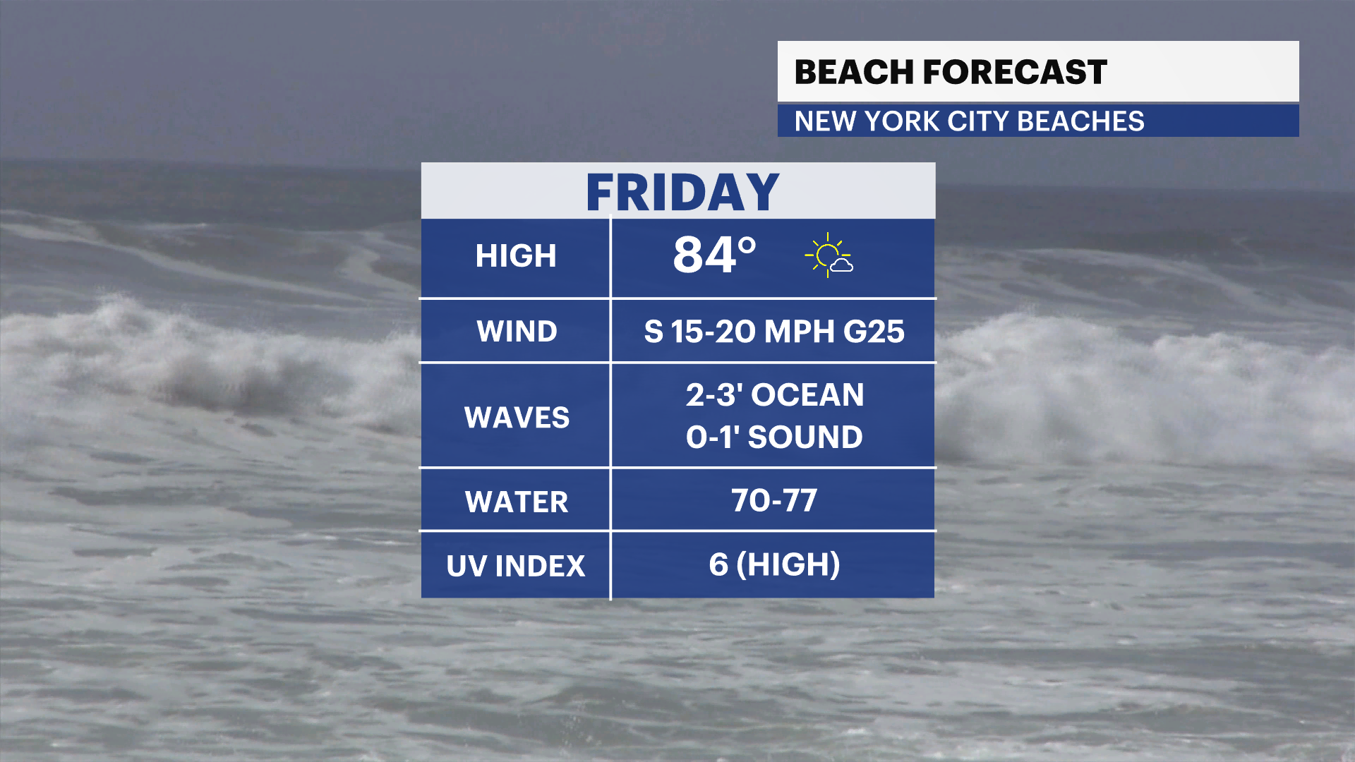
- Today will feel like summer as temperatures climb to the 80s with higher humidity and breezy conditions. Gusts can reach up to 25 mph.
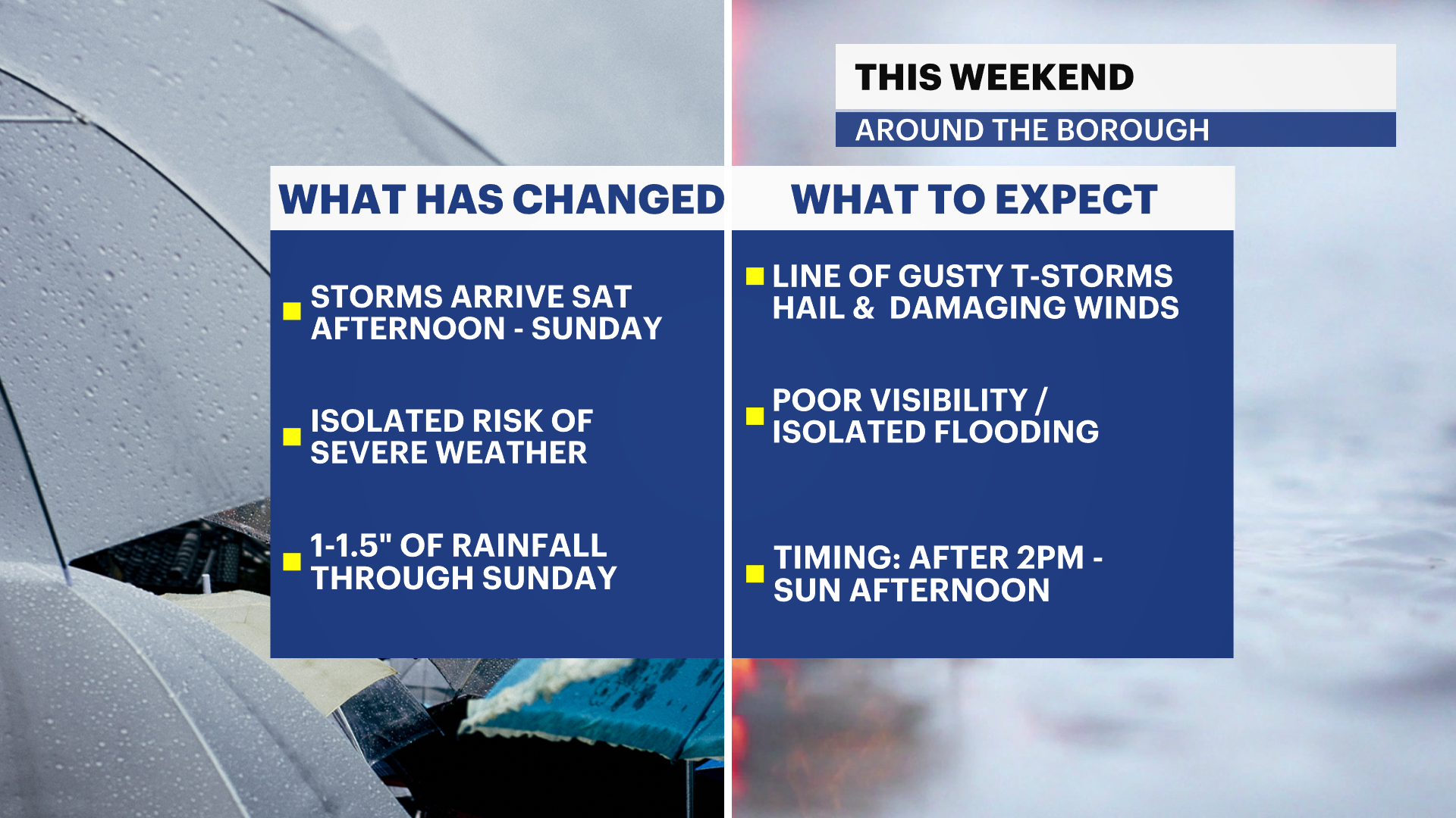
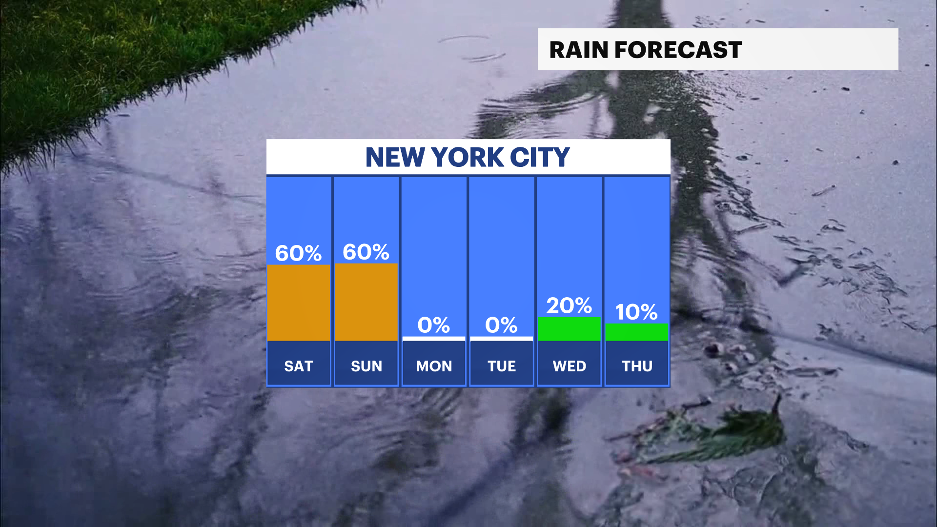
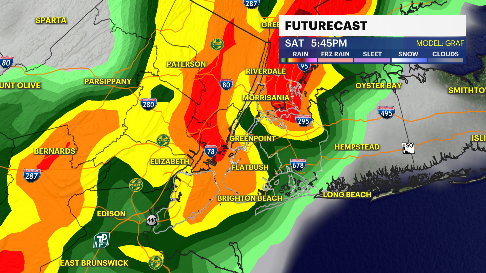
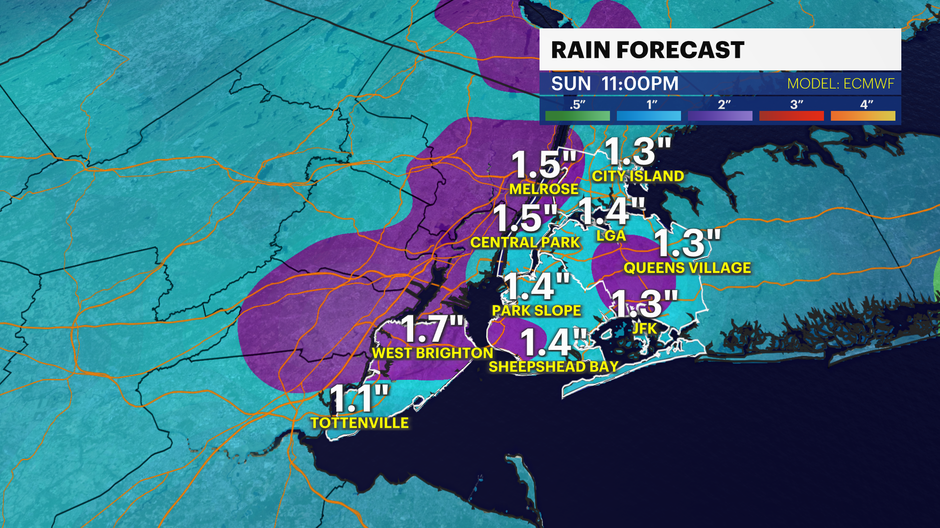
- Another cold front will move into our area Saturday late afternoon/ evening bringing a gusty line of showers and storms. The timing is after 2 p.m. to 1 p.m. Sunday. The timing is subject to change based on when the front moves out on Sunday.
- It will be warm and humid with highs in the mid-80s on Saturday ahead of the rain. There's an isolated risk of severe weather. Expect some strong gusty downpours, lightning, hail, large puddles and isolated flooding in poor drainage and the most vulnerable neighborhoods. Stay tuned for updates! The front lingers nearby bringing leftover spotty showers into Sunday keeping temperatures much cooler. Highs will fall to the low 70s.
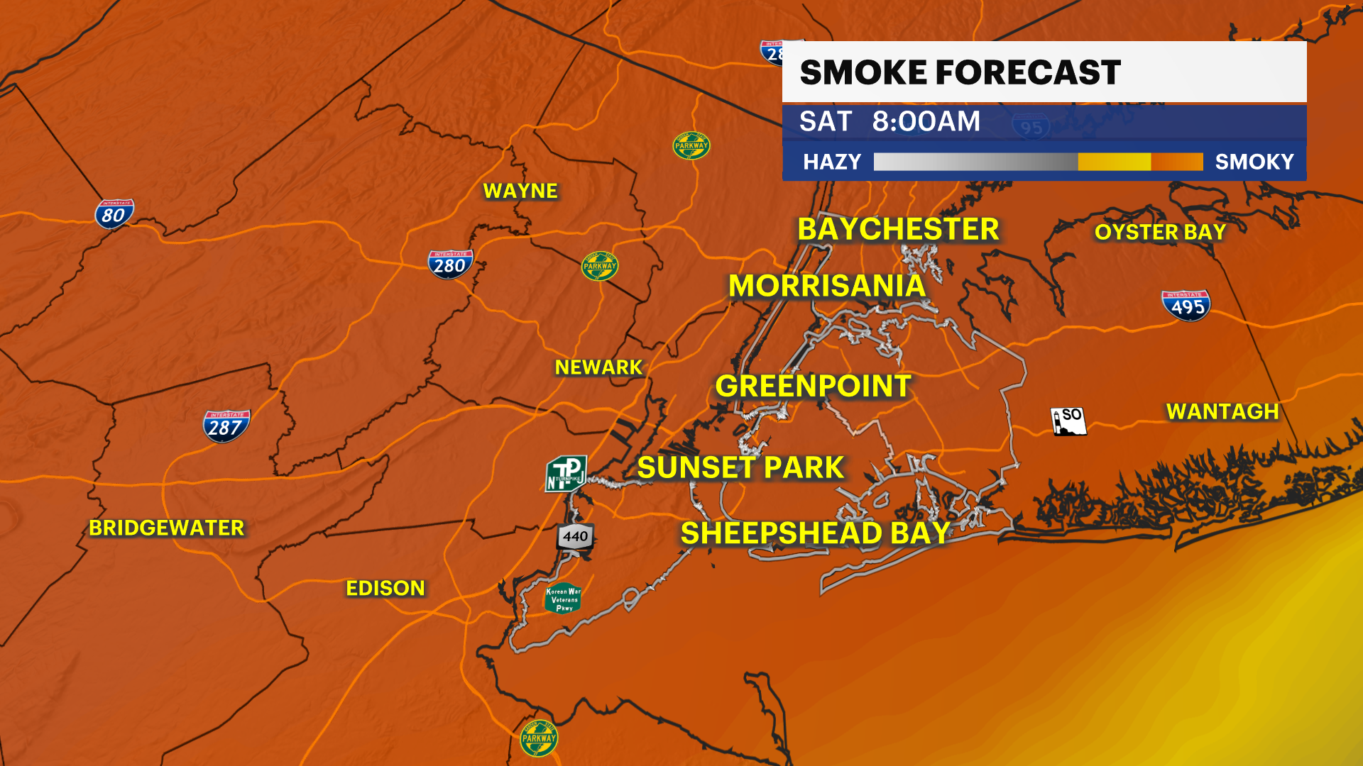
- There's a potential for Canadian wildfire smoke to return this evening into Saturday. We'll continue to watch for the haze/smoky sky and potential impacts to the air quality over the next 12-24 hours. Stay tuned for updates.
- We're still under abnormally dry to moderate drought over parts of the city. If this current drought continues through the Fall season, this will dull and shorten the foliage season and bring a rise to fire weather conditions. We'll continue to monitor drought conditions over the next few weeks and keep you up to date.
- As the little taste of Summer comes to an end on Saturday, a Fall stretch of weather settles in Sunday through next week.
TRACKING THE TROPICS: There's a tropical wave in the Tropical Atlantic that has a high chance of development in the Atlantic by this weekend and become a tropical depression. Once this storm forms, it will slowly move west and possibly pose a threat to the Lesser Antilles and Leeward Islands next week. We'll continue to track it closely over the next several days. Stay tuned for updates!

Today: Mostly sunny, warmer, a light breeze and muggy. Highs near 83.
Tonight: Mild and noticeably humid summer night. Lows near 71.
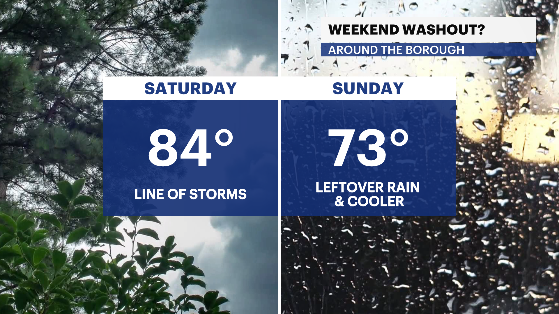
Saturday: Mostly sunny with some haze, warm and steamy. Afternoon line of gusty storms. Highs near 84. Lows near 62.
Sunday: Cloudy, leftover showers, and cooler. Highs near 73. Lows near 57.
Monday: Sunny, mild and pleasant. Highs near 73. Lows near 56.
More from News 12
News 12 weather blog
1:04

Most of Brooklyn under extreme heat watch
1:59

'An opportunity to just relax.' Some Brooklyn residents revel in snowfall
2:01

Thunderbolt 12: Tracking snowy road conditions in Borough Park
2:40

STORM WATCH: The outlook for December is stormy. Here is an early look
1:24
