Cloudy morning gives way to sunny and breezy Monday across the Hudson Valley
Conditions improve quickly into Monday, clouds at first, then sunshine takes over.
More Stories





White Plains Information
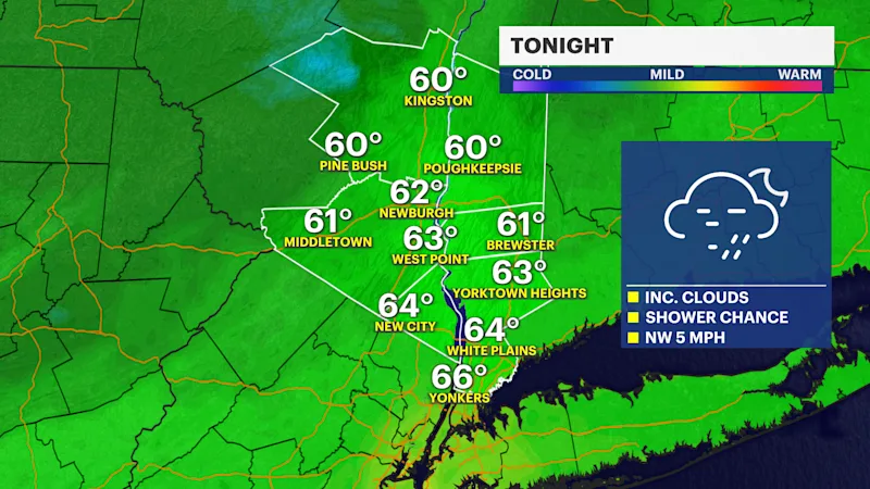
Conditions improve quickly into Monday, with clouds at first, then sunshine takes over. It will also be noticeably cooler and breezy, with temperatures only reaching the upper 60s to low 70s.
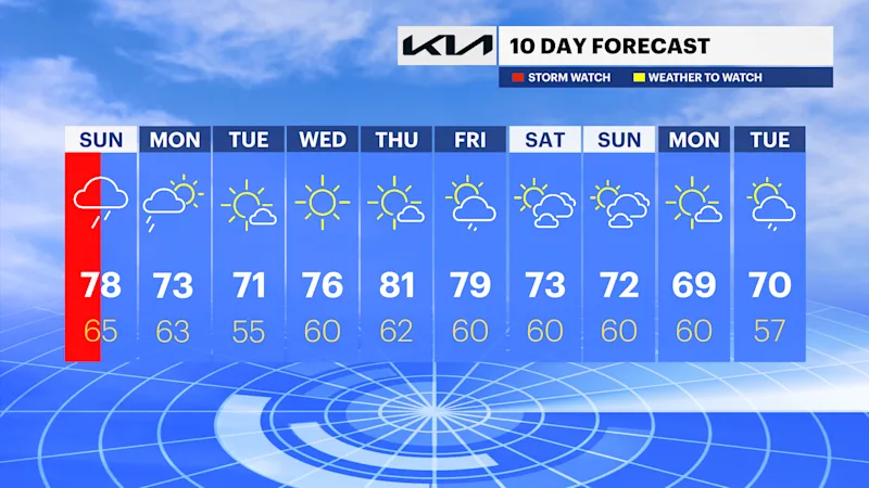
Tuesday remains cool and sunny before temperatures gradually rebound through the middle of the week.
Wednesday and Thursday bring plenty of sunshine, with highs climbing through the 70s. Shower chances return Friday and continue into Saturday, but neither day looks like a washout.
FORECAST
Monday: A brief chance of an early shower, then increasing sunshine. Cooler and breezy with highs in the upper 60s to low 70s.
Tuesday: Sunny and cool, with highs in the upper 60s to low 70s.
Wednesday: Sunny and milder, with highs in the mid- to upper 70s.
Thursday: Mostly sunny and warmer, with highs in the upper 70s to around 80.
Friday: Partly sunny,- with a chance of showers. Highs in the mid to upper 70s.
Saturday: Partly sunny, with a chance of showers. Highs in the low to mid-70s.