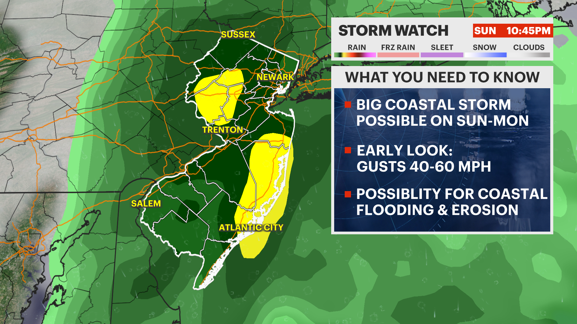
Coastal storm threatens NJ for Sunday & Monday
Moderate to major impacts are possible along the Jersey Shore.
More Stories


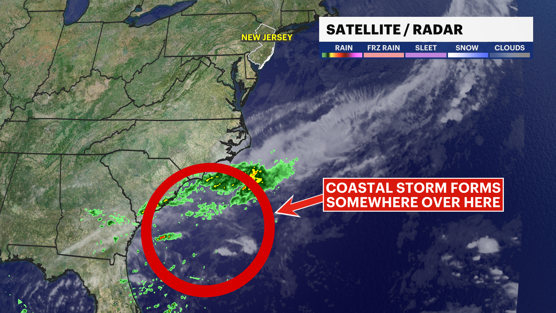
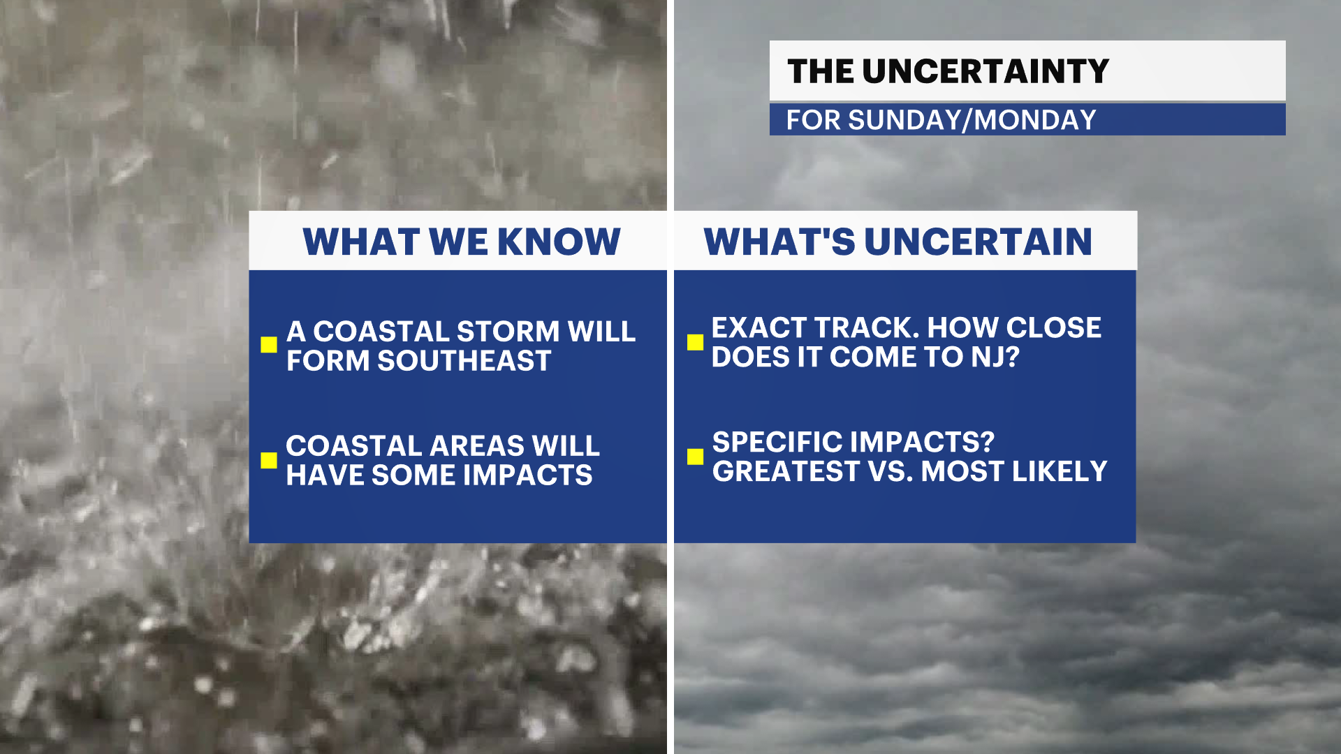
A coastal storm is forming over the Southeast Coast. The location of the storm's center will help determine how big of an impact it will have over New Jersey once it begins to move northward.
There are three scenarios on the table as we sort out the possibility for big impacts. Regardless of the scenario, areas along the coast should CONSIDER how they'd respond to potential impacts of coastal flooding and erosion - in a much bigger way than we've seen in recent storms over the last several months. To this note, the NWS has already issued a COASTAL FLOOD WATCH for the NJ coastline as we are running at the highest high tide cycle of the year known as the King Tides. With higher high tides, a coastal storm or even just a simple easterly wind can cause for problems.
Scenario 1: Storm tracks closer to the coast.
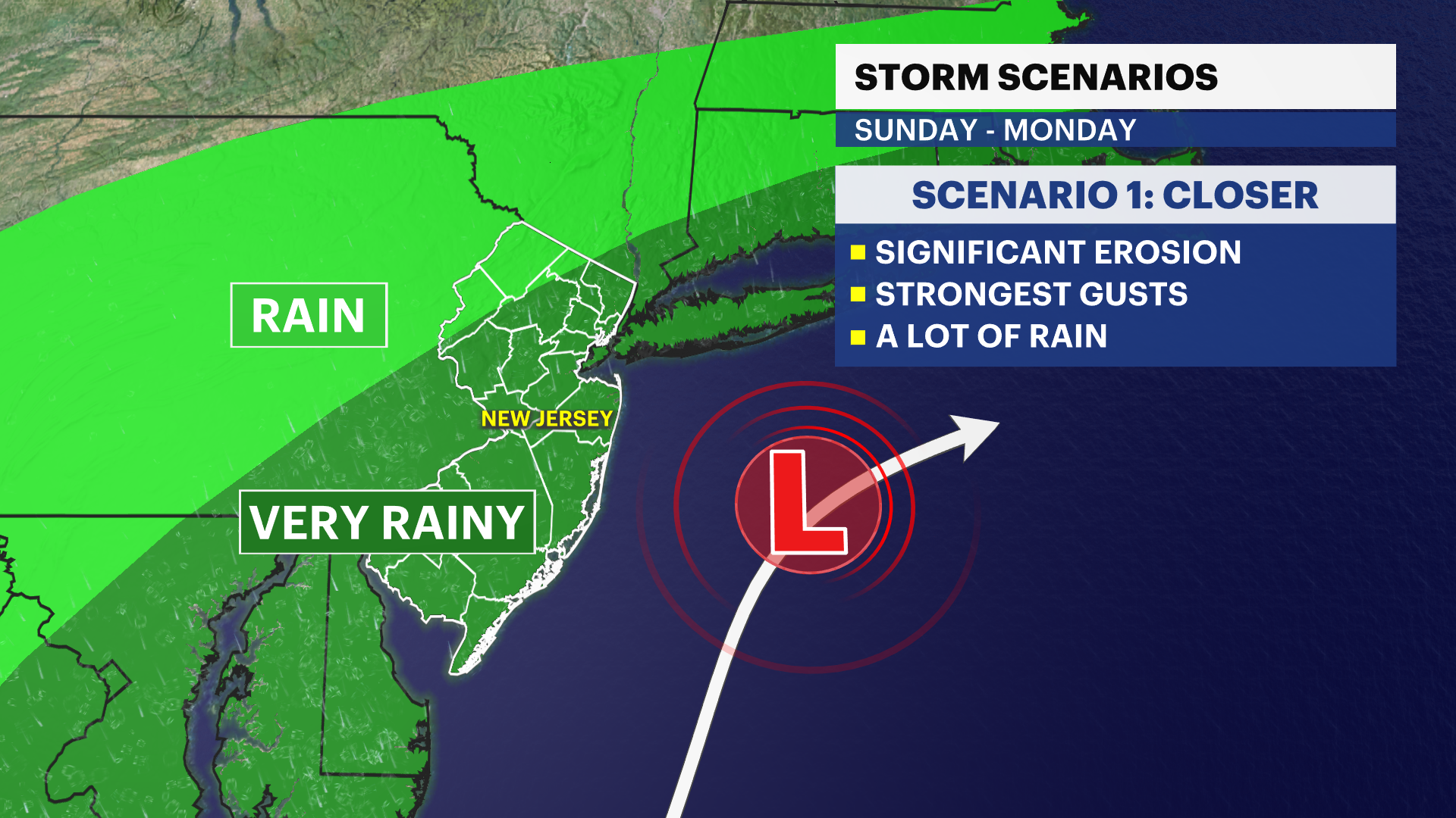
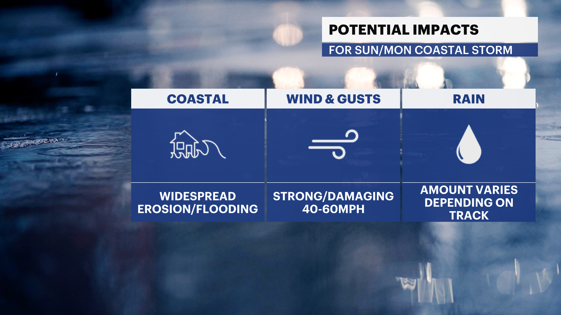
Major impacts to the NJ shore with significant beach erosion and flooding.
A LOT of rain (totals can exceed 3-4", which can impact inland areas)
Strong gusts in excess of 40-60mph, especially at the coast.
Scenario 2: Storm is suppressed south due to strong high pressure to the northeast.
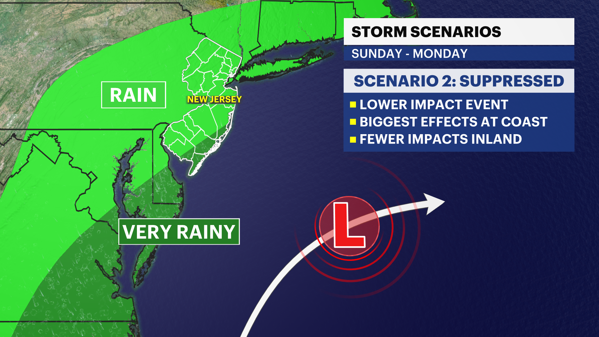
Moderate impacts to the NJ shore, with a good chance for beach erosion and some flooding, especially Ocean county and south.
Inland areas wouldn't be seeing many significant impacts - just windy rain.
Scenario 3: Fujiwhara with future Hurricane Jerry.
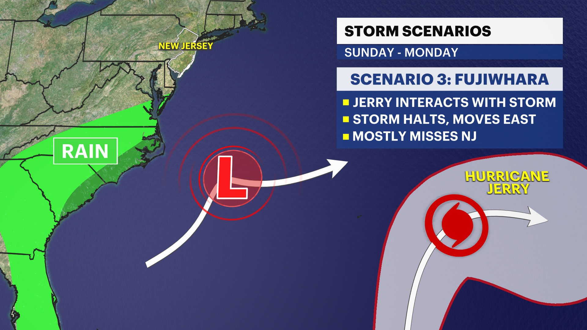
This is the least likely scenario at this time.
The coastal storm "hard stops" before it comes remotely close to NJ and is tossed out to sea as it interacts with the nearby tropical cyclone.
This can only happen if the center of the coastal storm forms too far away from the coast/way farther east than currently predicted.
𝙒𝙃𝘼𝙏 𝘿𝙊 𝙔𝙊𝙐 𝘿𝙊 𝙉𝙊𝙒?
If you live at the coast, consider how moderate to major coastal flooding will impact you. This can be a bad flood event if it unfolds, with some modelling suggesting 3-5 ft inundation. Details become specific and nuanced within 48 hours ahead of the storm, and things will change rapidly.
𝘾𝘼𝙉𝘾𝙀𝙇 𝙋𝙇𝘼𝙉𝙎?
Not for Saturday. Saturday's alright - just cloudy with some late day showers/sprinkles. For Sunday plans, consider making this decision by end of day Friday as we will have a better idea of track [with some margin of error].